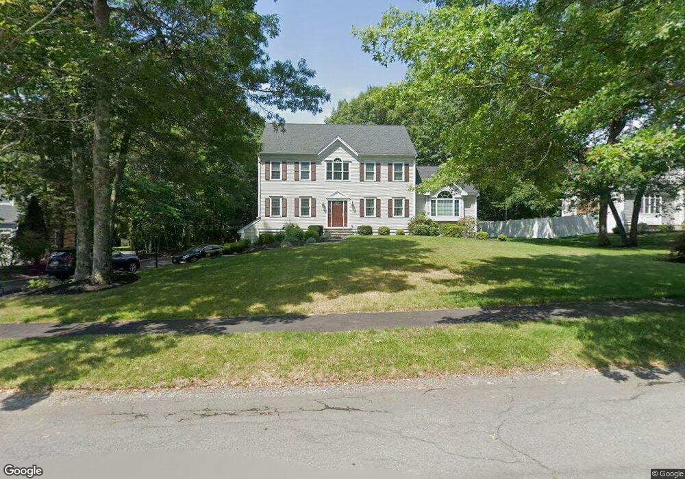
300 Prince Rogers Way Marshfield, MA 02050
Estimated Value: $1,136,000 - $1,393,000
3
Beds
3
Baths
2,940
Sq Ft
$437/Sq Ft
Est. Value
About This Home
This home is located at 300 Prince Rogers Way, Marshfield, MA 02050 and is currently estimated at $1,283,626, approximately $436 per square foot. 300 Prince Rogers Way is a home located in Plymouth County with nearby schools including Martinson Elementary School, Furnace Brook Middle School, and Marshfield High School.
Ownership History
Date
Name
Owned For
Owner Type
Purchase Details
Closed on
Sep 29, 1997
Sold by
Prince Rogers Rt and Delaney Michael J
Bought by
Dirksmeier Steven L and Dirksmeier Susan K
Current Estimated Value
Home Financials for this Owner
Home Financials are based on the most recent Mortgage that was taken out on this home.
Original Mortgage
$258,600
Outstanding Balance
$41,620
Interest Rate
7.47%
Mortgage Type
Purchase Money Mortgage
Estimated Equity
$1,242,006
Create a Home Valuation Report for This Property
The Home Valuation Report is an in-depth analysis detailing your home's value as well as a comparison with similar homes in the area
Home Values in the Area
Average Home Value in this Area
Purchase History
| Date | Buyer | Sale Price | Title Company |
|---|---|---|---|
| Dirksmeier Steven L | $329,593 | -- |
Source: Public Records
Mortgage History
| Date | Status | Borrower | Loan Amount |
|---|---|---|---|
| Open | Dirksmeier Steven L | $100,000 | |
| Closed | Dirksmeier Steven L | $60,000 | |
| Open | Dirksmeier Steven L | $258,600 |
Source: Public Records
Tax History Compared to Growth
Tax History
| Year | Tax Paid | Tax Assessment Tax Assessment Total Assessment is a certain percentage of the fair market value that is determined by local assessors to be the total taxable value of land and additions on the property. | Land | Improvement |
|---|---|---|---|---|
| 2025 | $10,413 | $1,051,800 | $370,900 | $680,900 |
| 2024 | $10,058 | $968,000 | $349,100 | $618,900 |
| 2023 | $9,372 | $850,500 | $314,100 | $536,400 |
| 2022 | $9,372 | $723,700 | $261,900 | $461,800 |
| 2021 | $8,923 | $676,500 | $261,900 | $414,600 |
| 2020 | $8,860 | $664,700 | $261,900 | $402,800 |
| 2019 | $8,578 | $641,100 | $261,900 | $379,200 |
| 2018 | $8,466 | $633,200 | $261,900 | $371,300 |
| 2017 | $8,324 | $606,700 | $261,900 | $344,800 |
| 2016 | $7,937 | $571,800 | $251,000 | $320,800 |
| 2015 | $7,493 | $563,800 | $251,000 | $312,800 |
| 2014 | $7,510 | $565,100 | $251,000 | $314,100 |
Source: Public Records
Map
Nearby Homes
- 10 Penstock Ln
- 21 Chowdermarch St
- 451 School St Unit 5-2
- 451 School St Unit 3-4
- 1155 Main St
- 848 Plain St Unit 23
- 21 Union St
- 5 Royal Dane Dr Unit 45
- 1 Valley Path
- 2 Proprietors Dr Unit 25
- 2 Proprietors Dr Unit 23
- 2 Proprietors Dr Unit 26
- 2 Proprietors Dr Unit 27
- 2 Proprietors Dr Unit 24
- 341 Furnace St
- 480 Pleasant St
- 167 Planting Field Rd
- 14 Red Pony Path
- 218 Schoosett St
- 8 Quaker Cir
- 306 Prince Rogers Way
- 290 Prince Rogers Way
- 289 Prince Rogers Way
- 210 Quail Run
- 318 Prince Rogers Way
- 276 Prince Rogers Way
- 321 Prince Rogers Way
- 277 Prince Rogers Way
- 266 Prince Rogers Way
- 330 Prince Rogers Way
- 207 Quail Run
- 267 Prince Rogers Way
- 188 Quail Run
- 333 Prince Rogers Way
- 253 Prince Rogers Way
- 258 Prince Rogers Way
- 338 Prince Rogers Way
- 241 Prince Rogers Way
- 250 Prince Rogers Way
- 29 Sawmill Ln