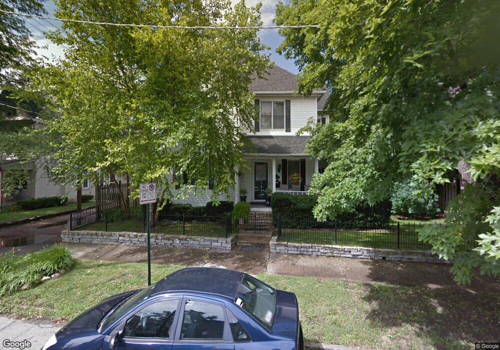
300 W 6th Ave Columbus, OH 43201
Dennison Place NeighborhoodEstimated Value: $430,000 - $630,000
3
Beds
2
Baths
1,950
Sq Ft
$273/Sq Ft
Est. Value
About This Home
This home is located at 300 W 6th Ave, Columbus, OH 43201 and is currently estimated at $531,851, approximately $272 per square foot. 300 W 6th Ave is a home located in Franklin County with nearby schools including Hubbard Elementary School, Dominion Middle School, and Whetstone High School.
Ownership History
Date
Name
Owned For
Owner Type
Purchase Details
Closed on
May 11, 2001
Sold by
Coggins Michael R
Bought by
Atha Angelyn M
Current Estimated Value
Home Financials for this Owner
Home Financials are based on the most recent Mortgage that was taken out on this home.
Original Mortgage
$179,800
Outstanding Balance
$66,938
Interest Rate
6.99%
Estimated Equity
$464,913
Purchase Details
Closed on
Apr 14, 1992
Bought by
Coggins Michael R
Purchase Details
Closed on
Sep 8, 1987
Purchase Details
Closed on
Aug 21, 1987
Create a Home Valuation Report for This Property
The Home Valuation Report is an in-depth analysis detailing your home's value as well as a comparison with similar homes in the area
Home Values in the Area
Average Home Value in this Area
Purchase History
| Date | Buyer | Sale Price | Title Company |
|---|---|---|---|
| Atha Angelyn M | $189,300 | Amerititle Agency Inc | |
| Coggins Michael R | $124,600 | -- | |
| -- | -- | -- | |
| -- | -- | -- |
Source: Public Records
Mortgage History
| Date | Status | Borrower | Loan Amount |
|---|---|---|---|
| Open | Atha Angelyn M | $179,800 |
Source: Public Records
Tax History Compared to Growth
Tax History
| Year | Tax Paid | Tax Assessment Tax Assessment Total Assessment is a certain percentage of the fair market value that is determined by local assessors to be the total taxable value of land and additions on the property. | Land | Improvement |
|---|---|---|---|---|
| 2024 | $7,193 | $160,270 | $42,740 | $117,530 |
| 2023 | $7,101 | $160,270 | $42,740 | $117,530 |
| 2022 | $7,873 | $151,800 | $29,190 | $122,610 |
| 2021 | $7,887 | $151,800 | $29,190 | $122,610 |
| 2020 | $7,897 | $151,800 | $29,190 | $122,610 |
| 2019 | $7,056 | $116,310 | $22,470 | $93,840 |
| 2018 | $6,299 | $116,310 | $22,470 | $93,840 |
| 2017 | $7,051 | $116,310 | $22,470 | $93,840 |
| 2016 | $6,121 | $92,400 | $20,020 | $72,380 |
| 2015 | $5,556 | $92,400 | $20,020 | $72,380 |
| 2014 | $5,570 | $92,400 | $20,020 | $72,380 |
| 2013 | $2,497 | $84,000 | $18,200 | $65,800 |
Source: Public Records
Map
Nearby Homes
- 343 King Ave Unit 345
- 396 W 7th Ave
- 398 W 5th Ave
- 1245 Pennsylvania Ave
- 154-156 W 6th Ave
- 1298 Hunter Ave
- 1438-1440 Hunter Ave
- 93 King Ave Unit 95
- 477 W 4th Ave
- 512 Riverfront Ln
- 506 Riverfront Ln
- 63 Smith Place
- 516 Riverfront Ln
- 502 Riverfront Ln
- 42 King Ave
- 6 1/2 Clark Place
- 1173 Perry St Unit 20P
- 337 Tappan St
- 1042 Neil Ave
- 1276 N High St Unit 206
- 1337 Neil Ave
- 304-314 W 6th Ave
- 1333 Neil Ave Unit 1333
- 1329 Neil Ave
- 1345 Neil Ave
- 1331 Neil Ave Unit 1331
- 1351 Neil Ave
- 297 W 6th Ave Unit 301
- 297 W 6th Ave Unit A
- 318 W 6th Ave
- 307 W 6th Ave Unit 9
- 311 W 6th Ave Unit 313
- 1315 Neil Ave Unit 317
- 1355 Neil Ave
- 320 W 6th Ave
- 313 W 6th Ave
- 1309 Neil Ave
- 0 W 6th Ave
- 1359 Neil Ave
- 317 W 6th Ave