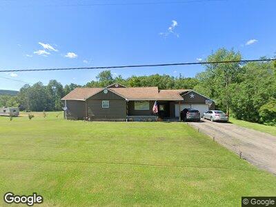
3001 E Valley Rd Smethport, PA 16749
Estimated Value: $109,420 - $147,000
--
Bed
--
Bath
1,229
Sq Ft
$107/Sq Ft
Est. Value
About This Home
This home is located at 3001 E Valley Rd, Smethport, PA 16749 and is currently estimated at $131,855, approximately $107 per square foot. 3001 E Valley Rd is a home located in McKean County with nearby schools including Smethport Area Elementary School and Smethport Area Junior/Senior High School.
Ownership History
Date
Name
Owned For
Owner Type
Purchase Details
Closed on
Sep 17, 2015
Sold by
Williams Melanie J and Williams Shirley J
Bought by
Cunningham Daniel G and Cunningham Melanie J
Current Estimated Value
Home Financials for this Owner
Home Financials are based on the most recent Mortgage that was taken out on this home.
Original Mortgage
$80,000
Interest Rate
3.94%
Mortgage Type
Stand Alone Refi Refinance Of Original Loan
Purchase Details
Closed on
Apr 22, 2010
Sold by
Williams Shirley J
Bought by
Williams Melanie J and Williams Shirley J
Home Financials for this Owner
Home Financials are based on the most recent Mortgage that was taken out on this home.
Original Mortgage
$50,000
Interest Rate
4.99%
Mortgage Type
New Conventional
Create a Home Valuation Report for This Property
The Home Valuation Report is an in-depth analysis detailing your home's value as well as a comparison with similar homes in the area
Home Values in the Area
Average Home Value in this Area
Purchase History
| Date | Buyer | Sale Price | Title Company |
|---|---|---|---|
| Cunningham Daniel G | -- | None Available | |
| Williams Melanie J | -- | None Available | |
| Williams Shirley J | -- | None Available |
Source: Public Records
Mortgage History
| Date | Status | Borrower | Loan Amount |
|---|---|---|---|
| Closed | Cunningham Daniel E | $86,000 | |
| Closed | Cunningham Daniel G | $80,000 | |
| Closed | Williams Shirley J | $50,000 |
Source: Public Records
Tax History Compared to Growth
Tax History
| Year | Tax Paid | Tax Assessment Tax Assessment Total Assessment is a certain percentage of the fair market value that is determined by local assessors to be the total taxable value of land and additions on the property. | Land | Improvement |
|---|---|---|---|---|
| 2025 | $1,622 | $45,460 | $11,000 | $34,460 |
| 2024 | $1,566 | $45,460 | $11,000 | $34,460 |
| 2023 | $1,566 | $45,460 | $11,000 | $34,460 |
| 2022 | $1,566 | $45,460 | $11,000 | $34,460 |
| 2021 | $1,547 | $45,460 | $11,000 | $34,460 |
| 2020 | $1,547 | $45,460 | $11,000 | $34,460 |
| 2019 | $1,472 | $45,460 | $11,000 | $34,460 |
| 2018 | $14 | $45,460 | $11,000 | $34,460 |
| 2017 | -- | $45,460 | $11,000 | $34,460 |
| 2016 | $1,332 | $45,460 | $11,000 | $34,460 |
| 2015 | $511 | $45,460 | $11,000 | $34,460 |
| 2014 | $511 | $45,460 | $11,000 | $34,460 |
Source: Public Records
Map
Nearby Homes
- 105 Rock Run Rd
- 5690 Route 46
- 2231 W Eldred Rd
- 3365 Route 446
- 3142 Route 155
- 1521 Prentisvale Rd
- 1778 Looker Mountain Trail
- 402 E Main St
- 134 Emerald Isle
- 308 Emerald Isle
- 314 Emerald Isle
- 41 Bank St
- 305 State St
- 408 W Water St
- 00 Smith Rd
- 19 W Willow St
- 916 W Main St
- 1010 W Main St
- 1400 W Main St
- 1408 W Main St