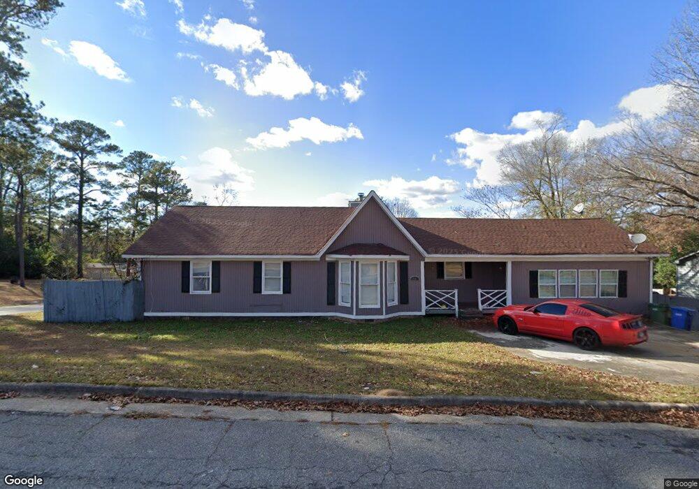
3001 Lansing Ave Columbus, GA 31907
Eastern Columbus NeighborhoodEstimated Value: $160,000 - $209,000
3
Beds
3
Baths
2,043
Sq Ft
$91/Sq Ft
Est. Value
About This Home
This home is located at 3001 Lansing Ave, Columbus, GA 31907 and is currently estimated at $185,053, approximately $90 per square foot. 3001 Lansing Ave is a home located in Muscogee County with nearby schools including Forrest Road Elementary School, Fort Middle School, and Kendrick High School.
Ownership History
Date
Name
Owned For
Owner Type
Purchase Details
Closed on
Dec 14, 2017
Sold by
Jones Maurice
Bought by
Jones Enterprise And Sales Llc
Current Estimated Value
Purchase Details
Closed on
May 17, 2013
Sold by
Us Bank National Associati
Bought by
Jones Maurice
Purchase Details
Closed on
Dec 4, 2012
Sold by
Bender Terrolyn R
Bought by
Us Bank National Association T
Create a Home Valuation Report for This Property
The Home Valuation Report is an in-depth analysis detailing your home's value as well as a comparison with similar homes in the area
Home Values in the Area
Average Home Value in this Area
Purchase History
| Date | Buyer | Sale Price | Title Company |
|---|---|---|---|
| Jones Enterprise And Sales Llc | -- | -- | |
| Jones Maurice | $30,000 | -- | |
| Us Bank National Association T | $57,200 | -- |
Source: Public Records
Tax History Compared to Growth
Tax History
| Year | Tax Paid | Tax Assessment Tax Assessment Total Assessment is a certain percentage of the fair market value that is determined by local assessors to be the total taxable value of land and additions on the property. | Land | Improvement |
|---|---|---|---|---|
| 2025 | $1,534 | $65,032 | $7,004 | $58,028 |
| 2024 | $1,534 | $39,200 | $7,004 | $32,196 |
| 2023 | $1,544 | $39,200 | $7,004 | $32,196 |
| 2022 | $1,467 | $45,448 | $7,004 | $38,444 |
| 2021 | $1,481 | $38,312 | $7,004 | $31,308 |
| 2020 | $1,565 | $38,312 | $7,004 | $31,308 |
| 2019 | $1,436 | $41,230 | $7,004 | $34,226 |
| 2018 | $1,630 | $46,812 | $7,004 | $39,808 |
| 2017 | $2,174 | $46,812 | $7,004 | $39,808 |
| 2016 | $996 | $24,148 | $2,863 | $21,285 |
| 2015 | $997 | $24,148 | $2,863 | $21,285 |
| 2014 | $496 | $12,000 | $2,863 | $9,137 |
| 2013 | -- | $30,016 | $2,863 | $27,153 |
Source: Public Records
Map
Nearby Homes
- 3027 Lansing Ave
- 6000 Caribou Dr
- 2940 Urban Ave
- 3301 Musket Dr
- 6028 Caribou Dr
- 5906 Forrest Rd
- 6059 Nassau Cir
- 2807 Doyle Ave
- 2672 Honeysuckle Dr
- 2525 Corineth Dr
- 5833 Gleneden Dr
- 5929 Gleneden Dr
- 5920 Gleneden Dr
- 2942 Poppy Seed Loop
- 2708 Courtland Ave
- 5260 Woodruff Farm Rd
- 5018 Woodruff Farm Rd
- 3041 Waddell Dr
- 2501 White Chapel Dr
- 2505 White Chapel Dr
- 5851 Norton St
- 3013 Lansing Ave
- 5841 Norton St
- 2949 Lansing Ave
- 3000 Lansing Ave
- 3010 Lansing Ave
- 3023 Lansing Ave
- 3012 Gleason Ave
- 3014 Lansing Ave
- 2945 Lansing Ave
- 5831 Norton St
- 2954 Lansing Ave
- 2954 Gleason Ave
- 3016 Gleason Ave
- 3018 Lansing Ave
- 2946 Lansing Ave
- 2943 Lansing Ave
- 3022 Gleason Ave
- 2950 Gleason Ave
- 5915 Norton St