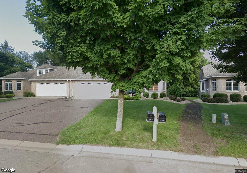
3003 Highpointe Curve Saint Paul, MN 55113
South Owasso NeighborhoodEstimated Value: $447,914 - $520,000
2
Beds
2
Baths
1,729
Sq Ft
$278/Sq Ft
Est. Value
About This Home
This home is located at 3003 Highpointe Curve, Saint Paul, MN 55113 and is currently estimated at $481,479, approximately $278 per square foot. 3003 Highpointe Curve is a home located in Ramsey County with nearby schools including Central Park Elementary School, Roseville Area Middle School, and Roseville Area Senior High School.
Ownership History
Date
Name
Owned For
Owner Type
Purchase Details
Closed on
Jun 22, 2017
Sold by
Kump Rosalyn M
Bought by
Daly Mary
Current Estimated Value
Home Financials for this Owner
Home Financials are based on the most recent Mortgage that was taken out on this home.
Original Mortgage
$231,000
Outstanding Balance
$191,721
Interest Rate
3.94%
Estimated Equity
$289,758
Purchase Details
Closed on
Jul 21, 2009
Sold by
Davis Kenneth F and Davis Kim D
Bought by
Kump Rosalyn M
Purchase Details
Closed on
Aug 27, 2004
Sold by
Peichel James and Peichel Alissa
Bought by
Davis Kenneth and Davis Kim
Purchase Details
Closed on
Jul 26, 2002
Sold by
Fleming Walter and Fleming Phyllis M
Bought by
Rath Allisa M and Peichel James R
Purchase Details
Closed on
Nov 26, 1997
Sold by
Harstad Hills Inc
Bought by
Harstad Homes Inc
Create a Home Valuation Report for This Property
The Home Valuation Report is an in-depth analysis detailing your home's value as well as a comparison with similar homes in the area
Home Values in the Area
Average Home Value in this Area
Purchase History
| Date | Buyer | Sale Price | Title Company |
|---|---|---|---|
| Daly Mary | $339,897 | Burnet Title | |
| Kump Rosalyn M | $282,500 | -- | |
| Davis Kenneth | $305,900 | -- | |
| Rath Allisa M | $262,500 | -- | |
| Harstad Homes Inc | $49,900 | -- | |
| Fleming Walter | $179,900 | -- |
Source: Public Records
Mortgage History
| Date | Status | Borrower | Loan Amount |
|---|---|---|---|
| Open | Daly Mary | $231,000 |
Source: Public Records
Tax History Compared to Growth
Tax History
| Year | Tax Paid | Tax Assessment Tax Assessment Total Assessment is a certain percentage of the fair market value that is determined by local assessors to be the total taxable value of land and additions on the property. | Land | Improvement |
|---|---|---|---|---|
| 2025 | $5,900 | $435,200 | $100,000 | $335,200 |
| 2024 | $5,900 | $430,100 | $100,000 | $330,100 |
| 2023 | $5,900 | $417,000 | $100,000 | $317,000 |
| 2022 | $5,228 | $393,300 | $100,000 | $293,300 |
| 2021 | $5,208 | $349,900 | $100,000 | $249,900 |
| 2020 | $5,036 | $370,400 | $100,000 | $270,400 |
| 2019 | $4,912 | $338,200 | $56,000 | $282,200 |
| 2018 | $4,328 | $322,100 | $56,000 | $266,100 |
| 2017 | $3,700 | $280,100 | $56,000 | $224,100 |
| 2016 | $3,884 | $0 | $0 | $0 |
| 2015 | $3,892 | $264,900 | $56,000 | $208,900 |
| 2014 | $3,664 | $0 | $0 | $0 |
Source: Public Records
Map
Nearby Homes
- 2970 Western Ave N
- 405 Judith Ave
- 2841 Galtier St
- 387 Iona Ln
- 2814 Matilda St
- 2821 Galtier St
- 2802 Marion St
- 540 Woodhill Dr Unit 71
- 2720 MacKubin St
- 417 W Horseshoe Dr
- 2730 Dale St N Unit D101
- 2687 Galtier St
- 2939 W Owasso Blvd
- 2720 Dale St N Unit C208
- 2710 Dale St N Unit B212
- 3318 W Owasso Blvd
- 556 County Road C W
- 667 County Road C W
- 3163 Christopher Ln
- 3399 Kent St Unit 211
- 3001 Highpointe Curve
- 3007 Highpointe Curve
- 0 Unassigned
- 3009 Highpointe Curve
- 450 S Owasso Blvd W
- 2997 Highpointe Curve
- 2995 Highpointe Curve
- 3000 Highpointe Curve
- 3013 Highpointe Curve
- 3002 Highpointe Curve
- 450 450 Owasso-Boulevard-s
- 209 McCarrons Place
- 2998 Highcourte
- 3015 Highpointe Curve
- 2989 Highpointe Curve
- 2996 Highcourte
- 2987 Highpointe Curve
- 2994 Highcourte
- 3014 Highpointe Curve
- 3019 Highpointe Curve