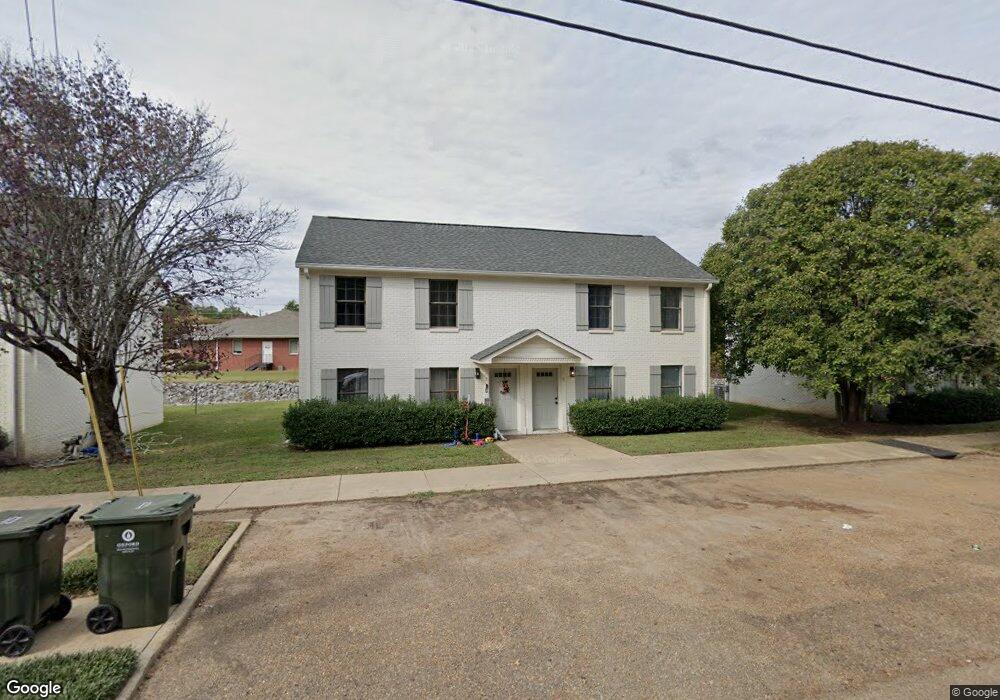
3005 Davis Dr Oxford, MS 38655
Estimated Value: $342,966 - $1,027,000
--
Bed
1
Bath
2,031
Sq Ft
$293/Sq Ft
Est. Value
About This Home
This home is located at 3005 Davis Dr, Oxford, MS 38655 and is currently estimated at $595,742, approximately $293 per square foot. 3005 Davis Dr is a home with nearby schools including Central Elementary School, Bramlett Elementary School, and Della Davidson Elementary School.
Ownership History
Date
Name
Owned For
Owner Type
Purchase Details
Closed on
Oct 24, 2023
Sold by
Reynolds William Edward
Bought by
Real Stock Llc
Current Estimated Value
Purchase Details
Closed on
Jun 30, 2023
Sold by
Reynolds William E
Bought by
Mcphail Wayne and Mcphail Frances Elizabeth
Purchase Details
Closed on
Mar 10, 2023
Sold by
Burnett Nathan T
Bought by
Reynolds William Edward
Purchase Details
Closed on
Mar 6, 2023
Sold by
Burnett Heather S
Bought by
Burnett Nathan T
Purchase Details
Closed on
Dec 17, 2015
Sold by
Veasey Charles Larry and Veasey Cassandra B
Bought by
Burnett Nathan T and Burnett Heather S
Home Financials for this Owner
Home Financials are based on the most recent Mortgage that was taken out on this home.
Original Mortgage
$136,000
Interest Rate
3.91%
Mortgage Type
Future Advance Clause Open End Mortgage
Create a Home Valuation Report for This Property
The Home Valuation Report is an in-depth analysis detailing your home's value as well as a comparison with similar homes in the area
Home Values in the Area
Average Home Value in this Area
Purchase History
| Date | Buyer | Sale Price | Title Company |
|---|---|---|---|
| Real Stock Llc | -- | None Listed On Document | |
| Mcphail Wayne | -- | None Listed On Document | |
| Reynolds William Edward | -- | None Listed On Document | |
| Burnett Nathan T | -- | None Listed On Document | |
| Burnett Nathan T | -- | None Available |
Source: Public Records
Mortgage History
| Date | Status | Borrower | Loan Amount |
|---|---|---|---|
| Previous Owner | Burnett Nathan T | $136,000 |
Source: Public Records
Tax History Compared to Growth
Tax History
| Year | Tax Paid | Tax Assessment Tax Assessment Total Assessment is a certain percentage of the fair market value that is determined by local assessors to be the total taxable value of land and additions on the property. | Land | Improvement |
|---|---|---|---|---|
| 2024 | $2,684 | $20,315 | $0 | $0 |
| 2023 | $2,684 | $20,315 | $0 | $0 |
| 2022 | $2,643 | $20,315 | $0 | $0 |
| 2021 | $730 | $20,315 | $0 | $0 |
| 2020 | $713 | $20,399 | $0 | $0 |
| 2019 | $713 | $20,399 | $0 | $0 |
| 2018 | $717 | $20,511 | $0 | $0 |
| 2017 | $717 | $20,511 | $0 | $0 |
| 2016 | $647 | $19,190 | $0 | $0 |
| 2015 | -- | $19,190 | $0 | $0 |
| 2014 | -- | $19,190 | $0 | $0 |
Source: Public Records
Map
Nearby Homes
- 2109 #26 Harris Dr
- 1802 Jackson Ave W Unit 19
- 1802 #37 W Jackson Ave
- 624 Miramar Ln
- 638 Miramar Ln
- 661 Miramar Ln
- 618 Miramar Ln
- 675 Miramar Ln
- 625 Miramar Ln
- 1007 Belle Terre Ln
- 636 Miramar Ln
- 506 Hemingway Ln
- 408-410 Galleria Dr
- 1802 #26 W Jackson Ave
- 2150 Anderson Rd
- 115 Red Rose Ln
- 1602 Jackson Ave W
- 312 Hathorn Rd
- 1203 Anderson Rd
- 532 Hathorn Rd
- 119 Michael Dr Unit 119
- 117 Michael Dr Unit 117
- 3006 Davis Dr
- 111 Michael Dr
- 111 Michael Dr Unit 111
- 3008 Davis Dr
- 3012 Davis Dr
- 118 Michael Dr
- 118 Michael Dr Unit 118
- 14 Davis Dr
- 101 Michael Dr Unit 101
- 3014 Davis Dr
- 114 Michael Dr Unit 114
- 106 Michael Dr
- 306 Davis Dr
- 37394143 Davis Dr
- 0 Davis Dr
- 116 Michael Dr
- 102 Michael Dr Unit 102 Michael Drive
- 104 Michael Dr Unit 104