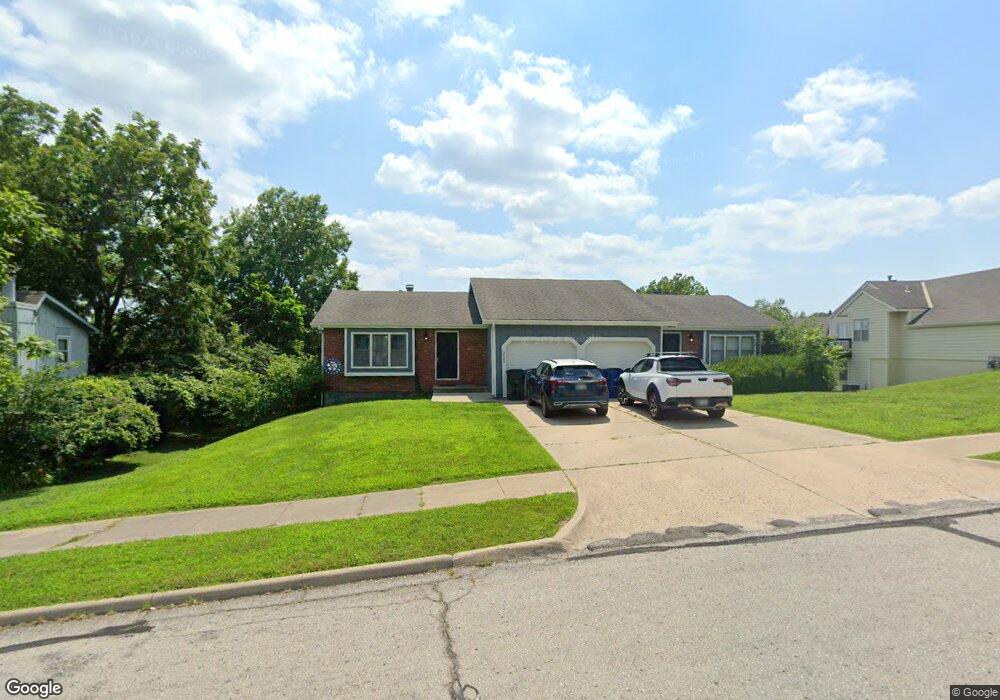
3005 University Dr Lawrence, KS 66049
Sunset Hills NeighborhoodEstimated Value: $269,000 - $411,000
3
Beds
2
Baths
1,348
Sq Ft
$260/Sq Ft
Est. Value
About This Home
This home is located at 3005 University Dr, Lawrence, KS 66049 and is currently estimated at $350,917, approximately $260 per square foot. 3005 University Dr is a home located in Douglas County with nearby schools including Sunset Hill Elementary School, West Middle School, and Lawrence Free State High School.
Ownership History
Date
Name
Owned For
Owner Type
Purchase Details
Closed on
Aug 22, 2024
Sold by
Bost Ashley P and Bost Megan
Bought by
Dude Investments Llc
Current Estimated Value
Purchase Details
Closed on
Jun 30, 2015
Sold by
Trustco Bank
Bought by
The Kansas University Endowment Associat
Purchase Details
Closed on
Jun 9, 2014
Sold by
Roberts Donald R
Bought by
Roberts Donald R and Donald R Roberts Revocable Trust
Create a Home Valuation Report for This Property
The Home Valuation Report is an in-depth analysis detailing your home's value as well as a comparison with similar homes in the area
Home Values in the Area
Average Home Value in this Area
Purchase History
| Date | Buyer | Sale Price | Title Company |
|---|---|---|---|
| Dude Investments Llc | -- | None Listed On Document | |
| The Kansas University Endowment Associat | -- | None Available | |
| Roberts Donald R | -- | None Available |
Source: Public Records
Tax History Compared to Growth
Tax History
| Year | Tax Paid | Tax Assessment Tax Assessment Total Assessment is a certain percentage of the fair market value that is determined by local assessors to be the total taxable value of land and additions on the property. | Land | Improvement |
|---|---|---|---|---|
| 2025 | $5,144 | $42,125 | $7,475 | $34,650 |
| 2024 | $5,144 | $41,435 | $7,475 | $33,960 |
| 2023 | $4,834 | $37,605 | $7,475 | $30,130 |
| 2022 | $4,357 | $33,705 | $6,900 | $26,805 |
| 2021 | $3,844 | $28,807 | $5,031 | $23,776 |
| 2020 | $3,774 | $28,428 | $5,031 | $23,397 |
| 2019 | $3,702 | $27,922 | $4,598 | $23,324 |
| 2018 | $3,658 | $27,393 | $4,598 | $22,795 |
| 2017 | $3,459 | $25,634 | $4,598 | $21,036 |
| 2016 | $3,254 | $25,197 | $4,598 | $20,599 |
| 2015 | -- | $24,794 | $4,598 | $20,196 |
| 2014 | -- | $26,732 | $4,598 | $22,134 |
Source: Public Records
Map
Nearby Homes
- 1319 Westbrooke St
- 1339 Westbrooke St
- 1405 Westbrooke St
- 2822 University Dr
- 1439 Applegate Ct
- 1424 Applegate Ct Unit A
- 3025 Wellington Ct
- 1104 Lawrence Ave
- 1214 Crestline Dr
- 2600 Oxford Rd
- 2609 Westdale Rd
- 3408 W 13th St
- 1014 Lawrence Ave
- 3404 Oxford Ct
- 1008 Lawrence Ave
- 3417 Seminole Dr
- 1507 Medinah Cir
- 3012 W 19th St
- 923 Crestline Dr
- 3001 University Dr
- 3009 University Dr
- 1312 Westbrooke St
- 3000 University Dr
- 1313 Westbrooke St
- 1301 Westbrooke St
- 1307 Westbrooke St
- 1314 Westbrooke St
- 1306 Westbrooke St
- 1315 Westbrooke St
- 1300 Westbrooke St
- 1318 Westbrooke St
- 1303 Westbrooke St
- 1309 Westbrooke St
- 1316 Westbrooke St
- 1308 Westbrooke St
- 1349 Westbrooke St
- 1320 Westbrooke St
- 2912 Stratford Rd
- 1305 Westbrooke St