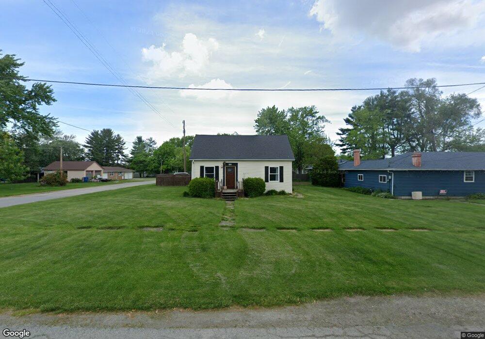
301 E Bates St Hebron, IN 46341
Porter County NeighborhoodEstimated Value: $184,000 - $227,000
Studio
1
Bath
1,194
Sq Ft
$169/Sq Ft
Est. Value
About This Home
This home is located at 301 E Bates St, Hebron, IN 46341 and is currently estimated at $201,584, approximately $168 per square foot. 301 E Bates St is a home located in Porter County with nearby schools including Hebron Elementary School, Hebron Middle School, and Hebron High School.
Ownership History
Date
Name
Owned For
Owner Type
Purchase Details
Closed on
Feb 26, 2021
Sold by
Goldie Timothy K and Goldie Lori A
Bought by
Roeske Danielle
Current Estimated Value
Purchase Details
Closed on
Apr 6, 2020
Sold by
Goldie Lori A and Edwin Donaldson Living Trust
Bought by
Goldie Timothy K and Goldie Loria A
Purchase Details
Closed on
Feb 27, 2008
Sold by
Donaldson Edwin P and Donaldson Edwin
Bought by
Donaldson Edwin P and Edwin Donaldson Living Trust
Create a Home Valuation Report for This Property
The Home Valuation Report is an in-depth analysis detailing your home's value as well as a comparison with similar homes in the area
Home Values in the Area
Average Home Value in this Area
Purchase History
| Date | Buyer | Sale Price | Title Company |
|---|---|---|---|
| Roeske Danielle | -- | Mtc | |
| Goldie Timothy K | -- | None Available | |
| Donaldson Edwin P | -- | None Available |
Source: Public Records
Tax History
| Year | Tax Paid | Tax Assessment Tax Assessment Total Assessment is a certain percentage of the fair market value that is determined by local assessors to be the total taxable value of land and additions on the property. | Land | Improvement |
|---|---|---|---|---|
| 2025 | $2,722 | $132,000 | $22,800 | $109,200 |
| 2024 | $1,038 | $122,200 | $22,800 | $99,400 |
| 2023 | $1,011 | $117,700 | $21,500 | $96,200 |
| 2022 | $1,111 | $112,700 | $21,500 | $91,200 |
| 2021 | $1,043 | $101,000 | $21,500 | $79,500 |
| 2020 | $1,027 | $98,300 | $18,800 | $79,500 |
| 2019 | $810 | $89,600 | $18,800 | $70,800 |
| 2018 | $784 | $85,500 | $18,800 | $66,700 |
| 2017 | $852 | $90,900 | $18,800 | $72,100 |
| 2016 | $867 | $92,400 | $18,700 | $73,700 |
| 2014 | $786 | $84,200 | $17,200 | $67,000 |
| 2013 | -- | $79,200 | $17,300 | $61,900 |
Source: Public Records
Map
Nearby Homes
- 307 E Casey St
- 301 W Bates St
- 0 W Wilson St
- 515 Tamarack Trail
- 403 S Washington St
- 409 S Jefferson St
- 19 Maxwell St
- 20 Maxwell St
- 709 Beverly Dr
- 201 N Quincy St
- 203 N Quincy St
- 79 Maple Ct
- 134 Elm Ct
- 118 Cherry Ct
- 14910 County Line Rd
- 805 W Wilson St
- 587 Osburn St
- 589 Osburn St
- 440 Fry St
- 443 Bricker St
- 303 E Bates St
- 305 N Taylor St
- 207 E Bates St
- 305 E Bates St
- 307 N Taylor St
- 304 E Casey St
- 306 N Taylor St
- 205 E Bates St
- 302 E Bates St
- 208 N Taylor St
- 304 E Bates St
- 307 E Bates St
- 306 E Casey St
- 306 E Bates St
- 308 N Taylor St
- 206 N Taylor St
- 203 E Bates St
- 308 N Quincy St
- E E Casey St
- 206 E Bates St
Your Personal Tour Guide
Ask me questions while you tour the home.