K
Seller's Agent in 2026
Kayla Boyd
Triple Creek Realty LLC
(573) 366-1410
40 Total Sales
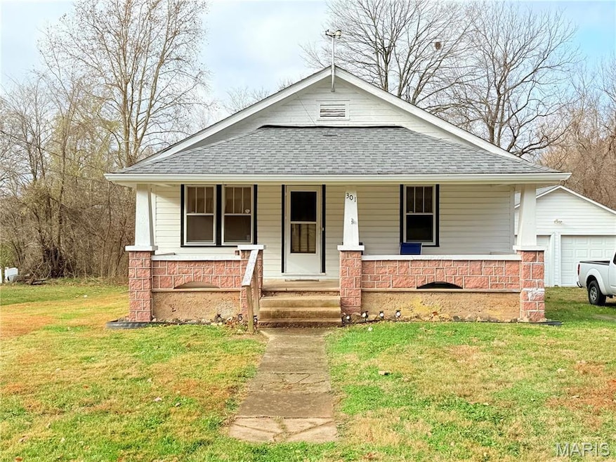
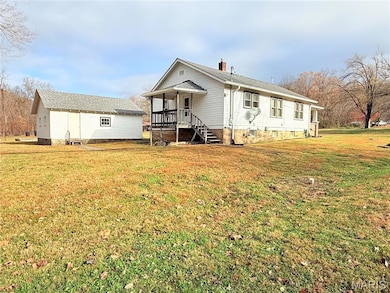
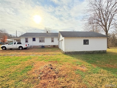
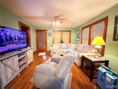
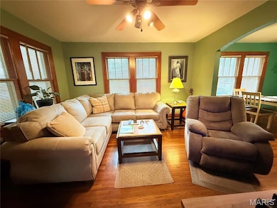
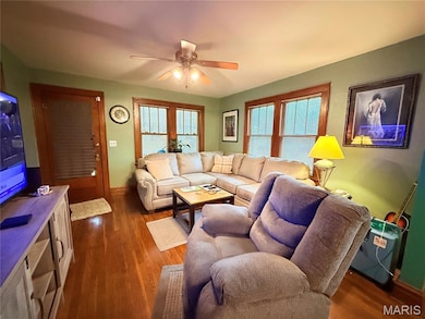
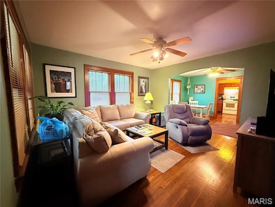
Discover charm and character in this well-kept 2 bedroom, 1 bath home with a full walkout basement and a 2-car detached garage. This inviting property features real hardwood floors and beautiful wood trim throughout, creating a warm and timeless feel. Enjoy meals and gatherings in the spacious dining room, and take advantage of the versatile bonus room, perfect for office, playroom, or cozy sitting area. Relax on a large front porch with your morning coffee, or step out onto the back porch for grilling and entertaining in the private backyard. The clean, spacious basement offers abundant storage and convenient access to the yard. Recent updates Include a new HVAC system (installed just months ago) and new leaf guards for low maintenance living. The detached 2-car garage provides excellent space for multiple vehicles or extra storage. Located on a quiet dead-end street with no through traffic, this home offers peace and privacy while still being close to everything that you need. Don’t miss your chance to own this wonderful maintained home schedule your showing today. House can come fully furnished if buyer wants.
Last Agent to Sell the Property
Triple Creek Realty LLC License #2024023461 Listed on: 11/20/2025
| Date | Type | Sale Price | Title Company |
|---|---|---|---|
| Deed | $15,000 | -- | |
| Deed | -- | -- | |
| Deed | -- | -- | |
| Deed | $44,800 | -- | |
| Deed | -- | -- | |
| Deed | $43,900 | -- |
| Date | Event | Price | List to Sale | Price per Sq Ft |
|---|---|---|---|---|
| 01/27/2026 01/27/26 | Sold | -- | -- | -- |
| 12/16/2025 12/16/25 | Pending | -- | -- | -- |
| 11/20/2025 11/20/25 | For Sale | $149,000 | -- | $145 / Sq Ft |
| Year | Tax Paid | Tax Assessment Tax Assessment Total Assessment is a certain percentage of the fair market value that is determined by local assessors to be the total taxable value of land and additions on the property. | Land | Improvement |
|---|---|---|---|---|
| 2024 | $300 | $6,300 | $1,330 | $4,970 |
| 2023 | $294 | $6,300 | $1,330 | $4,970 |
| 2022 | $287 | $6,140 | $1,170 | $4,970 |
| 2021 | $282 | $6,140 | $1,170 | $4,970 |
| 2020 | $262 | $5,610 | $1,170 | $4,440 |
| 2019 | $262 | $5,610 | $1,170 | $4,440 |
| 2018 | $262 | $5,610 | $1,170 | $4,440 |
| 2017 | $262 | $5,610 | $1,170 | $4,440 |
| 2016 | $263 | $5,840 | $1,170 | $4,670 |
| 2015 | -- | $5,840 | $1,170 | $4,670 |
| 2014 | -- | $6,060 | $1,170 | $4,890 |
| 2011 | -- | $0 | $0 | $0 |
K
Seller's Agent in 2026
Kayla Boyd
Triple Creek Realty LLC
(573) 366-1410
40 Total Sales
D
Seller Co-Listing Agent in 2026
Dayton Boyd
Triple Creek Realty LLC
(573) 760-4635
9 Total Sales
Source: MARIS MLS
MLS Number: MIS25077753
APN: 11903000100030060000
Disclaimer: Certain information contained herein is derived from information provided by parties other than Homes.com. All information provided is deemed reliable, but is not guaranteed to be accurate and should be independently verified.
![]() Based on information submitted to the MLS GRID. All data is obtained from various sources and may not have been verified by broker or MLS GRID. Supplied Open House Information is subject to change without notice. All information should be independently reviewed and verified for accuracy. Properties may or may not be listed by the office/agent presenting the information. Some IDX listings have been excluded from this website.
Based on information submitted to the MLS GRID. All data is obtained from various sources and may not have been verified by broker or MLS GRID. Supplied Open House Information is subject to change without notice. All information should be independently reviewed and verified for accuracy. Properties may or may not be listed by the office/agent presenting the information. Some IDX listings have been excluded from this website.
Based on information submitted to the MLS GRID
Ask me questions while you tour the home.
