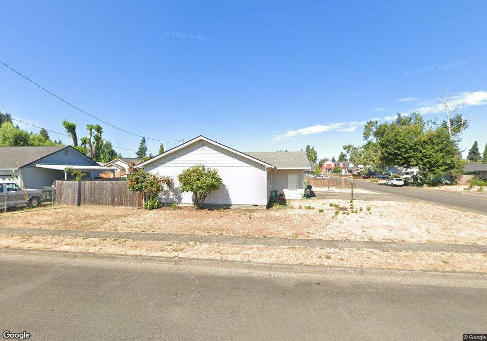
301 S 3rd St Creswell, OR 97426
Estimated Value: $396,000 - $433,000
4
Beds
2
Baths
1,828
Sq Ft
$223/Sq Ft
Est. Value
About This Home
This home is located at 301 S 3rd St, Creswell, OR 97426 and is currently estimated at $407,924, approximately $223 per square foot. 301 S 3rd St is a home located in Lane County with nearby schools including Creslane Elementary School, Creswell Middle School, and Creswell High School.
Ownership History
Date
Name
Owned For
Owner Type
Purchase Details
Closed on
Aug 15, 2022
Sold by
Green Dennis W
Bought by
Green Living Trust
Current Estimated Value
Purchase Details
Closed on
Jan 29, 2004
Sold by
Peterson Roy V and Peterson Arlene A
Bought by
Green Dennis W and Green Evelyn A
Create a Home Valuation Report for This Property
The Home Valuation Report is an in-depth analysis detailing your home's value as well as a comparison with similar homes in the area
Home Values in the Area
Average Home Value in this Area
Purchase History
| Date | Buyer | Sale Price | Title Company |
|---|---|---|---|
| Green Living Trust | -- | None Listed On Document | |
| Green Dennis W | $110,000 | Western Title & Escrow Co |
Source: Public Records
Tax History Compared to Growth
Tax History
| Year | Tax Paid | Tax Assessment Tax Assessment Total Assessment is a certain percentage of the fair market value that is determined by local assessors to be the total taxable value of land and additions on the property. | Land | Improvement |
|---|---|---|---|---|
| 2025 | $2,596 | $158,195 | -- | -- |
| 2024 | $1,942 | $153,588 | -- | -- |
| 2023 | $1,942 | $149,115 | $0 | $0 |
| 2022 | $2,092 | $144,772 | $0 | $0 |
| 2021 | $2,021 | $140,556 | $0 | $0 |
| 2020 | $1,992 | $136,463 | $0 | $0 |
| 2019 | $1,949 | $132,489 | $0 | $0 |
| 2018 | $1,921 | $124,884 | $0 | $0 |
| 2017 | $1,864 | $124,884 | $0 | $0 |
| 2016 | $1,909 | $121,247 | $0 | $0 |
| 2015 | $1,840 | $117,716 | $0 | $0 |
| 2014 | $1,825 | $114,287 | $0 | $0 |
Source: Public Records
Map
Nearby Homes
- 589 Mary Neal Ln
- 0 Holbrook Ln Unit 339588620
- 521 S 7th St
- 1 Queens Ave Unit 1
- 645 Boulder Loop
- 368 Hillegas Ave
- 156 N 1st St
- 692 N 1st St
- 689 Blue Jay Loop
- 700 N Mill St Unit 109
- 700 N Mill St
- 460 Meadow Ln
- 83354 N Pacific Hwy
- 491 Ironwood Loop
- 33320 Bryant Rd
- 316 Sunday Dr
- 375 Sunday Dr
- 336 Sunday Dr
- 32968 Camas Swale Rd
- 685 St Andrews Loop