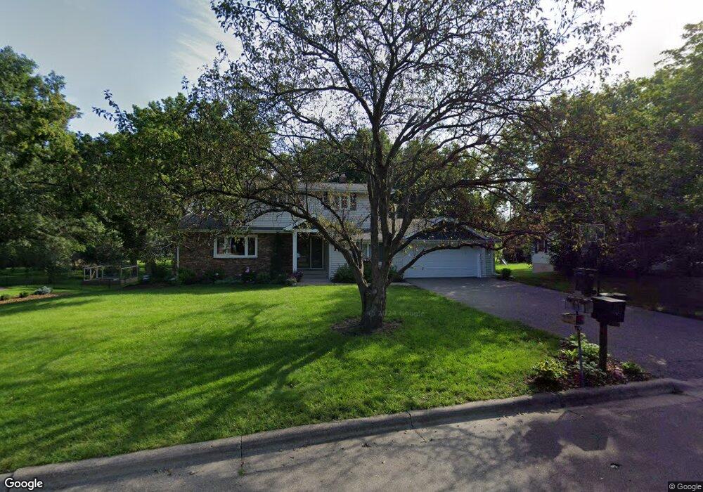
3010 Sandy Hook Dr Saint Paul, MN 55113
South Owasso NeighborhoodEstimated Value: $556,000 - $684,000
4
Beds
4
Baths
2,686
Sq Ft
$235/Sq Ft
Est. Value
About This Home
This home is located at 3010 Sandy Hook Dr, Saint Paul, MN 55113 and is currently estimated at $630,443, approximately $234 per square foot. 3010 Sandy Hook Dr is a home located in Ramsey County with nearby schools including Emmet D. Williams Elementary School, Roseville Area Middle School, and Roseville Area High School.
Ownership History
Date
Name
Owned For
Owner Type
Purchase Details
Closed on
Jul 1, 2019
Sold by
West Steven R
Bought by
Ankeny Jacob S and Ankeny Chelsea Jm
Current Estimated Value
Home Financials for this Owner
Home Financials are based on the most recent Mortgage that was taken out on this home.
Original Mortgage
$457,900
Outstanding Balance
$401,161
Interest Rate
3.82%
Mortgage Type
New Conventional
Estimated Equity
$229,282
Purchase Details
Closed on
Jun 23, 2017
Sold by
West Sandra J and West Sandra Jean
Bought by
West Steven R
Home Financials for this Owner
Home Financials are based on the most recent Mortgage that was taken out on this home.
Original Mortgage
$375,000
Interest Rate
3.95%
Mortgage Type
New Conventional
Purchase Details
Closed on
May 22, 1998
Sold by
Park Soon John and Park Seun Hee
Bought by
West Steven R and West Sandy J
Create a Home Valuation Report for This Property
The Home Valuation Report is an in-depth analysis detailing your home's value as well as a comparison with similar homes in the area
Home Values in the Area
Average Home Value in this Area
Purchase History
| Date | Buyer | Sale Price | Title Company |
|---|---|---|---|
| Ankeny Jacob S | $482,000 | None Available | |
| West Steven R | -- | Land Title Inc | |
| West Steven R | $186,000 | -- |
Source: Public Records
Mortgage History
| Date | Status | Borrower | Loan Amount |
|---|---|---|---|
| Open | Ankeny Jacob S | $457,900 | |
| Previous Owner | West Steven R | $375,000 |
Source: Public Records
Tax History
| Year | Tax Paid | Tax Assessment Tax Assessment Total Assessment is a certain percentage of the fair market value that is determined by local assessors to be the total taxable value of land and additions on the property. | Land | Improvement |
|---|---|---|---|---|
| 2025 | $8,120 | $609,800 | $152,600 | $457,200 |
| 2023 | $8,120 | $561,200 | $152,600 | $408,600 |
| 2022 | $7,200 | $540,200 | $152,600 | $387,600 |
| 2021 | $6,506 | $475,400 | $169,600 | $305,800 |
| 2020 | $6,794 | $458,500 | $169,600 | $288,900 |
| 2019 | $6,450 | $448,300 | $169,600 | $278,700 |
| 2018 | $6,454 | $413,800 | $169,600 | $244,200 |
| 2017 | $5,882 | $403,300 | $169,600 | $233,700 |
| 2016 | $6,114 | $0 | $0 | $0 |
| 2015 | $6,524 | $400,000 | $159,000 | $241,000 |
| 2014 | $5,790 | $0 | $0 | $0 |
Source: Public Records
Map
Nearby Homes
- 340 S Owasso Blvd W
- 613 S Owasso Blvd W
- 405 Judith Ave
- 255 County Road C2 W
- 2972 Woodbridge St
- 3070 Woodbridge St
- 2730 Dale St N Unit D309
- 2720 Dale St N Unit C114
- 2700 Dale St N Unit A214
- 2648 MacKubin St
- 2710 Dale St N Unit B307
- 3098 Victoria St N
- 3318 W Owasso Blvd
- 419 County Road C W
- 972 Lydia Dr W
- 556 County Road C W
- 2870 Victoria St N
- 3399 Kent St Unit 211
- 2869 Victoria St N
- 953 Lydia Ave W
- 3020 Sandy Hook Dr
- 3000 Sandy Hook Dr
- 3011 Little Bay Rd
- 3021 Little Bay Rd
- 3001 Little Bay Rd
- 3032 Sandy Hook Dr
- 3011 Sandy Hook Dr
- 3001 Sandy Hook Dr
- 3017 Sandy Hook Dr
- 3031 Little Bay Rd
- 3025 Sandy Hook Dr
- 3042 Sandy Hook Dr
- 553 S Owasso Blvd W
- 3043 Little Bay Rd
- 3043 Sandy Hook Dr
- 3010 Little Bay Rd
- 3030 Little Bay Rd
- 3000 Little Bay Rd
- 3050 Sandy Hook Dr
- 518 Heinel Dr
Your Personal Tour Guide
Ask me questions while you tour the home.