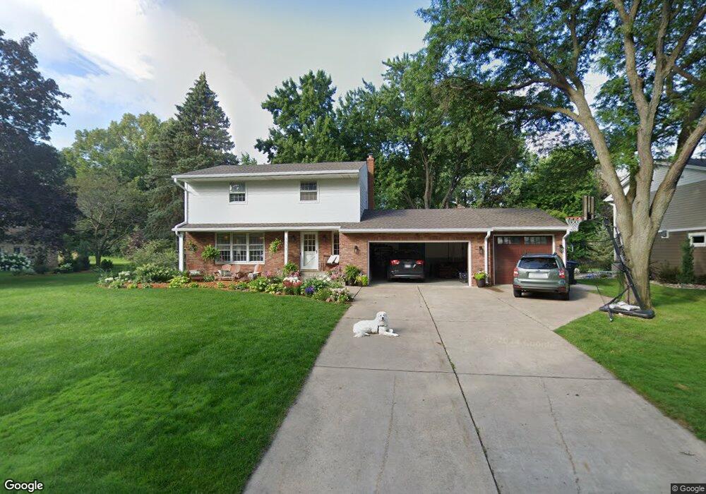
3011 Little Bay Rd Saint Paul, MN 55113
South Owasso NeighborhoodEstimated Value: $540,000 - $742,000
4
Beds
3
Baths
1,996
Sq Ft
$312/Sq Ft
Est. Value
About This Home
This home is located at 3011 Little Bay Rd, Saint Paul, MN 55113 and is currently estimated at $622,963, approximately $312 per square foot. 3011 Little Bay Rd is a home located in Ramsey County with nearby schools including Emmet D. Williams Elementary School, Roseville Area Middle School, and Roseville Area Senior High School.
Ownership History
Date
Name
Owned For
Owner Type
Purchase Details
Closed on
Apr 9, 2018
Sold by
Gustafson David Philip and Milrath Gustafson Kayla Christine
Bought by
Macgregor Harold and Macgregor Ashley
Current Estimated Value
Home Financials for this Owner
Home Financials are based on the most recent Mortgage that was taken out on this home.
Original Mortgage
$383,200
Outstanding Balance
$328,760
Interest Rate
4.43%
Mortgage Type
New Conventional
Estimated Equity
$294,203
Purchase Details
Closed on
Aug 13, 2015
Sold by
Willard Paul W and Willard Mary E
Bought by
Gustafson David Philip and Milbrath Gustafson Kayla Chritsine
Home Financials for this Owner
Home Financials are based on the most recent Mortgage that was taken out on this home.
Original Mortgage
$398,050
Interest Rate
4.09%
Mortgage Type
New Conventional
Create a Home Valuation Report for This Property
The Home Valuation Report is an in-depth analysis detailing your home's value as well as a comparison with similar homes in the area
Home Values in the Area
Average Home Value in this Area
Purchase History
| Date | Buyer | Sale Price | Title Company |
|---|---|---|---|
| Macgregor Harold | $479,000 | Network Title Inc | |
| Gustafson David Philip | $431,696 | Edina Realty Title Inc |
Source: Public Records
Mortgage History
| Date | Status | Borrower | Loan Amount |
|---|---|---|---|
| Open | Macgregor Harold | $383,200 | |
| Previous Owner | Gustafson David Philip | $398,050 |
Source: Public Records
Tax History Compared to Growth
Tax History
| Year | Tax Paid | Tax Assessment Tax Assessment Total Assessment is a certain percentage of the fair market value that is determined by local assessors to be the total taxable value of land and additions on the property. | Land | Improvement |
|---|---|---|---|---|
| 2025 | $7,028 | $525,800 | $148,400 | $377,400 |
| 2023 | $7,028 | $496,700 | $148,400 | $348,300 |
| 2022 | $6,734 | $477,300 | $148,400 | $328,900 |
| 2021 | $6,310 | $444,700 | $165,700 | $279,000 |
| 2020 | $6,820 | $444,700 | $165,700 | $279,000 |
| 2019 | $5,708 | $450,000 | $165,700 | $284,300 |
| 2018 | $5,948 | $369,600 | $165,700 | $203,900 |
| 2017 | $5,094 | $374,000 | $165,700 | $208,300 |
| 2016 | $4,932 | $0 | $0 | $0 |
| 2015 | $5,192 | $328,400 | $155,300 | $173,100 |
| 2014 | $4,792 | $0 | $0 | $0 |
Source: Public Records
Map
Nearby Homes
- 2970 Western Ave N
- 613 S Owasso Blvd W
- 405 Judith Ave
- 387 Iona Ln
- 2748 Kent St
- 2814 Matilda St
- 255 County Road C2 W
- 540 Woodhill Dr Unit 71
- 2720 MacKubin St
- 417 W Horseshoe Dr
- 3071 Avon St N
- 2730 Dale St N Unit D101
- 2730 Dale St N Unit D309
- 2802 Marion St
- 2720 Dale St N Unit C208
- 2710 Dale St N Unit B212
- 437 County Road C W
- 3318 W Owasso Blvd
- 3020 Rice St Unit Trailer B16
- 3163 Christopher Ln
- 3001 Little Bay Rd
- 3021 Little Bay Rd
- 3010 Sandy Hook Dr
- 3000 Sandy Hook Dr
- 3020 Sandy Hook Dr
- 3031 Little Bay Rd
- 3010 Little Bay Rd
- 3000 Little Bay Rd
- 3030 Little Bay Rd
- 3032 Sandy Hook Dr
- 3043 Little Bay Rd
- 3040 Little Bay Rd
- 3042 Sandy Hook Dr
- 455 S Owasso Blvd W
- 450 450 Owasso-Boulevard-s
- 3011 Sandy Hook Dr
- 3001 Sandy Hook Dr
- 3053 Little Bay Rd
- 3017 Sandy Hook Dr
- 3050 Little Bay Rd