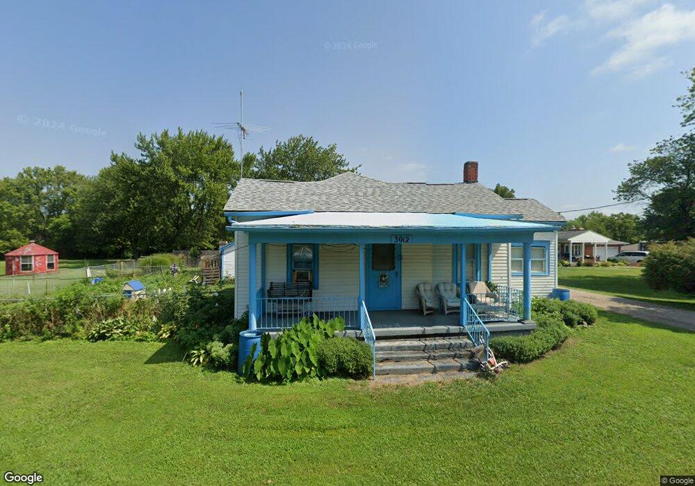
3012 State Route 122 Franklin, OH 45005
Estimated Value: $226,993 - $383,000
4
Beds
1
Bath
1,102
Sq Ft
$296/Sq Ft
Est. Value
About This Home
This home is located at 3012 State Route 122, Franklin, OH 45005 and is currently estimated at $326,498, approximately $296 per square foot. 3012 State Route 122 is a home located in Warren County with nearby schools including Clearcreek Elementary School, Dennis Elementary School, and Springboro Intermediate School.
Ownership History
Date
Name
Owned For
Owner Type
Purchase Details
Closed on
Dec 6, 1990
Sold by
Horn Horn and Horn Louis D
Bought by
Pennington Pennington and Pennington Ronald L
Current Estimated Value
Purchase Details
Closed on
Jan 4, 1988
Sold by
Gibbs Gibbs and Gibbs Douglas W
Bought by
Horn Horn and Horn Louis D
Purchase Details
Closed on
Jul 9, 1986
Sold by
Gibbs Gibbs and Gibbs Douglas W
Bought by
Gibbs Gibbs and Gibbs Douglas W
Purchase Details
Closed on
Feb 4, 1986
Sold by
Cornwell Cornwell and Cornwell Ruth
Bought by
Cornwell Cornwell and Cornwell Ruth
Purchase Details
Closed on
Sep 19, 1980
Sold by
Cobb Cobb and Cobb Amanda
Create a Home Valuation Report for This Property
The Home Valuation Report is an in-depth analysis detailing your home's value as well as a comparison with similar homes in the area
Home Values in the Area
Average Home Value in this Area
Purchase History
| Date | Buyer | Sale Price | Title Company |
|---|---|---|---|
| Pennington Pennington | $54,900 | -- | |
| Horn Horn | $45,000 | -- | |
| Gibbs Gibbs | -- | -- | |
| Cornwell Cornwell | -- | -- | |
| -- | -- | -- |
Source: Public Records
Tax History Compared to Growth
Tax History
| Year | Tax Paid | Tax Assessment Tax Assessment Total Assessment is a certain percentage of the fair market value that is determined by local assessors to be the total taxable value of land and additions on the property. | Land | Improvement |
|---|---|---|---|---|
| 2024 | $1,805 | $68,430 | $46,370 | $22,060 |
| 2023 | $1,242 | $48,373 | $28,819 | $19,554 |
| 2022 | $1,553 | $48,374 | $28,819 | $19,555 |
| 2021 | $1,435 | $48,374 | $28,819 | $19,555 |
| 2020 | $1,269 | $39,326 | $23,429 | $15,897 |
| 2019 | $1,632 | $39,326 | $23,429 | $15,897 |
| 2018 | $1,621 | $39,326 | $23,429 | $15,897 |
| 2017 | $1,602 | $34,783 | $20,405 | $14,378 |
| 2016 | $1,671 | $34,783 | $20,405 | $14,378 |
| 2015 | $1,674 | $34,783 | $20,405 | $14,378 |
| 2014 | $1,643 | $32,400 | $19,450 | $12,950 |
| 2013 | $1,632 | $36,940 | $21,270 | $15,670 |
Source: Public Records
Map
Nearby Homes
- 2958 St Rt 122
- 2958 State Route 122
- 3085 Ohio 122
- 2866 State Route 122
- 2866 Ohio 122
- 3095 Canvasback Ct
- 3071 Canvasback Ct
- 3077 Canvasback Ct
- 3089 Canvasback Ct
- 3083 Canvasback Ct
- Chattanooga Plan at Trails of Greycliff
- Somerset Plan at Trails of Greycliff
- Miramar Plan at Trails of Greycliff
- Carlisle Plan at Trails of Greycliff
- Birmingham Plan at Trails of Greycliff
- Rockford Plan at Trails of Greycliff
- Truman Plan at Trails of Greycliff
- Longwood Plan at Trails of Greycliff
- Sanibel Plan at Trails of Greycliff
- 3098 Canvasback Ct
- 2994 State Route 122
- 3084 Ohio 122
- 3084 Ohio 122 Unit 12
- 3040 State Route 122
- 2974 State Route 122
- 2974 St Rt 122
- 2985 State Route 122
- 3011 State Route 122
- 2940 State Route 122
- 2961 State Route 122
- 2922 State Route 122
- 2825 Ohio 122
- 3082 State Route 122
- 2902 State Route 122
- 3084 State Route 122
- 3084 State Route 122 Unit 12
- 3084 State Route 122 Unit 12
- 3084 State Route 122
- 3086 State Route 122
- 2880 State Route 122