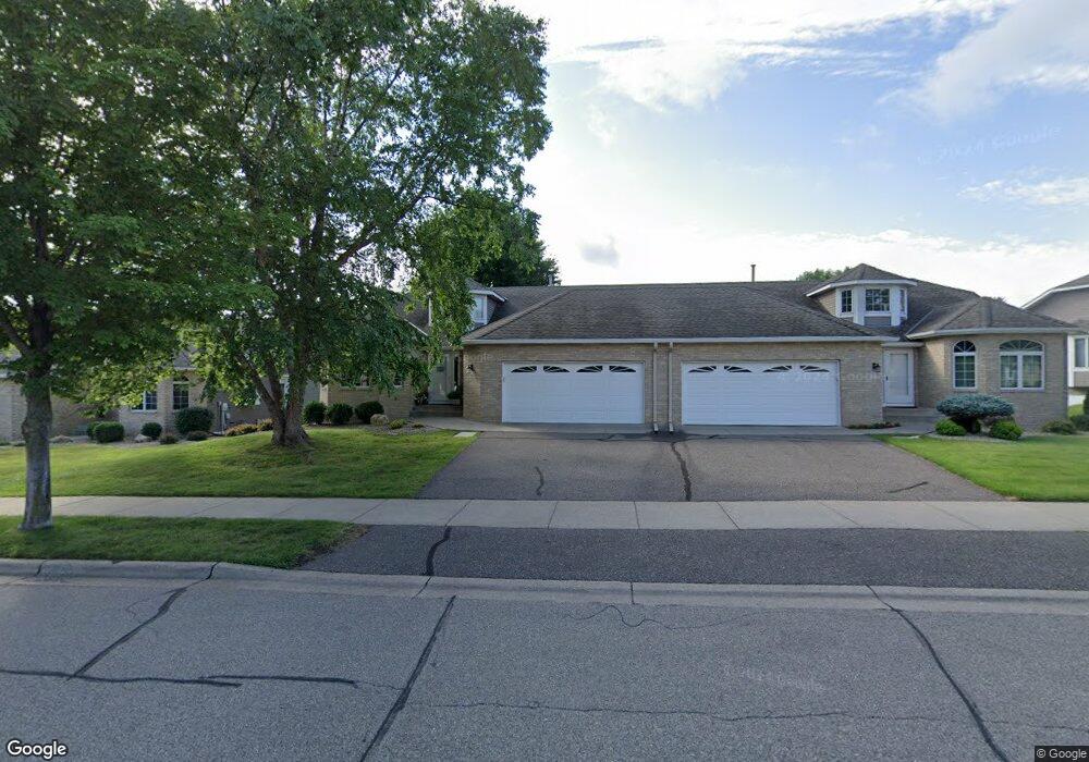
3014 Highpointe Curve Saint Paul, MN 55113
South Owasso NeighborhoodEstimated Value: $496,527 - $548,000
3
Beds
3
Baths
1,729
Sq Ft
$298/Sq Ft
Est. Value
About This Home
This home is located at 3014 Highpointe Curve, Saint Paul, MN 55113 and is currently estimated at $514,382, approximately $297 per square foot. 3014 Highpointe Curve is a home located in Ramsey County with nearby schools including Central Park Elementary School, Roseville Area Middle School, and Roseville Area Senior High School.
Ownership History
Date
Name
Owned For
Owner Type
Purchase Details
Closed on
Sep 25, 2018
Sold by
Hill Michael James and Scheuring Hill Ann Marie
Bought by
Michael And Ann Hill Family Trust
Current Estimated Value
Home Financials for this Owner
Home Financials are based on the most recent Mortgage that was taken out on this home.
Original Mortgage
$401,850
Outstanding Balance
$349,715
Interest Rate
4.5%
Estimated Equity
$164,667
Purchase Details
Closed on
Aug 27, 2018
Sold by
Sarenpa Roger A and Sarenpa Mary K
Bought by
Hill Michael James and Scheuring Hill Ann Marie
Home Financials for this Owner
Home Financials are based on the most recent Mortgage that was taken out on this home.
Original Mortgage
$401,850
Outstanding Balance
$349,715
Interest Rate
4.5%
Estimated Equity
$164,667
Purchase Details
Closed on
Oct 14, 2005
Sold by
Degidio Donald N and Degidio Bonita A
Bought by
Sarenpa Roger A and Sarenpa Mary K
Create a Home Valuation Report for This Property
The Home Valuation Report is an in-depth analysis detailing your home's value as well as a comparison with similar homes in the area
Home Values in the Area
Average Home Value in this Area
Purchase History
| Date | Buyer | Sale Price | Title Company |
|---|---|---|---|
| Michael And Ann Hill Family Trust | -- | None Available | |
| Hill Michael James | $423,000 | Partners Title Llc | |
| Sarenpa Roger A | $424,000 | -- |
Source: Public Records
Mortgage History
| Date | Status | Borrower | Loan Amount |
|---|---|---|---|
| Open | Hill Michael James | $401,850 |
Source: Public Records
Tax History Compared to Growth
Tax History
| Year | Tax Paid | Tax Assessment Tax Assessment Total Assessment is a certain percentage of the fair market value that is determined by local assessors to be the total taxable value of land and additions on the property. | Land | Improvement |
|---|---|---|---|---|
| 2025 | $6,694 | $486,600 | $100,000 | $386,600 |
| 2023 | $6,694 | $473,100 | $100,000 | $373,100 |
| 2022 | $6,054 | $443,500 | $100,000 | $343,500 |
| 2021 | $5,830 | $400,800 | $100,000 | $300,800 |
| 2020 | $5,788 | $411,100 | $100,000 | $311,100 |
| 2019 | $5,954 | $384,200 | $56,000 | $328,200 |
| 2018 | $5,258 | $384,200 | $56,000 | $328,200 |
| 2017 | $4,502 | $334,100 | $56,000 | $278,100 |
| 2016 | $4,630 | $0 | $0 | $0 |
| 2015 | $4,512 | $310,000 | $56,000 | $254,000 |
| 2014 | $4,234 | $0 | $0 | $0 |
Source: Public Records
Map
Nearby Homes
- 2970 Western Ave N
- 405 Judith Ave
- 2841 Galtier St
- 2814 Matilda St
- 2821 Galtier St
- 387 Iona Ln
- 2802 Marion St
- 417 W Horseshoe Dr
- 2720 MacKubin St
- 540 Woodhill Dr Unit 71
- 2687 Galtier St
- 2730 Dale St N Unit D101
- 2720 Dale St N Unit C208
- 2710 Dale St N Unit B212
- 2939 W Owasso Blvd
- 556 County Road C W
- 3318 W Owasso Blvd
- 667 County Road C W
- 3399 Kent St Unit 211
- 3163 Christopher Ln
- 3020 Highpointe Curve
- 0 Unassigned
- 3022 Highpointe Curve
- 3002 Highpointe Curve
- 3000 Highpointe Curve
- 3019 Highpointe Curve
- 3026 Highpointe Curve
- 3015 Highpointe Curve
- 3013 Highpointe Curve
- 3025 Highpointe Curve Unit 310
- 3074 Highpointe Curve
- 3028 Highpointe Curve
- 3076 Highpointe Curve
- 0 Unassigned
- 2990 Highcourte
- 3009 Highpointe Curve
- 3027 Highpointe Curve
- 2988 Highcourte
- 3007 Highpointe Curve
- 2984 Highcourte