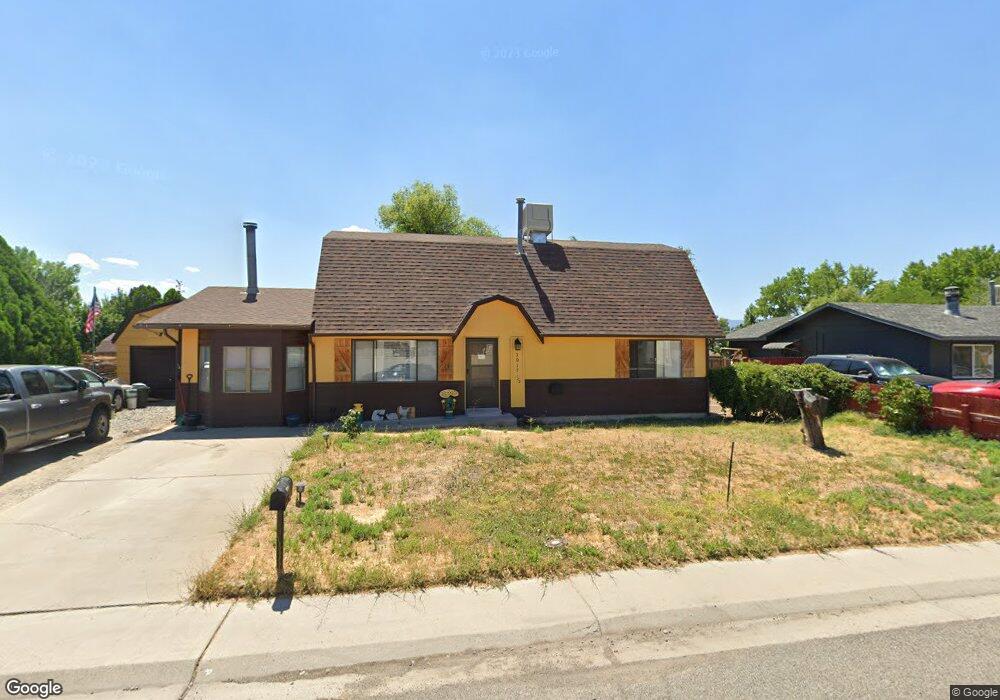
3017 1/2 Gunnison Way Grand Junction, CO 81504
Estimated Value: $341,000 - $361,000
3
Beds
2
Baths
1,674
Sq Ft
$212/Sq Ft
Est. Value
About This Home
This home is located at 3017 1/2 Gunnison Way, Grand Junction, CO 81504 and is currently estimated at $354,303, approximately $211 per square foot. 3017 1/2 Gunnison Way is a home located in Mesa County with nearby schools including Pear Park Elementary School, Grand Mesa Middle School, and Central High School.
Ownership History
Date
Name
Owned For
Owner Type
Purchase Details
Closed on
Jan 12, 2018
Sold by
Gordon Lacee R and Gordon Colin B
Bought by
Duford Mark S and Duford Sara Michele
Current Estimated Value
Home Financials for this Owner
Home Financials are based on the most recent Mortgage that was taken out on this home.
Original Mortgage
$188,491
Outstanding Balance
$160,894
Interest Rate
4.4%
Mortgage Type
FHA
Estimated Equity
$193,409
Purchase Details
Closed on
Jul 21, 2010
Sold by
Gordon Lacee R
Bought by
Gordon Lacee R and Gordon Colin B
Purchase Details
Closed on
Sep 13, 2004
Sold by
Gordon Lisa Ann
Bought by
Gordon Steven Ray
Purchase Details
Closed on
Aug 12, 1993
Sold by
Seep Russell W and Seep Louise I
Bought by
Seep Russell W
Create a Home Valuation Report for This Property
The Home Valuation Report is an in-depth analysis detailing your home's value as well as a comparison with similar homes in the area
Home Values in the Area
Average Home Value in this Area
Purchase History
| Date | Buyer | Sale Price | Title Company |
|---|---|---|---|
| Duford Mark S | $195,000 | Old Republic Title | |
| Gordon Lacee R | -- | None Available | |
| Gordon Steven Ray | -- | -- | |
| Seep Russell W | -- | None Listed On Document |
Source: Public Records
Mortgage History
| Date | Status | Borrower | Loan Amount |
|---|---|---|---|
| Open | Duford Mark S | $188,491 |
Source: Public Records
Tax History Compared to Growth
Tax History
| Year | Tax Paid | Tax Assessment Tax Assessment Total Assessment is a certain percentage of the fair market value that is determined by local assessors to be the total taxable value of land and additions on the property. | Land | Improvement |
|---|---|---|---|---|
| 2024 | $1,302 | $17,510 | $3,040 | $14,470 |
| 2023 | $1,302 | $17,510 | $3,040 | $14,470 |
| 2022 | $1,181 | $15,600 | $3,480 | $12,120 |
| 2021 | $1,187 | $16,050 | $3,580 | $12,470 |
| 2020 | $1,018 | $14,070 | $2,500 | $11,570 |
| 2019 | $965 | $14,070 | $2,500 | $11,570 |
| 2018 | $851 | $11,360 | $2,160 | $9,200 |
| 2017 | $848 | $11,360 | $2,160 | $9,200 |
| 2016 | $629 | $8,630 | $2,190 | $6,440 |
| 2015 | $630 | $8,630 | $2,190 | $6,440 |
| 2014 | $592 | $9,060 | $1,990 | $7,070 |
Source: Public Records
Map
Nearby Homes
- 3018 Hill Ct
- 3008 Fallawater Ct
- 2997 North Ave
- 454 1/2 Seminole Ct
- 3064 Gunnison Ave
- 442 Florence Rd
- 431 Colorow Dr
- 483 Jaquette Ln
- 2979 D 1 2 Rd
- TBD Penny Ln Unit Lot 8
- TBD Penny Ln Unit Lot 5
- TBD Penny Ln Unit Lot 6
- TBD Penny Ln Unit Lot 4
- TBD Penny Ln Unit Lot 9
- TBD Penny Ln Unit Lot 3
- TBD Penny Ln Unit Lot 7
- TBD Penny Ln Unit Lot 2
- 2955 Apollo Dr
- 2958 Apollo Dr
- 2954 Apollo Dr
- 3017 Gunnison Ave
- 3017 1/2 Gunnison Ave
- 3019 Gunnison Ave
- 480 Teco Dr
- 473 Dodge St
- 472 Robin Ct
- 3018 1/2 Gunnison Ave
- 471 Dodge St
- 470 Robin Ct
- 0 Robin Ct Unit 597207
- 0 Robin Ct Unit 626819
- 471 Robin Ct
- 479 Teco Ct
- 482 Teco Ct
- 469 Dodge St
- 0 Dodge St
- 3021 Gunnison Ave
- 3015 Gunnison Ave
- 481 Dodge Ct
- 472 Dodge St