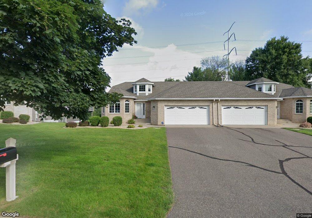
3019 Highpointe Curve Saint Paul, MN 55113
South Owasso NeighborhoodEstimated Value: $505,228 - $526,000
3
Beds
3
Baths
3,175
Sq Ft
$163/Sq Ft
Est. Value
About This Home
This home is located at 3019 Highpointe Curve, Saint Paul, MN 55113 and is currently estimated at $516,807, approximately $162 per square foot. 3019 Highpointe Curve is a home located in Ramsey County with nearby schools including Central Park Elementary School, Roseville Area Middle School, and Roseville Area Senior High School.
Ownership History
Date
Name
Owned For
Owner Type
Purchase Details
Closed on
Jun 18, 2024
Sold by
Richard J Ivance Trust and Ivance Joy J
Bought by
Richard J Ivance Family Trust
Current Estimated Value
Purchase Details
Closed on
Jun 11, 2020
Sold by
Crane Jerome P and Crane Mary E
Bought by
Ivance Richard J and Ivance Joy J
Home Financials for this Owner
Home Financials are based on the most recent Mortgage that was taken out on this home.
Original Mortgage
$340,000
Interest Rate
3.2%
Mortgage Type
New Conventional
Purchase Details
Closed on
Oct 17, 2014
Sold by
Crane Jerme P and Crane Mary E
Bought by
Crane Mary E
Purchase Details
Closed on
Sep 16, 2008
Sold by
Gilbert Louis P and Gilbert Jean C
Bought by
Stewart Harvey C and Stewart Margaret J
Purchase Details
Closed on
Sep 10, 1996
Sold by
Harstad Homes Inc
Bought by
Gilbert Louis P
Create a Home Valuation Report for This Property
The Home Valuation Report is an in-depth analysis detailing your home's value as well as a comparison with similar homes in the area
Home Values in the Area
Average Home Value in this Area
Purchase History
| Date | Buyer | Sale Price | Title Company |
|---|---|---|---|
| Richard J Ivance Family Trust | -- | None Listed On Document | |
| Ivance Richard J | $425,000 | Titlesmart Inc | |
| Crane Mary E | $515 | None Available | |
| Stewart Harvey C | $354,900 | -- | |
| Gilbert Louis P | $220,625 | -- | |
| Harstad Homes Inc | $49,900 | -- |
Source: Public Records
Mortgage History
| Date | Status | Borrower | Loan Amount |
|---|---|---|---|
| Previous Owner | Ivance Richard J | $340,000 |
Source: Public Records
Tax History Compared to Growth
Tax History
| Year | Tax Paid | Tax Assessment Tax Assessment Total Assessment is a certain percentage of the fair market value that is determined by local assessors to be the total taxable value of land and additions on the property. | Land | Improvement |
|---|---|---|---|---|
| 2025 | $7,080 | $511,700 | $100,000 | $411,700 |
| 2023 | $7,080 | $500,400 | $100,000 | $400,400 |
| 2022 | $6,374 | $469,200 | $100,000 | $369,200 |
| 2021 | $6,110 | $420,900 | $100,000 | $320,900 |
| 2020 | $6,214 | $430,600 | $100,000 | $330,600 |
| 2019 | $6,392 | $410,300 | $56,000 | $354,300 |
| 2018 | $5,652 | $410,300 | $56,000 | $354,300 |
| 2017 | $4,838 | $356,800 | $56,000 | $300,800 |
| 2016 | $5,006 | $0 | $0 | $0 |
| 2015 | $4,822 | $332,800 | $56,000 | $276,800 |
| 2014 | $4,510 | $0 | $0 | $0 |
Source: Public Records
Map
Nearby Homes
- 2970 Western Ave N
- 405 Judith Ave
- 2841 Galtier St
- 2814 Matilda St
- 2821 Galtier St
- 387 Iona Ln
- 2802 Marion St
- 417 W Horseshoe Dr
- 540 Woodhill Dr Unit 71
- 2720 MacKubin St
- 2687 Galtier St
- 2730 Dale St N Unit D101
- 2720 Dale St N Unit C208
- 2710 Dale St N Unit B212
- 2939 W Owasso Blvd
- 556 County Road C W
- 3318 W Owasso Blvd
- 667 County Road C W
- 3399 Kent St Unit 211
- 3163 Christopher Ln
- 3015 Highpointe Curve
- 3013 Highpointe Curve
- 3025 Highpointe Curve Unit 310
- 3027 Highpointe Curve
- 3014 Highpointe Curve
- 3009 Highpointe Curve
- 3020 Highpointe Curve
- 3022 Highpointe Curve
- 3031 Highpointe Curve
- 3007 Highpointe Curve
- 3002 Highpointe Curve
- 3026 Highpointe Curve
- 0 Unassigned
- 3033 Highpointe Curve
- 3028 Highpointe Curve
- 3000 Highpointe Curve
- 3003 Highpointe Curve
- 3001 Highpointe Curve
- 0 Unassigned
- 3037 Highpointe Curve