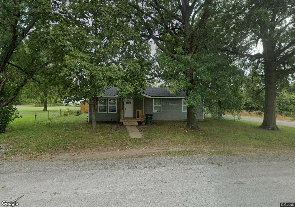
302 Adams Ave Aurora, MO 65605
Estimated Value: $139,000 - $144,000
2
Beds
2
Baths
1,000
Sq Ft
$142/Sq Ft
Est. Value
About This Home
This home is located at 302 Adams Ave, Aurora, MO 65605 and is currently estimated at $142,333, approximately $142 per square foot. 302 Adams Ave is a home located in Lawrence County with nearby schools including Pate Early Childhood Center, Robinson Intermediate School, and Robinson Elementary School.
Ownership History
Date
Name
Owned For
Owner Type
Purchase Details
Closed on
Nov 6, 2025
Sold by
Blessed Home Builders Llc
Bought by
Blessed Properties Llc
Current Estimated Value
Purchase Details
Closed on
Aug 7, 2025
Sold by
Blessed Properties Llc
Bought by
Blessed Home Builders Llc
Purchase Details
Closed on
Aug 8, 2022
Sold by
Wilson Cory S and Wilson Sheena A
Bought by
Blessed Properties Llc
Purchase Details
Closed on
Sep 23, 2018
Sold by
Wilson Peggy
Bought by
Wilson Cory S
Purchase Details
Closed on
Dec 17, 2013
Sold by
Wilson Roger and Wilson Sandy
Bought by
Wilson Peggy
Purchase Details
Closed on
Sep 3, 2010
Sold by
Hoadley Leland and Hoadley Janet M
Bought by
Wilson Roger and Wilson Sandy
Create a Home Valuation Report for This Property
The Home Valuation Report is an in-depth analysis detailing your home's value as well as a comparison with similar homes in the area
Home Values in the Area
Average Home Value in this Area
Purchase History
| Date | Buyer | Sale Price | Title Company |
|---|---|---|---|
| Blessed Properties Llc | -- | Meridian Title | |
| Blessed Home Builders Llc | -- | None Listed On Document | |
| Blessed Properties Llc | -- | Waco Title | |
| Blessed Properties Llc | -- | Waco Title | |
| Wilson Cory S | -- | None Available | |
| Wilson Peggy | -- | None Available | |
| Wilson Roger | -- | -- | |
| Wilson Roger | -- | None Available |
Source: Public Records
Tax History
| Year | Tax Paid | Tax Assessment Tax Assessment Total Assessment is a certain percentage of the fair market value that is determined by local assessors to be the total taxable value of land and additions on the property. | Land | Improvement |
|---|---|---|---|---|
| 2025 | $561 | $11,210 | $2,490 | $8,720 |
| 2024 | $523 | $10,360 | $2,490 | $7,870 |
| 2023 | $520 | $10,360 | $2,490 | $7,870 |
| 2022 | $395 | $7,870 | $2,490 | $5,380 |
| 2021 | $395 | $7,870 | $2,490 | $5,380 |
| 2020 | $351 | $6,920 | $1,540 | $5,380 |
| 2019 | $345 | $6,920 | $1,540 | $5,380 |
| 2018 | $344 | $6,920 | $1,540 | $5,380 |
| 2017 | $342 | $6,920 | $1,540 | $5,380 |
| 2016 | -- | $6,390 | $1,540 | $4,850 |
| 2015 | -- | $6,390 | $1,540 | $4,850 |
| 2014 | -- | $6,390 | $1,540 | $4,850 |
Source: Public Records
Map
Nearby Homes
- 225 Morgan Ave
- 123 Cofield St
- 503 Mcnatt Ave
- 115 W Lee St
- 111 W Cofield St
- 112 N Madison Ave
- 722 Wilson Ave
- 141 W Pleasant St
- 311 W Pleasant St
- 304 E Cofield St
- 421 W College St
- 238 E Delta St
- 216 S Elliott Ave
- 330 W Summit St
- 512 W College St
- 000 Crescent St
- 114 E College St
- 220 S Park Ave
- 504 S Lincoln Ave
- 405 W Summit St
- 301 N Adams Ave
- 309 Morgan Ave
- 226 W Tyndal St
- 224 W Tyndal St
- 319 W Cofield St
- 325 N Adams Ave
- 227 Morgan Ave
- 227 Morgan Ave
- 227 Morgan Ave Unit 1215585
- 312 W Tyndal St
- 325 Morgan Ave
- 223 Morgan Ave
- 225 Morgan Ave Unit 1402082
- 145 Cofield St
- 221 Morgan Ave
- 324 W Tyndal St
- 302 N Harrison Ave
- 148 W Cofield St
- 225 W Tyndal St
- 303 W Tyndall St
Your Personal Tour Guide
Ask me questions while you tour the home.