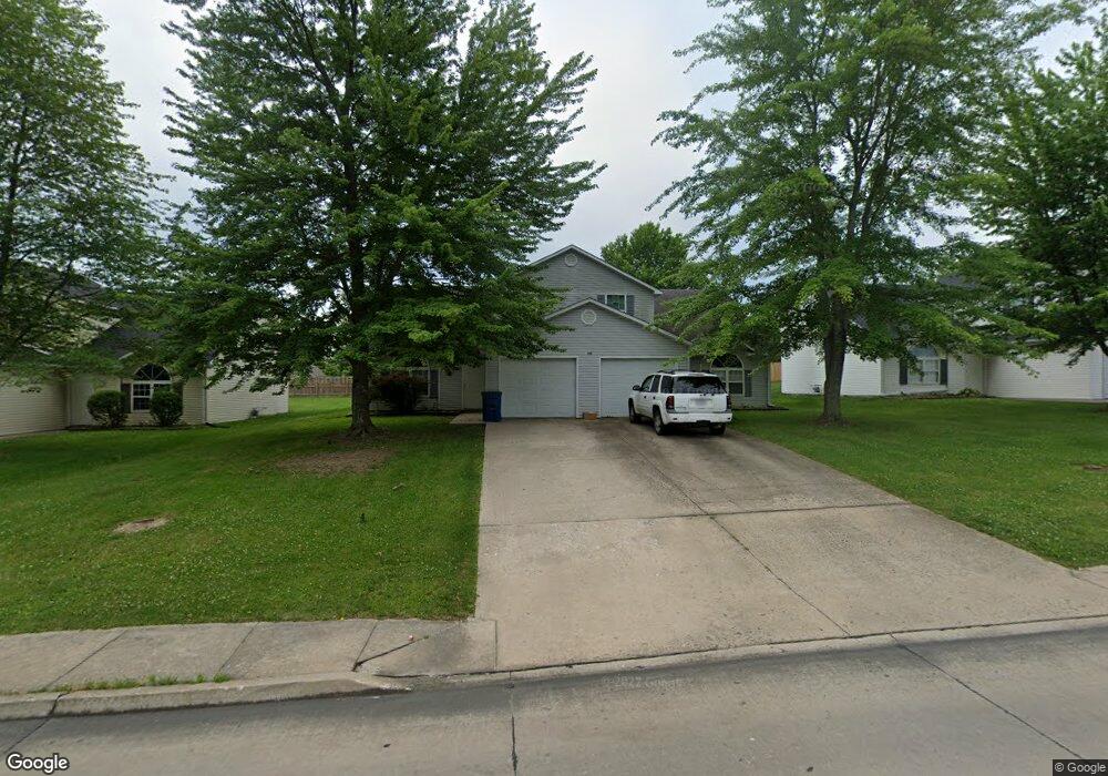
302 E Liberty Ln Unit A & B Ashland, MO 65010
Estimated Value: $303,000 - $332,087
6
Beds
4
Baths
2,784
Sq Ft
$114/Sq Ft
Est. Value
About This Home
This home is located at 302 E Liberty Ln Unit A & B, Ashland, MO 65010 and is currently estimated at $316,362, approximately $113 per square foot. 302 E Liberty Ln Unit A & B is a home located in Boone County with nearby schools including Southern Boone Primary School, Southern Boone Elementary School, and Southern Boone Middle School.
Ownership History
Date
Name
Owned For
Owner Type
Purchase Details
Closed on
Apr 20, 2022
Sold by
Big Spaces Llc
Bought by
First Choice Properties Llc
Current Estimated Value
Home Financials for this Owner
Home Financials are based on the most recent Mortgage that was taken out on this home.
Original Mortgage
$289,278
Outstanding Balance
$273,773
Interest Rate
5%
Mortgage Type
New Conventional
Estimated Equity
$42,589
Purchase Details
Closed on
Jan 3, 2008
Sold by
South Woods Properties Inc
Bought by
South Woods Properties Llc
Create a Home Valuation Report for This Property
The Home Valuation Report is an in-depth analysis detailing your home's value as well as a comparison with similar homes in the area
Home Values in the Area
Average Home Value in this Area
Purchase History
| Date | Buyer | Sale Price | Title Company |
|---|---|---|---|
| First Choice Properties Llc | -- | None Listed On Document | |
| South Woods Properties Llc | -- | None Available |
Source: Public Records
Mortgage History
| Date | Status | Borrower | Loan Amount |
|---|---|---|---|
| Open | First Choice Properties Llc | $289,278 |
Source: Public Records
Tax History
| Year | Tax Paid | Tax Assessment Tax Assessment Total Assessment is a certain percentage of the fair market value that is determined by local assessors to be the total taxable value of land and additions on the property. | Land | Improvement |
|---|---|---|---|---|
| 2025 | $2,227 | $31,597 | $1,748 | $29,849 |
| 2024 | $2,034 | $28,728 | $1,748 | $26,980 |
| 2023 | $2,033 | $28,728 | $1,748 | $26,980 |
| 2022 | $1,899 | $26,600 | $1,748 | $24,852 |
| 2021 | $1,895 | $26,600 | $1,748 | $24,852 |
| 2020 | $1,763 | $24,624 | $1,748 | $22,876 |
| 2019 | $1,763 | $24,624 | $1,748 | $22,876 |
| 2018 | $1,559 | $0 | $0 | $0 |
| 2017 | $1,560 | $24,624 | $1,748 | $22,876 |
| 2016 | $1,564 | $24,624 | $1,748 | $22,876 |
| 2015 | $1,546 | $24,624 | $1,748 | $22,876 |
| 2014 | -- | $24,624 | $1,748 | $22,876 |
Source: Public Records
Map
Nearby Homes
- 208 Renee Dr
- 206 Renee Dr
- 502 Douglas Dr
- 204 Redtail Dr
- 209 E Johnson Ave
- 104 Maple St
- 15429 Allegiance Ave
- 511 Sue Dr
- 600 Peterson Ln
- 16110 Blue Heron Dr
- LOT 2 & 5 Eastside Dr
- 5580 Charlotte Dr
- 15157 Denali Dr
- 15132 Denali Dr
- 16300 Old Highway 63 S
- 15159 Congaree Dr
- 4850 Rebellion Ln
- 6343 Yellowstone Dr
- 601 Turner Ave
- 15271 Congaree Dr
- 302 E Liberty Ln
- 300 E Liberty Ln
- 300 E Liberty Ln Unit A & B
- 304 E Liberty Ln
- 304 E Liberty Ln Unit A & B
- 303 Amanda Dr
- 306 E Liberty Ln
- 306 E Liberty Ln Unit A & B
- 305 Amanda Dr
- 303 E Liberty Ln
- 303 E Liberty Ln
- 305 E Liberty Ln
- 206 E Liberty Ln
- 301 E Liberty Ln
- 301 E Liberty Ln
- 301 E Liberty Ln Unit A&B
- 308 E Liberty Ln
- 308 E Liberty Ln Unit A & B
- 207 E Liberty Ln
- 207 E Liberty Ln Unit A & B
Your Personal Tour Guide
Ask me questions while you tour the home.