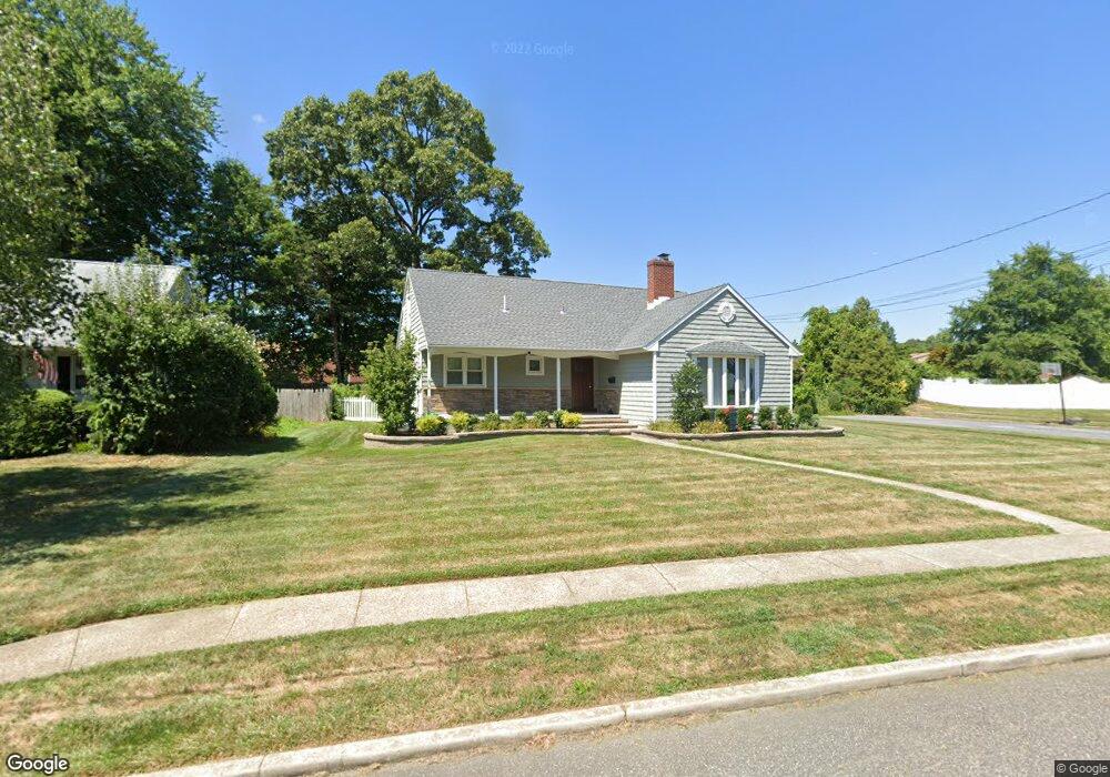
302 N Woodstock Dr Cherry Hill, NJ 08034
Estimated Value: $395,115 - $511,000
--
Bed
--
Bath
1,744
Sq Ft
$265/Sq Ft
Est. Value
About This Home
This home is located at 302 N Woodstock Dr, Cherry Hill, NJ 08034 and is currently estimated at $462,779, approximately $265 per square foot. 302 N Woodstock Dr is a home located in Camden County with nearby schools including Horace Mann Elementary School, John A Carusi Middle School, and Cherry Hill High-West High School.
Ownership History
Date
Name
Owned For
Owner Type
Purchase Details
Closed on
Dec 24, 2018
Sold by
Wash Janet and Estate Of Shirley N Kormandy
Bought by
Cdp Holdings Llc
Current Estimated Value
Purchase Details
Closed on
Jan 27, 1958
Sold by
Cdp Holdings Llc
Bought by
Shropshire Bryan D and Alexander Emily M
Home Financials for this Owner
Home Financials are based on the most recent Mortgage that was taken out on this home.
Original Mortgage
$256,000
Interest Rate
5.1%
Mortgage Type
New Conventional
Create a Home Valuation Report for This Property
The Home Valuation Report is an in-depth analysis detailing your home's value as well as a comparison with similar homes in the area
Home Values in the Area
Average Home Value in this Area
Purchase History
| Date | Buyer | Sale Price | Title Company |
|---|---|---|---|
| Cdp Holdings Llc | $180,000 | Surety Title Co | |
| Shropshire Bryan D | $320,000 | Erlichman Neil | |
| Shropshire Bryan D | $320,000 | Erlichman Neil |
Source: Public Records
Mortgage History
| Date | Status | Borrower | Loan Amount |
|---|---|---|---|
| Previous Owner | Shropshire Bryan D | $256,000 |
Source: Public Records
Tax History Compared to Growth
Tax History
| Year | Tax Paid | Tax Assessment Tax Assessment Total Assessment is a certain percentage of the fair market value that is determined by local assessors to be the total taxable value of land and additions on the property. | Land | Improvement |
|---|---|---|---|---|
| 2025 | $8,624 | $193,400 | $64,200 | $129,200 |
| 2024 | $8,127 | $193,400 | $64,200 | $129,200 |
| 2023 | $8,127 | $193,400 | $64,200 | $129,200 |
| 2022 | $7,902 | $193,400 | $64,200 | $129,200 |
| 2021 | $7,927 | $193,400 | $64,200 | $129,200 |
| 2020 | $7,831 | $193,400 | $64,200 | $129,200 |
| 2019 | $7,827 | $193,400 | $64,200 | $129,200 |
| 2018 | $7,806 | $193,400 | $64,200 | $129,200 |
| 2017 | $7,699 | $193,400 | $64,200 | $129,200 |
| 2016 | $7,597 | $193,400 | $64,200 | $129,200 |
| 2015 | $7,227 | $193,400 | $64,200 | $129,200 |
| 2014 | $7,144 | $193,400 | $64,200 | $129,200 |
Source: Public Records
Map
Nearby Homes
- 316 N Woodstock Dr
- 140 Uxbridge Unit C0140
- 290 Tavistock
- 301 Tavistock
- 204 Tavistock
- 175 Mansfield Blvd N
- 412 E Summit Ave
- 29 Moore Ave
- 127 Oakdale Rd
- 301 Reillywood Ave
- 300 Portsmouth Rd
- 16 Moore Ave
- 225 Spruce St
- 35 Colonial Ridge Dr
- 307 Provincetown Cir
- 95 Lane of Acres
- 1010 Salem Rd
- 130 Centre St
- 166 Ellis St
- 311 Lincoln Ave
- 304 N Woodstock Dr
- 220 N Woodstock Dr
- 306 N Woodstock Dr
- 229 Uxbridge
- 226 Uxbridge
- 301 N Woodstock Dr
- 230 Uxbridge
- 231 Uxbridge Unit C0231
- 228 Uxbridge
- 305 N Woodstock Dr
- 232 Uxbridge
- 225 Uxbridge
- 227 Uxbridge
- 223 N Woodstock Dr
- 233 Uxbridge
- 218 N Woodstock Dr
- 224 Uxbridge
- 234 Uxbridge
- 223 Uxbridge
- 307 N Woodstock Dr