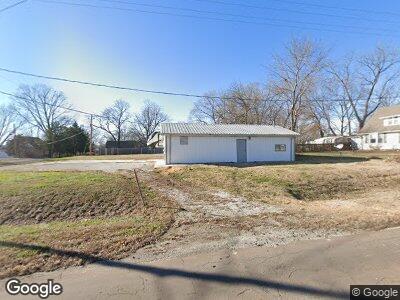
302 Port Arthur Rd Trimble, MO 64492
Estimated Value: $171,500
--
Bed
--
Bath
960
Sq Ft
$179/Sq Ft
Est. Value
About This Home
This home is located at 302 Port Arthur Rd, Trimble, MO 64492 and is currently priced at $171,500, approximately $178 per square foot. 302 Port Arthur Rd is a home located in Clinton County with nearby schools including Ellis Elementary School, Clinton County R-III Middle School, and Plattsburg High School.
Ownership History
Date
Name
Owned For
Owner Type
Purchase Details
Closed on
Feb 10, 2023
Sold by
Rouse Holland Dani
Bought by
Ld And Company Llc
Current Estimated Value
Home Financials for this Owner
Home Financials are based on the most recent Mortgage that was taken out on this home.
Original Mortgage
$98,000
Outstanding Balance
$95,043
Interest Rate
6.33%
Mortgage Type
New Conventional
Purchase Details
Closed on
Jan 1, 1997
Bought by
Holland Gary L
Create a Home Valuation Report for This Property
The Home Valuation Report is an in-depth analysis detailing your home's value as well as a comparison with similar homes in the area
Home Values in the Area
Average Home Value in this Area
Purchase History
| Date | Buyer | Sale Price | Title Company |
|---|---|---|---|
| Ld And Company Llc | -- | Stewart Title | |
| Holland Gary L | -- | -- |
Source: Public Records
Mortgage History
| Date | Status | Borrower | Loan Amount |
|---|---|---|---|
| Open | Ld & Company Llc | $98,000 |
Source: Public Records
Tax History Compared to Growth
Tax History
| Year | Tax Paid | Tax Assessment Tax Assessment Total Assessment is a certain percentage of the fair market value that is determined by local assessors to be the total taxable value of land and additions on the property. | Land | Improvement |
|---|---|---|---|---|
| 2023 | $511 | $6,864 | $2,618 | $4,246 |
| 2022 | $514 | $6,864 | $2,618 | $4,246 |
| 2021 | $510 | $6,864 | $2,618 | $4,246 |
| 2020 | $791 | $10,560 | $2,816 | $7,744 |
| 2019 | $788 | $10,560 | $2,816 | $7,744 |
| 2018 | $787 | $10,560 | $2,816 | $7,744 |
| 2017 | $785 | $10,560 | $2,816 | $7,744 |
| 2016 | $799 | $10,560 | $2,816 | $7,744 |
| 2013 | -- | $10,560 | $0 | $0 |
Source: Public Records
Map
Nearby Homes
- 501 Port Arthur Rd
- 417 2nd St
- 502 N Main St
- 10A Highway 169
- 556 Dolinger Ct
- 7128 SW Highway F
- 407 Cape Cod Rd
- 7452 SW Crystal Ln
- 7385 SW Karen Rd
- 7878 SW Highway F
- 12 Howard Cir
- 19711 NE 197th Place
- 1405 NE 196th St
- 1910 Lake Dr
- 19620 NE 197th Terrace
- 2002 Lake Dr
- Lot 2 Z Hwy
- 8894 SW Highway Z
- 401 Lake Meadows Dr
- Lot 5 Z Hwy
- 302 Port Arthur Rd
- 312 Port Arthur Rd
- 301 Port Arthur Rd
- 26 E Walnut St
- 320 Port Arthur Rd
- 111 E Walnut St
- 321 Port Arthur Rd
- 313 Main St
- 207 Main St
- 205 Port Arthur Rd
- 302 Main St
- 303 2nd St
- Lot C Port Arthur Rd
- 208 Port Arthur Rd
- 206 Main St
- 24 W Cherry St
- 203 Port Arthur Rd
- 25 W Walnut St
- 210 Port Arthur Rd
- 320 Main St