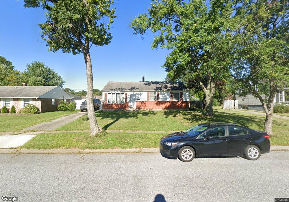
302 S Brownleaf Rd Newark, DE 19713
Estimated Value: $269,000 - $321,000
3
Beds
1
Bath
960
Sq Ft
$303/Sq Ft
Est. Value
About This Home
This home is located at 302 S Brownleaf Rd, Newark, DE 19713 and is currently estimated at $290,994, approximately $303 per square foot. 302 S Brownleaf Rd is a home located in New Castle County with nearby schools including Robert S. Gallaher Elementary School, Christiana High School, and Shue-Medill Middle School.
Ownership History
Date
Name
Owned For
Owner Type
Purchase Details
Closed on
Dec 17, 2015
Sold by
Vaida Andrew K and St Onge Anne Marie
Bought by
Vaida Andrew K
Current Estimated Value
Home Financials for this Owner
Home Financials are based on the most recent Mortgage that was taken out on this home.
Original Mortgage
$166,720
Outstanding Balance
$132,285
Interest Rate
3.97%
Mortgage Type
New Conventional
Estimated Equity
$158,709
Purchase Details
Closed on
Jul 29, 2002
Sold by
Clay Kathleen C
Bought by
Vaida Andrew K and Vaida Anne Marie
Home Financials for this Owner
Home Financials are based on the most recent Mortgage that was taken out on this home.
Original Mortgage
$126,150
Interest Rate
7.99%
Create a Home Valuation Report for This Property
The Home Valuation Report is an in-depth analysis detailing your home's value as well as a comparison with similar homes in the area
Home Values in the Area
Average Home Value in this Area
Purchase History
| Date | Buyer | Sale Price | Title Company |
|---|---|---|---|
| Vaida Andrew K | -- | Servicelink | |
| Vaida Andrew K | $126,150 | -- |
Source: Public Records
Mortgage History
| Date | Status | Borrower | Loan Amount |
|---|---|---|---|
| Open | Vaida Andrew K | $166,720 | |
| Closed | Vaida Andrew K | $126,150 |
Source: Public Records
Tax History
| Year | Tax Paid | Tax Assessment Tax Assessment Total Assessment is a certain percentage of the fair market value that is determined by local assessors to be the total taxable value of land and additions on the property. | Land | Improvement |
|---|---|---|---|---|
| 2024 | $1,937 | $45,500 | $7,300 | $38,200 |
| 2023 | $1,884 | $45,500 | $7,300 | $38,200 |
| 2022 | $1,880 | $45,500 | $7,300 | $38,200 |
| 2021 | $1,840 | $45,500 | $7,300 | $38,200 |
| 2020 | $1,793 | $45,500 | $7,300 | $38,200 |
| 2019 | $1,687 | $45,500 | $7,300 | $38,200 |
| 2018 | $1,543 | $45,500 | $7,300 | $38,200 |
| 2017 | $1,488 | $45,500 | $7,300 | $38,200 |
| 2016 | $1,484 | $45,500 | $7,300 | $38,200 |
| 2015 | $1,352 | $45,500 | $7,300 | $38,200 |
| 2014 | $1,352 | $45,500 | $7,300 | $38,200 |
Source: Public Records
Map
Nearby Homes
- 114 Fox Dr
- 214 Bluefield Rd
- 5 Regal Ct
- 138 Stature Ct
- 135 Salem Church Rd
- 4 Compass Rose Way
- 3 Lute Ct
- 21 Merion Rd
- 120 Diminish Dr
- 179 Rhythm Ct
- 5 Sustain Ct
- 139 Harmony Crest Dr
- 18 Malvina Ln
- 47 Carole Rd
- 434 Jacobsen Dr
- 112 Lynch Farm Dr
- 3 Marlyn Rd
- 151 W Rutherford Dr
- 640 Jacobsen Cir
- 17 Pearson Dr
- 304 S Brownleaf Rd
- 300 S Brownleaf Rd
- 119 Flintlock Rd
- 115 Flintlock Rd
- 306 S Brownleaf Rd
- 206 S Brownleaf Rd
- 301 S Brownleaf Rd
- 121 Flintlock Rd
- 113 Flintlock Rd
- 1101 Musket Rd
- 1100 Ralph Rd
- 400 S Brownleaf Rd
- 204 S Brownleaf Rd
- 111 Flintlock Rd
- 123 Flintlock Rd
- 1103 Musket Rd
- 116 Flintlock Rd
- 202 S Brownleaf Rd
- 402 S Brownleaf Rd
- 1102 Ralph Rd
Your Personal Tour Guide
Ask me questions while you tour the home.