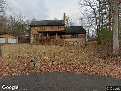
302 White Cap Ln Pigeon Forge, TN 37863
Estimated Value: $613,535 - $809,000
--
Bed
2
Baths
2,912
Sq Ft
$244/Sq Ft
Est. Value
About This Home
This home is located at 302 White Cap Ln, Pigeon Forge, TN 37863 and is currently estimated at $711,268, approximately $244 per square foot. 302 White Cap Ln is a home located in Sevier County with nearby schools including Northview Elementary School, Catons Chapel Elementary School, and Jones Cove Elementary School.
Ownership History
Date
Name
Owned For
Owner Type
Purchase Details
Closed on
May 16, 2006
Sold by
Mike Holsenback
Bought by
Limited Properties Inc
Current Estimated Value
Purchase Details
Closed on
Dec 7, 2005
Sold by
Earl Weathers
Bought by
Mike Holsenback
Purchase Details
Closed on
Sep 2, 2003
Sold by
Mark Trombley and Mark Yvonne R
Bought by
Earl Weathers
Home Financials for this Owner
Home Financials are based on the most recent Mortgage that was taken out on this home.
Original Mortgage
$200,000
Interest Rate
6.13%
Purchase Details
Closed on
Mar 15, 1994
Sold by
Etal Miller Gerald L
Bought by
Mark Trombley
Purchase Details
Closed on
Nov 19, 1991
Bought by
Miller Gerald L William Massalon
Create a Home Valuation Report for This Property
The Home Valuation Report is an in-depth analysis detailing your home's value as well as a comparison with similar homes in the area
Home Values in the Area
Average Home Value in this Area
Purchase History
| Date | Buyer | Sale Price | Title Company |
|---|---|---|---|
| Limited Properties Inc | -- | -- | |
| Mike Holsenback | $265,000 | -- | |
| Earl Weathers | $262,500 | -- | |
| Mark Trombley | $17,500 | -- | |
| Miller Gerald L William Massalon | $512,400 | -- |
Source: Public Records
Mortgage History
| Date | Status | Borrower | Loan Amount |
|---|---|---|---|
| Previous Owner | Miller Gerald L William Massalon | $200,000 |
Source: Public Records
Tax History Compared to Growth
Tax History
| Year | Tax Paid | Tax Assessment Tax Assessment Total Assessment is a certain percentage of the fair market value that is determined by local assessors to be the total taxable value of land and additions on the property. | Land | Improvement |
|---|---|---|---|---|
| 2024 | $274 | $83,225 | $10,000 | $73,225 |
| 2023 | $274 | $83,225 | $0 | $0 |
| 2022 | $1,369 | $83,225 | $10,000 | $73,225 |
| 2021 | $1,369 | $83,225 | $10,000 | $73,225 |
| 2020 | $1,319 | $83,225 | $10,000 | $73,225 |
| 2019 | $1,319 | $64,050 | $10,000 | $54,050 |
| 2018 | $1,319 | $64,050 | $10,000 | $54,050 |
| 2017 | $1,319 | $64,050 | $10,000 | $54,050 |
| 2016 | $1,319 | $64,050 | $10,000 | $54,050 |
| 2015 | -- | $65,650 | $0 | $0 |
| 2014 | $1,201 | $65,649 | $0 | $0 |
Source: Public Records
Map
Nearby Homes
- 2210 Battle Ground Dr
- 2229 Battle Ground Dr
- 2432 Henderson Springs Rd
- Lot 28 River Bank Rd
- 0 River Bank Rd Unit 1287584
- 1230 Bird Nest Way
- 1237 Bird Nest Way
- 1227 Bird Nest Way
- 1232 Bird Nest Way
- 1258 Bird Nest Way
- 1542 Bears Den Way
- 1518 Firefly Trail Way
- 1550 Bears Den Way
- 1215 Bird Nest Way
- 1707 High Rock Way
- 1106 Black Bear Cub Way
- 2140 Battle Hill Rd
- 644 Lloyd Huskey Rd
- 640 Lloyd Huskey Rd
- Lot 32 Blueberry Ridge Way
- 302 White Cap Ln
- 2236 Battle Ground Dr
- 305 White Cap Ln
- 2230 Battle Ground Dr
- 306 White Cap Ln
- 306 White Cap Ln Unit A
- 306 White Cap Ln
- Lot 10 White Cap Ln
- 2218 Battle Ground Dr
- 302 Travis Ln
- 0000 Battle Ground Dr
- 2243 Battle Hill Rd
- 2239 Battle Hill Rd
- 2226 Battle Ground Dr
- 0 White Cap Ln
- Lot 54 White Cap Ln
- 2214 Battle Ground Dr
- 2247 Battle Hill Rd
- 2247 Battle Hill Rd
- 2235 Battle Ground Dr