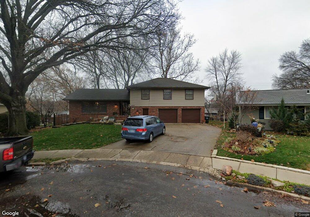
3020 Nathan Dr Lawrence, KS 66049
Sunset Hills NeighborhoodEstimated Value: $356,000 - $431,000
4
Beds
3
Baths
3,080
Sq Ft
$127/Sq Ft
Est. Value
About This Home
This home is located at 3020 Nathan Dr, Lawrence, KS 66049 and is currently estimated at $392,370, approximately $127 per square foot. 3020 Nathan Dr is a home located in Douglas County with nearby schools including Sunset Hill Elementary School, West Middle School, and Lawrence Free State High School.
Ownership History
Date
Name
Owned For
Owner Type
Purchase Details
Closed on
May 13, 2010
Sold by
Kass Doug and Kass Hilary
Bought by
Riley Paul Bradford and Riley Bobbi Lynn
Current Estimated Value
Home Financials for this Owner
Home Financials are based on the most recent Mortgage that was taken out on this home.
Original Mortgage
$250,267
Outstanding Balance
$167,497
Interest Rate
5.02%
Mortgage Type
VA
Estimated Equity
$224,873
Purchase Details
Closed on
May 6, 2004
Sold by
Friedman Paul G and Mayer Tanya R
Bought by
Kass Doug and Kass Hilary
Home Financials for this Owner
Home Financials are based on the most recent Mortgage that was taken out on this home.
Original Mortgage
$118,000
Interest Rate
4.75%
Mortgage Type
Purchase Money Mortgage
Create a Home Valuation Report for This Property
The Home Valuation Report is an in-depth analysis detailing your home's value as well as a comparison with similar homes in the area
Home Values in the Area
Average Home Value in this Area
Purchase History
| Date | Buyer | Sale Price | Title Company |
|---|---|---|---|
| Riley Paul Bradford | -- | First American Title | |
| Kass Doug | -- | Capital Title Ins Co Lc |
Source: Public Records
Mortgage History
| Date | Status | Borrower | Loan Amount |
|---|---|---|---|
| Open | Riley Paul Bradford | $250,267 | |
| Previous Owner | Kass Doug | $118,000 |
Source: Public Records
Tax History
| Year | Tax Paid | Tax Assessment Tax Assessment Total Assessment is a certain percentage of the fair market value that is determined by local assessors to be the total taxable value of land and additions on the property. | Land | Improvement |
|---|---|---|---|---|
| 2025 | $5,916 | $47,484 | $7,475 | $40,009 |
| 2024 | $5,530 | $44,448 | $5,750 | $38,698 |
| 2023 | $5,349 | $41,527 | $5,520 | $36,007 |
| 2022 | $4,797 | $37,042 | $4,830 | $32,212 |
| 2021 | $4,251 | $31,821 | $3,795 | $28,026 |
| 2020 | $3,927 | $29,567 | $3,795 | $25,772 |
| 2019 | $3,787 | $28,555 | $3,795 | $24,760 |
| 2018 | $3,765 | $28,184 | $3,680 | $24,504 |
| 2017 | $3,821 | $28,277 | $3,680 | $24,597 |
| 2016 | $3,676 | $28,417 | $3,680 | $24,737 |
| 2015 | $3,682 | $28,463 | $3,680 | $24,783 |
| 2014 | $3,603 | $28,129 | $3,680 | $24,449 |
Source: Public Records
Map
Nearby Homes
- 3009 W 8th St
- 1008 Lawrence Ave
- 2915 W 7th St
- 819 Crawford Dr
- 3226 Cardinal Dr
- 1036 Holiday Dr
- 2407 Yale Rd
- 3007 Trail Rd
- 2729 Stratford Rd
- 3415 Trail Rd
- 2127 Orchard Ln
- 1011 Lakecrest Rd
- 916 Christie Ct
- 1029 Highland Dr
- 2124 Terrace Rd
- 3712 Trail Rd
- 3808 Pinnacle Cir
- 317 Tallgrass Ct
- 0 Raintree Place
- 3922 Willshire Dr
Your Personal Tour Guide
Ask me questions while you tour the home.