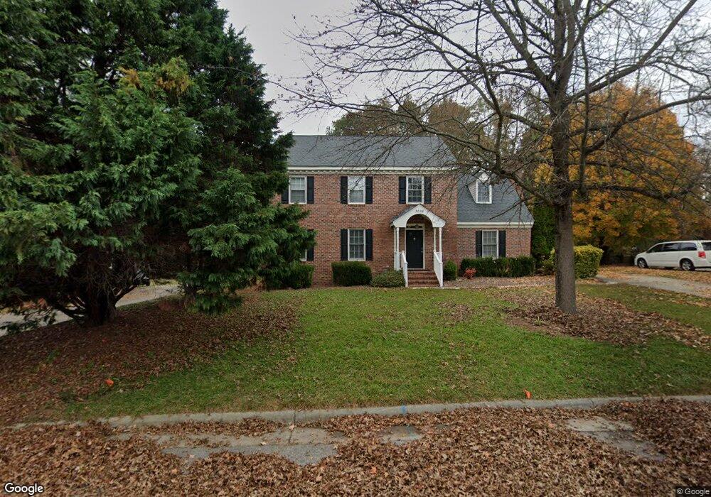
3028 Brassfield Dr Rocky Mount, NC 27803
Estimated Value: $297,899 - $326,000
4
Beds
3
Baths
2,289
Sq Ft
$134/Sq Ft
Est. Value
About This Home
This home is located at 3028 Brassfield Dr, Rocky Mount, NC 27803 and is currently estimated at $307,225, approximately $134 per square foot. 3028 Brassfield Dr is a home located in Nash County with nearby schools including Williford Elementary School, Winstead Avenue Elementary School, and G.R. Edwards Middle School.
Ownership History
Date
Name
Owned For
Owner Type
Purchase Details
Closed on
Dec 29, 2009
Sold by
Mcmahon Mason D
Bought by
Parham Frank L
Current Estimated Value
Home Financials for this Owner
Home Financials are based on the most recent Mortgage that was taken out on this home.
Original Mortgage
$76,240
Outstanding Balance
$49,164
Interest Rate
4.68%
Mortgage Type
Credit Line Revolving
Estimated Equity
$258,061
Create a Home Valuation Report for This Property
The Home Valuation Report is an in-depth analysis detailing your home's value as well as a comparison with similar homes in the area
Home Values in the Area
Average Home Value in this Area
Purchase History
| Date | Buyer | Sale Price | Title Company |
|---|---|---|---|
| Parham Frank L | $95,225 | None Available |
Source: Public Records
Mortgage History
| Date | Status | Borrower | Loan Amount |
|---|---|---|---|
| Open | Parham Frank L | $76,240 |
Source: Public Records
Tax History Compared to Growth
Tax History
| Year | Tax Paid | Tax Assessment Tax Assessment Total Assessment is a certain percentage of the fair market value that is determined by local assessors to be the total taxable value of land and additions on the property. | Land | Improvement |
|---|---|---|---|---|
| 2025 | $1,588 | $252,010 | $25,630 | $226,380 |
| 2024 | $1,588 | $168,270 | $24,340 | $143,930 |
| 2023 | $1,127 | $168,270 | $0 | $0 |
| 2022 | $1,153 | $168,270 | $24,340 | $143,930 |
| 2021 | $1,127 | $168,270 | $24,340 | $143,930 |
| 2020 | $1,127 | $168,270 | $24,340 | $143,930 |
| 2019 | $1,127 | $168,270 | $24,340 | $143,930 |
| 2018 | $1,127 | $168,270 | $0 | $0 |
| 2017 | $1,127 | $168,270 | $0 | $0 |
| 2015 | $1,183 | $176,521 | $0 | $0 |
| 2014 | $1,183 | $176,521 | $0 | $0 |
Source: Public Records
Map
Nearby Homes
- 5025 Netherwood Rd
- 4037 Brassfield Dr
- 616 Chad St
- 3904 Crosswinds Dr
- 5013 Brassfield Dr
- 108 Chelsea Ct
- 3905 Crosswinds Dr
- 600 Nichole Ln
- 113 Edinborough Ct
- 3812 Gloucester Rd
- 3545 Chelsea Dr
- 4204 Carybrook Rd
- 108 Buckingham Ct
- 1012 Turnstone Dr
- 3801 Hawthorne Rd
- 1921 Bethlehem Rd
- 3617 Hawthorne Rd
- 3712 Hawthorne Rd
- 3609 Hawthorne Rd
- 4001 Lochinvar Ln
- 3032 Brassfield Dr
- 3024 Brassfield Dr
- 3036 Brassfield Dr
- 3020 Brassfield Dr
- 4053 Gloucester Rd
- 3013 Brassfield Dr
- 4045 Gloucester Rd
- 3017 Brassfield Dr
- 3009 Brassfield Dr
- 3040 Brassfield Dr
- 184King Charles Ct 184
- 3021 Brassfield Dr
- 3016 Brassfield Dr
- 4041 Gloucester Rd
- 4036 Gloucester Rd
- 3005 Brassfield Dr
- 3025 Brassfield Dr
- 3044 Brassfield Dr
- 4032 Gloucester Rd