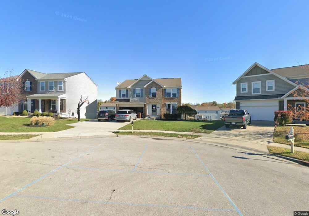
3029 Bruces Trail Independence, KY 41051
Estimated Value: $396,092 - $438,000
4
Beds
3
Baths
2,822
Sq Ft
$146/Sq Ft
Est. Value
About This Home
This home is located at 3029 Bruces Trail, Independence, KY 41051 and is currently estimated at $410,773, approximately $145 per square foot. 3029 Bruces Trail is a home located in Kenton County with nearby schools including Taylor Mill Elementary School, Woodland Middle School, and Scott High School.
Ownership History
Date
Name
Owned For
Owner Type
Purchase Details
Closed on
Dec 17, 2013
Sold by
Fischer Single Family Homes Iii Ltd
Bought by
Heller Michael B and Heller Alicia M
Current Estimated Value
Home Financials for this Owner
Home Financials are based on the most recent Mortgage that was taken out on this home.
Original Mortgage
$208,108
Outstanding Balance
$155,792
Interest Rate
4.25%
Mortgage Type
New Conventional
Estimated Equity
$254,981
Purchase Details
Closed on
Sep 16, 2013
Sold by
Shadybrook Llc
Bought by
Fischer Single Family Homes Iii Ltd
Create a Home Valuation Report for This Property
The Home Valuation Report is an in-depth analysis detailing your home's value as well as a comparison with similar homes in the area
Home Values in the Area
Average Home Value in this Area
Purchase History
| Date | Buyer | Sale Price | Title Company |
|---|---|---|---|
| Heller Michael B | $219,062 | Homestead Title Agency Ltd | |
| Fischer Single Family Homes Iii Ltd | $34,000 | None Available |
Source: Public Records
Mortgage History
| Date | Status | Borrower | Loan Amount |
|---|---|---|---|
| Open | Heller Michael B | $208,108 |
Source: Public Records
Tax History Compared to Growth
Tax History
| Year | Tax Paid | Tax Assessment Tax Assessment Total Assessment is a certain percentage of the fair market value that is determined by local assessors to be the total taxable value of land and additions on the property. | Land | Improvement |
|---|---|---|---|---|
| 2024 | $3,152 | $257,300 | $42,000 | $215,300 |
| 2023 | $3,247 | $257,300 | $42,000 | $215,300 |
| 2022 | $3,303 | $257,300 | $42,000 | $215,300 |
| 2021 | $3,352 | $257,300 | $42,000 | $215,300 |
| 2020 | $2,924 | $219,000 | $42,000 | $177,000 |
| 2019 | $2,932 | $219,000 | $42,000 | $177,000 |
| 2018 | $2,948 | $219,000 | $42,000 | $177,000 |
| 2017 | $2,867 | $219,000 | $42,000 | $177,000 |
| 2015 | $2,787 | $219,000 | $34,000 | $185,000 |
| 2014 | $2,748 | $219,000 | $34,000 | $185,000 |
Source: Public Records
Map
Nearby Homes
- 3068 Saddlebred Ct
- 3088 Summitrun Dr
- 3140 Summitrun Dr
- 3146 Meadoway Ct
- 3327 Summitrun Dr
- 6256 Woodsgrove Ct
- 907 Stablewatch Dr
- 6269 Streamside Dr
- 951 Stablewatch Dr
- 6339 Arabian Dr
- 6212 Streamside Dr
- 6388 Alexandra Ct
- 964 Stablewatch Dr
- 1477 Hands Pike
- 6416 Arabian Dr
- 690 Rusconi Dr
- Somerset Plan at Hickory Valley
- Avalon Plan at Hickory Valley
- Rockford Plan at Hickory Valley
- Miramar Plan at Hickory Valley
- 3025 Bruces Trail
- 3025 Bruces Trail Unit 164
- 3033 Bruces Trail
- 3037 Bruces Trail
- 3037 Bruces Trail Unit 167
- 2911 Faubush Ct
- 2911 Faubush Ct Unit 241
- 2907 Faubush Ct
- 2907 Faubush Ct
- 2907 Faubush Ct Unit 242
- 2915 Faubush Ct
- 2903 Faubush Ct
- 2903 Faubush Ct Unit 243
- 2919 Faubush Ct
- 3041 Bruces Trail
- 3041 Bruces Trail Unit 168
- 3028 Bruces Trail Unit 161
- 3028 Bruces Trail
- 2899 Faubush Ct
- 6312 Finchley Rd