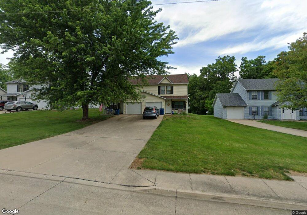
303 E Liberty Ln Ashland, MO 65010
Estimated Value: $326,000 - $364,000
6
Beds
6
Baths
2,832
Sq Ft
$121/Sq Ft
Est. Value
About This Home
This home is located at 303 E Liberty Ln, Ashland, MO 65010 and is currently estimated at $341,838, approximately $120 per square foot. 303 E Liberty Ln is a home located in Boone County with nearby schools including Southern Boone Primary School, Southern Boone Elementary School, and Southern Boone Middle School.
Ownership History
Date
Name
Owned For
Owner Type
Purchase Details
Closed on
Nov 25, 2025
Sold by
Armstrong Family Trust and Armstrong Seth
Bought by
Williams Kelsey and Heckemeyer Taylor
Current Estimated Value
Home Financials for this Owner
Home Financials are based on the most recent Mortgage that was taken out on this home.
Original Mortgage
$245,000
Outstanding Balance
$244,536
Interest Rate
6.27%
Mortgage Type
New Conventional
Estimated Equity
$97,302
Purchase Details
Closed on
Apr 28, 2022
Sold by
Roanokei Llc
Bought by
Armstrong Family Trust
Home Financials for this Owner
Home Financials are based on the most recent Mortgage that was taken out on this home.
Original Mortgage
$192,375
Interest Rate
4.42%
Mortgage Type
New Conventional
Purchase Details
Closed on
Jan 3, 2008
Sold by
South Woods Properties Inc
Bought by
South Woods Properties Llc
Create a Home Valuation Report for This Property
The Home Valuation Report is an in-depth analysis detailing your home's value as well as a comparison with similar homes in the area
Home Values in the Area
Average Home Value in this Area
Purchase History
We collect this data history from publicly available records. To have your information removed, we recommend requesting removal directly through your county’s website.
| Date | Buyer | Sale Price | Title Company |
|---|---|---|---|
| Williams Kelsey | -- | None Listed On Document | |
| Armstrong Family Trust | -- | None Listed On Document | |
| South Woods Properties Llc | -- | None Available |
Source: Public Records
Mortgage History
We collect this data history from publicly available records. To have your information removed, we recommend requesting removal directly through your county’s website.
| Date | Status | Borrower | Loan Amount |
|---|---|---|---|
| Open | Williams Kelsey | $245,000 | |
| Previous Owner | Armstrong Family Trust | $192,375 |
Source: Public Records
Tax History
| Year | Tax Paid | Tax Assessment Tax Assessment Total Assessment is a certain percentage of the fair market value that is determined by local assessors to be the total taxable value of land and additions on the property. | Land | Improvement |
|---|---|---|---|---|
| 2025 | $2,231 | $31,654 | $2,622 | $29,032 |
| 2024 | $2,038 | $28,785 | $2,622 | $26,163 |
| 2023 | $2,037 | $28,785 | $2,622 | $26,163 |
| 2022 | $1,903 | $26,657 | $2,622 | $24,035 |
| 2021 | $1,899 | $26,657 | $2,622 | $24,035 |
| 2020 | $1,705 | $23,807 | $2,622 | $21,185 |
| 2019 | $1,705 | $23,807 | $2,622 | $21,185 |
| 2018 | $1,508 | $0 | $0 | $0 |
| 2017 | $1,508 | $23,807 | $2,622 | $21,185 |
| 2016 | $1,512 | $23,807 | $2,622 | $21,185 |
| 2015 | $1,495 | $23,807 | $2,622 | $21,185 |
| 2014 | -- | $23,807 | $2,622 | $21,185 |
Source: Public Records
Map
Nearby Homes
- 305 E Liberty Ln Unit A & B
- 303 E Liberty Ln Unit A&B
- 500 Middleton Dr
- 107 Sarah Dr
- 204 Redtail Dr
- 511 Redwing Dr
- 209 E Johnson Ave
- 602 Redwing Dr
- 104 Maple St
- 550 Sue Dr
- 5041 Loyalist Ln
- 5171 Democracy Dr
- 5200 Democracy Dr
- 100 Peterson Ln
- 600 Peterson Ln
- 16110 Blue Heron Dr
- 15157 Denali Dr
- 511 Turner Ave
- 16120 Blue Heron Dr
- 15132 Denali Dr
- 305 E Liberty Ln
- 303 E Liberty Ln
- 301 E Liberty Ln
- 301 E Liberty Ln
- 301 E Liberty Ln Unit A&B
- 208 Norma Ln
- 206 Norma Ln
- 304 E Liberty Ln
- 304 E Liberty Ln Unit A & B
- 302 E Liberty Ln
- 302 E Liberty Ln Unit A & B
- 513 Terra Linda Ln
- 207 E Liberty Ln
- 207 E Liberty Ln Unit A & B
- 306 E Liberty Ln
- 306 E Liberty Ln Unit A & B
- 511 Terra Linda Ln
- 300 E Liberty Ln
- 300 E Liberty Ln Unit A & B
- 204 Norma Ln
Your Personal Tour Guide
Ask me questions while you tour the home.