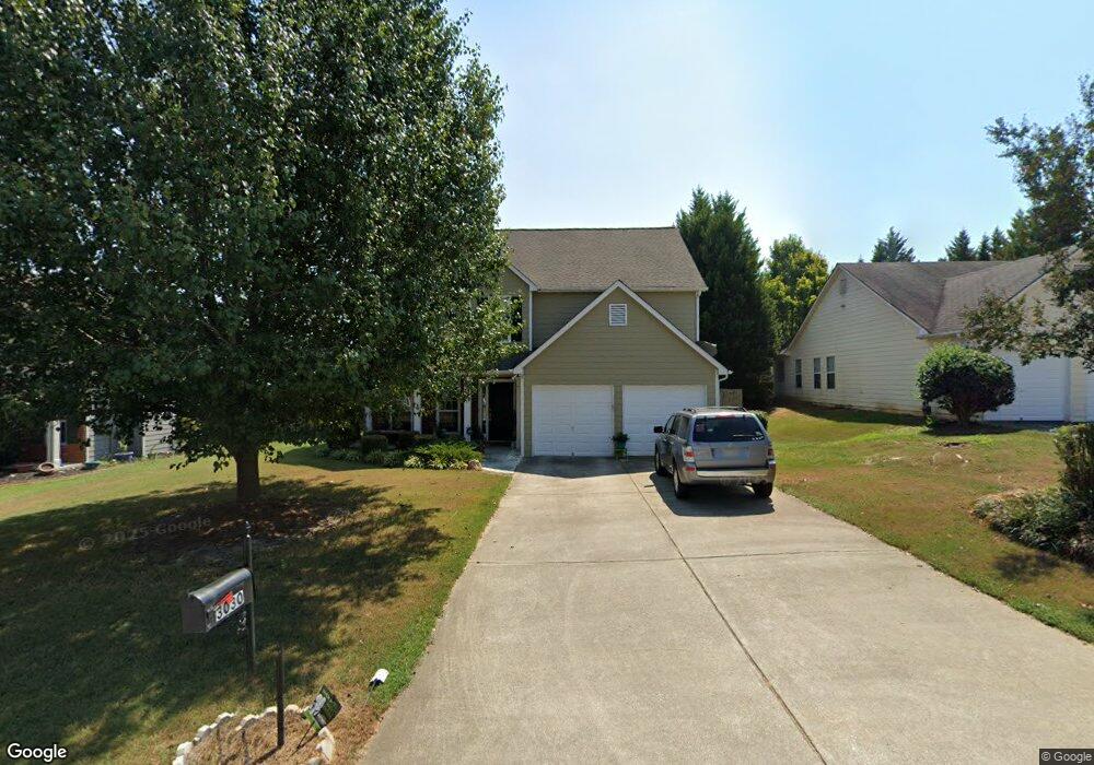
3030 Brookfield Dr Unit 1 Austell, GA 30106
Estimated Value: $309,000 - $351,000
3
Beds
3
Baths
1,925
Sq Ft
$170/Sq Ft
Est. Value
About This Home
This home is located at 3030 Brookfield Dr Unit 1, Austell, GA 30106 and is currently estimated at $326,524, approximately $169 per square foot. 3030 Brookfield Dr Unit 1 is a home located in Cobb County with nearby schools including Hendricks Elementary School, Garrett Middle School, and DELTA STEAM Academy.
Ownership History
Date
Name
Owned For
Owner Type
Purchase Details
Closed on
Sep 1, 2001
Sold by
Grove Park Development Inc
Bought by
Four Star Building Group Inc
Current Estimated Value
Purchase Details
Closed on
Jun 28, 2001
Sold by
Four Star Building Group Inc
Bought by
Blount Melba L
Home Financials for this Owner
Home Financials are based on the most recent Mortgage that was taken out on this home.
Original Mortgage
$136,050
Interest Rate
7.17%
Mortgage Type
New Conventional
Create a Home Valuation Report for This Property
The Home Valuation Report is an in-depth analysis detailing your home's value as well as a comparison with similar homes in the area
Home Values in the Area
Average Home Value in this Area
Purchase History
| Date | Buyer | Sale Price | Title Company |
|---|---|---|---|
| Four Star Building Group Inc | -- | -- | |
| Blount Melba L | $137,900 | -- |
Source: Public Records
Mortgage History
| Date | Status | Borrower | Loan Amount |
|---|---|---|---|
| Previous Owner | Blount Melba L | $136,050 |
Source: Public Records
Tax History Compared to Growth
Tax History
| Year | Tax Paid | Tax Assessment Tax Assessment Total Assessment is a certain percentage of the fair market value that is determined by local assessors to be the total taxable value of land and additions on the property. | Land | Improvement |
|---|---|---|---|---|
| 2024 | $372 | $114,932 | $16,000 | $98,932 |
| 2023 | $1,845 | $114,932 | $16,000 | $98,932 |
| 2022 | $1,688 | $79,656 | $16,000 | $63,656 |
| 2021 | $1,698 | $79,656 | $16,000 | $63,656 |
| 2020 | $1,431 | $65,620 | $16,000 | $49,620 |
| 2019 | $1,401 | $64,048 | $16,000 | $48,048 |
| 2018 | $1,401 | $64,048 | $16,000 | $48,048 |
| 2017 | $1,158 | $55,180 | $6,800 | $48,380 |
| 2016 | $886 | $44,248 | $6,800 | $37,448 |
| 2015 | $908 | $44,248 | $6,800 | $37,448 |
| 2014 | $685 | $35,564 | $0 | $0 |
Source: Public Records
Map
Nearby Homes
- 6031 Falcon Ct
- 6197 Union Grove Rd
- 5703 Newnan Cir
- 3903 Doe Run Dr
- 5975 Tate Dr Unit 1
- 3705 Tate Place
- 3636 Perry Point
- 3957 Evans Dr
- 0 Garrett Rd SW Unit 10603275
- 0 Garrett Rd SW Unit 7648220
- 5927 Sherrie Ln
- 3667 Humphries Hill Rd
- 3536 Perry Point
- 6277 N Sweetwater Rd
- 6309 Wellington Way
- 5452 Sweetsprings Dr SW
- 5420 Hiram Lithia Springs Rd
- 6503 Jackie Ln
- 3020 Ben Blvd
- 27 Shepherd Dr
- 3040 Brookfield Dr Unit 1
- 3020 Brookfield Dr
- 5060 Deer Brook Trail Unit 1
- 5050 Deer Brook Trail
- 3050 Brookfield Dr
- 3010 Brookfield Dr
- 5070 Deer Brook Trail
- 5040 Deer Brook Trail Unit 1
- 4015 Brookfield Way Unit 1
- 3015 Brookfield Dr Unit 1
- 5080 Deer Brook Trail Unit 1
- 0 Deer Brook Trail SW Unit 8773908
- 0 Deer Brook Trail SW Unit 8298668
- 0 Deer Brook Trail SW Unit 7560870
- 0 Deer Brook Trail SW Unit 8893751
- 0 Deer Brook Trail SW Unit 7211137
- 3005 Brookfield Dr
- 3060 Brookfield Dr
- 3000 Brookfield Dr Unit 1
- 5030 Deer Brook Trail
