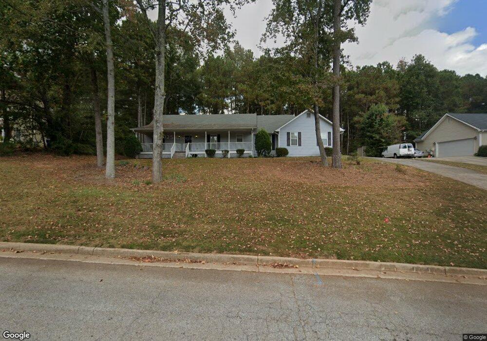
304 Mckenzie Dr Stockbridge, GA 30281
Estimated Value: $279,760 - $309,000
3
Beds
2
Baths
1,720
Sq Ft
$170/Sq Ft
Est. Value
About This Home
This home is located at 304 Mckenzie Dr, Stockbridge, GA 30281 and is currently estimated at $291,690, approximately $169 per square foot. 304 Mckenzie Dr is a home located in Henry County with nearby schools including Woodland Elementary School, Woodland Middle School, and Woodland High School.
Ownership History
Date
Name
Owned For
Owner Type
Purchase Details
Closed on
Feb 23, 2000
Sold by
Schubele Bruce F and Schubele Patricia J
Bought by
Bruce Sherrie M
Current Estimated Value
Home Financials for this Owner
Home Financials are based on the most recent Mortgage that was taken out on this home.
Original Mortgage
$108,000
Outstanding Balance
$33,980
Interest Rate
7.5%
Mortgage Type
New Conventional
Estimated Equity
$257,710
Purchase Details
Closed on
Mar 6, 1995
Sold by
Mnw Constructio N Co
Bought by
Schubele Bruce F Patricia J
Create a Home Valuation Report for This Property
The Home Valuation Report is an in-depth analysis detailing your home's value as well as a comparison with similar homes in the area
Home Values in the Area
Average Home Value in this Area
Purchase History
| Date | Buyer | Sale Price | Title Company |
|---|---|---|---|
| Bruce Sherrie M | $125,000 | -- | |
| Schubele Bruce F Patricia J | $104,000 | -- |
Source: Public Records
Mortgage History
| Date | Status | Borrower | Loan Amount |
|---|---|---|---|
| Open | Bruce Sherrie M | $108,000 | |
| Closed | Schubele Bruce F Patricia J | $0 |
Source: Public Records
Tax History Compared to Growth
Tax History
| Year | Tax Paid | Tax Assessment Tax Assessment Total Assessment is a certain percentage of the fair market value that is determined by local assessors to be the total taxable value of land and additions on the property. | Land | Improvement |
|---|---|---|---|---|
| 2025 | $3,056 | $107,480 | $16,000 | $91,480 |
| 2024 | $3,056 | $107,480 | $16,000 | $91,480 |
| 2023 | $2,115 | $113,320 | $16,000 | $97,320 |
| 2022 | $2,685 | $88,480 | $12,000 | $76,480 |
| 2021 | $2,361 | $74,760 | $12,000 | $62,760 |
| 2020 | $2,191 | $67,560 | $10,800 | $56,760 |
| 2019 | $2,136 | $65,240 | $10,800 | $54,440 |
| 2018 | $2,017 | $60,200 | $10,000 | $50,200 |
| 2016 | $1,674 | $49,000 | $10,000 | $39,000 |
| 2015 | -- | $40,240 | $7,200 | $33,040 |
| 2014 | $1,243 | $36,800 | $7,200 | $29,600 |
Source: Public Records
Map
Nearby Homes
- 320 Mckenzie Dr
- 0 Mckenzie Ave Unit 10593345
- 564 Mckenzie Ave
- 719 Erin Dr
- 164 Mckenzie Ct
- 1720 Highway 138 E
- 1810 Highway 138 E
- 805 Anna Kathryn Dr
- 825 Anna Kathryn Dr
- 809 Anna Kathryn Dr
- 807 Anna Kathryn Dr
- 829 Anna Kathryn Dr
- 830 Anna Kathryn Dr
- 811 Anna Kathryn Dr
- 831 Anna Kathryn Dr
- 813 Anna Kathryn Dr
- 551 Hood Rd
- 95 Fern Ct
- 65 Wynfield Dr
- 663 Moseley Dr
- 296 Mckenzie Dr
- 312 Mckenzie Dr
- 282 Mckenzie Dr
- 293 Mckenzie Dr
- 301 Mckenzie Dr Unit III
- 309 Mckenzie Dr Unit 26
- 309 Mckenzie Dr
- 1565 Salinger Ct
- 1678 Salinger Ct
- 1662 Salinger Ct
- 1658 Salinger Ct
- 1549 Salinger Ct
- 1521 Salinger Ct
- 1525 Salinger Ct
- 1513 Salinger Ct
- 1517 Salinger Ct
- 1501 Salinger Ct
- 285 Mckenzie Dr
- 280 Mckenzie Dr
- 328 Mckenzie Dr