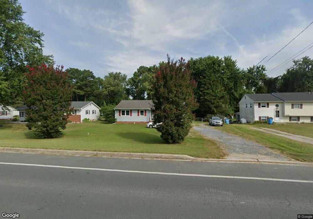
30442 Zion Rd Salisbury, MD 21804
North Salisbury NeighborhoodEstimated Value: $209,190 - $296,000
--
Bed
2
Baths
1,522
Sq Ft
$169/Sq Ft
Est. Value
About This Home
This home is located at 30442 Zion Rd, Salisbury, MD 21804 and is currently estimated at $256,798, approximately $168 per square foot. 30442 Zion Rd is a home located in Wicomico County with nearby schools including West Salisbury Elementary School, North Salisbury Elementary School, and Wicomico Middle School.
Ownership History
Date
Name
Owned For
Owner Type
Purchase Details
Closed on
Jun 20, 2014
Sold by
Mccauley Charles Robert
Bought by
Mccauley Charles Robert and Mccauley Linda Brooke
Current Estimated Value
Purchase Details
Closed on
May 30, 2002
Sold by
State Street Bank & Trust Co The
Bought by
Mccauley Charles R
Purchase Details
Closed on
Feb 19, 2002
Sold by
Price Kenneth I and Price Carol
Bought by
State Street Bank & Trust Co The and Trustee
Purchase Details
Closed on
Jan 4, 1985
Sold by
Smith William R and Smith Karen S
Bought by
Price Kenneth I and Price Carol
Home Financials for this Owner
Home Financials are based on the most recent Mortgage that was taken out on this home.
Original Mortgage
$47,500
Interest Rate
13.1%
Create a Home Valuation Report for This Property
The Home Valuation Report is an in-depth analysis detailing your home's value as well as a comparison with similar homes in the area
Home Values in the Area
Average Home Value in this Area
Purchase History
| Date | Buyer | Sale Price | Title Company |
|---|---|---|---|
| Mccauley Charles Robert | -- | None Available | |
| Mccauley Charles R | $82,000 | -- | |
| State Street Bank & Trust Co The | $79,700 | -- | |
| Price Kenneth I | $47,500 | -- |
Source: Public Records
Mortgage History
| Date | Status | Borrower | Loan Amount |
|---|---|---|---|
| Previous Owner | Price Kenneth I | $47,500 | |
| Closed | Mccauley Charles R | -- |
Source: Public Records
Tax History Compared to Growth
Tax History
| Year | Tax Paid | Tax Assessment Tax Assessment Total Assessment is a certain percentage of the fair market value that is determined by local assessors to be the total taxable value of land and additions on the property. | Land | Improvement |
|---|---|---|---|---|
| 2025 | $1,404 | $153,300 | $29,100 | $124,200 |
| 2024 | $1,404 | $144,400 | $0 | $0 |
| 2023 | $1,377 | $135,500 | $0 | $0 |
| 2022 | $1,350 | $126,600 | $29,100 | $97,500 |
| 2021 | $1,320 | $124,367 | $0 | $0 |
| 2020 | $1,320 | $122,133 | $0 | $0 |
| 2019 | $1,315 | $119,900 | $29,100 | $90,800 |
| 2018 | $1,310 | $118,800 | $0 | $0 |
| 2017 | $1,298 | $117,700 | $0 | $0 |
| 2016 | -- | $116,600 | $0 | $0 |
| 2015 | $1,238 | $116,600 | $0 | $0 |
| 2014 | $1,238 | $116,600 | $0 | $0 |
Source: Public Records
Map
Nearby Homes
- 30446 Zion Rd
- 30483 Bennett Rd
- 30536 Bennett Rd
- 30575 Zion Rd
- 517 Holly Ridge Ct
- 413 Lindenhurst Ct
- 529 Birchwood Dr
- 707 W Morris Leonard Rd
- 1002 Sherwood Cir
- 504 Parker Rd Unit 1
- 807 Brookmeade Ct
- 803 Lyndhurst Ln
- 2519 N Salisbury Blvd
- 2302 Allen Dr
- 421 Stream Valley Ct
- 6957 Amber Fields Ct
- 232 Cherry Way
- 0 N U S 13 Unit 1004257479
- 506 Barnsdale Dr
- 302 Pine Way