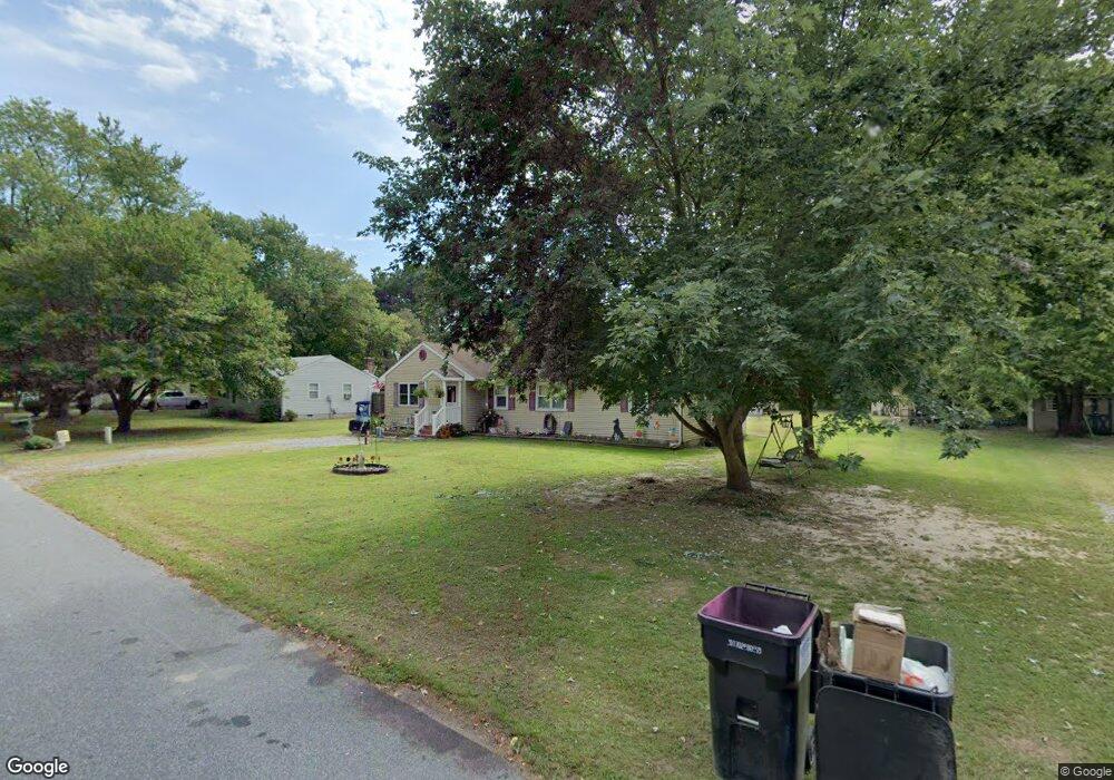
30453 Cannon Dr Salisbury, MD 21804
North Salisbury NeighborhoodEstimated Value: $193,931 - $259,000
--
Bed
2
Baths
1,664
Sq Ft
$138/Sq Ft
Est. Value
About This Home
This home is located at 30453 Cannon Dr, Salisbury, MD 21804 and is currently estimated at $229,983, approximately $138 per square foot. 30453 Cannon Dr is a home located in Wicomico County with nearby schools including West Salisbury Elementary School, North Salisbury Elementary School, and Wicomico Middle School.
Ownership History
Date
Name
Owned For
Owner Type
Purchase Details
Closed on
Sep 14, 2006
Sold by
Smullen George W
Bought by
Smullen George W and Smith Holly
Current Estimated Value
Home Financials for this Owner
Home Financials are based on the most recent Mortgage that was taken out on this home.
Original Mortgage
$50,000
Interest Rate
6.83%
Mortgage Type
Unknown
Purchase Details
Closed on
Aug 21, 2006
Sold by
Smullen George W
Bought by
Smullen George W and Smith Holly
Home Financials for this Owner
Home Financials are based on the most recent Mortgage that was taken out on this home.
Original Mortgage
$50,000
Interest Rate
6.83%
Mortgage Type
Unknown
Purchase Details
Closed on
Oct 12, 1999
Sold by
Smullen George W
Bought by
Smullen George W
Create a Home Valuation Report for This Property
The Home Valuation Report is an in-depth analysis detailing your home's value as well as a comparison with similar homes in the area
Home Values in the Area
Average Home Value in this Area
Purchase History
| Date | Buyer | Sale Price | Title Company |
|---|---|---|---|
| Smullen George W | -- | -- | |
| Smullen George W | -- | -- | |
| Smullen George W | -- | -- |
Source: Public Records
Mortgage History
| Date | Status | Borrower | Loan Amount |
|---|---|---|---|
| Closed | Smullen George W | $50,000 | |
| Closed | Smullen George W | $50,000 |
Source: Public Records
Tax History Compared to Growth
Tax History
| Year | Tax Paid | Tax Assessment Tax Assessment Total Assessment is a certain percentage of the fair market value that is determined by local assessors to be the total taxable value of land and additions on the property. | Land | Improvement |
|---|---|---|---|---|
| 2025 | $1,273 | $131,800 | $29,000 | $102,800 |
| 2024 | $1,273 | $126,533 | $0 | $0 |
| 2023 | $1,210 | $121,267 | $0 | $0 |
| 2022 | $1,242 | $116,000 | $29,000 | $87,000 |
| 2021 | $1,210 | $113,767 | $0 | $0 |
| 2020 | $1,210 | $111,533 | $0 | $0 |
| 2019 | $1,204 | $109,300 | $29,000 | $80,300 |
| 2018 | $1,199 | $108,333 | $0 | $0 |
| 2017 | $1,189 | $107,367 | $0 | $0 |
| 2016 | -- | $106,400 | $0 | $0 |
| 2015 | $1,113 | $106,400 | $0 | $0 |
| 2014 | $1,113 | $106,400 | $0 | $0 |
Source: Public Records
Map
Nearby Homes
- 30483 Bennett Rd
- 30536 Bennett Rd
- 30446 Zion Rd
- 30575 Zion Rd
- 517 Holly Ridge Ct
- 413 Lindenhurst Ct
- 529 Birchwood Dr
- 2519 N Salisbury Blvd
- 707 W Morris Leonard Rd
- 1002 Sherwood Cir
- 504 Parker Rd Unit 1
- 803 Lyndhurst Ln
- 2302 Allen Dr
- 0 N U S 13 Unit 1004257479
- 421 Stream Valley Ct
- 6957 Amber Fields Ct
- 0 Hampshire Rd Unit MDWC2014506
- 506 Barnsdale Dr
- 8233 Robin Hood Dr
- Lot 20 Pine Way
- 30461 Cannon Dr
- 30441 Cannon Dr
- 30467 Cannon Dr
- 30435 Cannon Dr
- 30450 Cannon Dr
- 30454 Cannon Dr
- 30464 Bennett Rd
- 30458 Bennett Rd
- 30470 Bennett Rd
- 30464 Cannon Dr
- 30442 Cannon Dr
- 30442 Cannon Dr
- 30442 Cannon Dr
- 30478 Bennett Rd
- 30452 Bennett Rd
- 30479 Cannon Dr
- 30425 Cannon Dr
- 30486 Bennett Rd
- 30480 Cannon Dr
- 30480 Cannon Dr