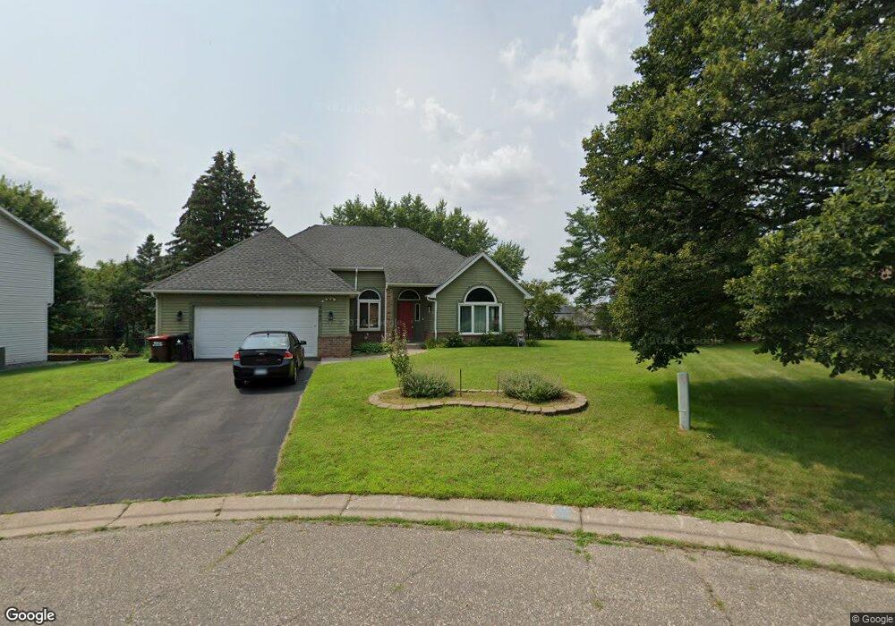
3047 Dorland Rd Saint Paul, MN 55109
Maplewood Heights NeighborhoodEstimated Value: $409,000 - $439,000
3
Beds
3
Baths
1,598
Sq Ft
$264/Sq Ft
Est. Value
About This Home
This home is located at 3047 Dorland Rd, Saint Paul, MN 55109 and is currently estimated at $421,117, approximately $263 per square foot. 3047 Dorland Rd is a home located in Ramsey County with nearby schools including Richardson Elementary School, John Glenn Middle School, and Christ Lutheran School.
Ownership History
Date
Name
Owned For
Owner Type
Purchase Details
Closed on
Oct 26, 2018
Sold by
Funk Barbara L
Bought by
Nickson Jonathan
Current Estimated Value
Home Financials for this Owner
Home Financials are based on the most recent Mortgage that was taken out on this home.
Original Mortgage
$279,837
Outstanding Balance
$245,557
Interest Rate
4.7%
Mortgage Type
FHA
Estimated Equity
$175,560
Create a Home Valuation Report for This Property
The Home Valuation Report is an in-depth analysis detailing your home's value as well as a comparison with similar homes in the area
Home Values in the Area
Average Home Value in this Area
Purchase History
| Date | Buyer | Sale Price | Title Company |
|---|---|---|---|
| Nickson Jonathan | $285,000 | Results Title |
Source: Public Records
Mortgage History
| Date | Status | Borrower | Loan Amount |
|---|---|---|---|
| Open | Nickson Jonathan | $279,837 |
Source: Public Records
Tax History Compared to Growth
Tax History
| Year | Tax Paid | Tax Assessment Tax Assessment Total Assessment is a certain percentage of the fair market value that is determined by local assessors to be the total taxable value of land and additions on the property. | Land | Improvement |
|---|---|---|---|---|
| 2025 | $5,354 | $407,900 | $65,900 | $342,000 |
| 2023 | $5,354 | $377,900 | $65,900 | $312,000 |
| 2022 | $4,582 | $372,800 | $65,900 | $306,900 |
| 2021 | $4,262 | $312,600 | $65,900 | $246,700 |
| 2020 | $4,426 | $298,700 | $65,900 | $232,800 |
| 2019 | $3,800 | $289,700 | $65,900 | $223,800 |
| 2018 | $3,926 | $256,400 | $65,900 | $190,500 |
| 2017 | $3,950 | $257,200 | $65,900 | $191,300 |
| 2016 | $3,860 | $0 | $0 | $0 |
| 2015 | $3,836 | $242,900 | $58,700 | $184,200 |
| 2014 | $3,298 | $0 | $0 | $0 |
Source: Public Records
Map
Nearby Homes
- 2340 Standridge Ave
- 2974 Winthrop Dr
- 2237 Maple Ln E
- 2321 Beam Ave
- 2911 Bartelmy Ln
- 2994 Mary St
- 2065 Woodlynn Ave
- 3175 Manitou Dr Unit 8
- 3167 Manitou Dr Unit 7
- 3148 Manitou Dr
- 2800 1st St N
- 3126 Manitou Dr
- 2523 Sumac Ridge
- 2739 Chippewa Ave
- 2735 Delaware Ave
- 2112 Radatz Ave
- 2729 Chippewa Ave
- 2556 Sumac Cir
- 2572 Sumac Ridge
- 3150 Glen Oaks Ave Unit 311
- 3041 Dorland Rd
- 3053 Dorland Rd
- 3044 Standridge Place
- 3052 Standridge Place
- 2325 Brenwood Curve
- 3035 Dorland Rd
- 3038 Standridge Place
- 3060 Standridge Place
- 2335 Brenwood Curve E
- 3040 Dorland Rd
- 2335 Brenwood Curve
- 3030 Standridge Place
- 3029 Dorland Rd
- 3029 Dorland Rd N
- 3032 Dorland Rd
- 3045 Standridge Place
- 3024 Standridge Place
- 2345 Brenwood Curve
- 3023 Dorland Rd
- 3024 Dorland Rd