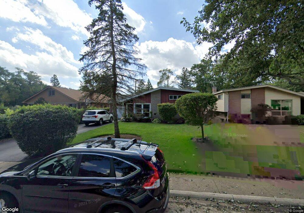
305 Forestway Dr Northbrook, IL 60062
Estimated Value: $438,000 - $526,000
3
Beds
2
Baths
1,231
Sq Ft
$389/Sq Ft
Est. Value
About This Home
This home is located at 305 Forestway Dr, Northbrook, IL 60062 and is currently estimated at $478,528, approximately $388 per square foot. 305 Forestway Dr is a home located in Cook County with nearby schools including Meadowbrook Elementary School, Northbrook Junior High School, and Glenbrook North High School.
Ownership History
Date
Name
Owned For
Owner Type
Purchase Details
Closed on
Jun 22, 2025
Sold by
Cooper Michael S and Cooper Erin
Bought by
Cooper Michael S
Current Estimated Value
Purchase Details
Closed on
Sep 2, 2002
Sold by
Young Curtis S and Young Jill L
Bought by
Cooper Michael S and Cooper Erin
Home Financials for this Owner
Home Financials are based on the most recent Mortgage that was taken out on this home.
Original Mortgage
$235,000
Interest Rate
6.24%
Purchase Details
Closed on
May 23, 1995
Sold by
Lasalle National Trust Na
Bought by
Young Curtis and Young Jill
Home Financials for this Owner
Home Financials are based on the most recent Mortgage that was taken out on this home.
Original Mortgage
$176,000
Interest Rate
7.87%
Create a Home Valuation Report for This Property
The Home Valuation Report is an in-depth analysis detailing your home's value as well as a comparison with similar homes in the area
Home Values in the Area
Average Home Value in this Area
Purchase History
| Date | Buyer | Sale Price | Title Company |
|---|---|---|---|
| Cooper Michael S | -- | None Listed On Document | |
| Cooper Michael S | $323,000 | -- | |
| Young Curtis | $220,000 | -- |
Source: Public Records
Mortgage History
| Date | Status | Borrower | Loan Amount |
|---|---|---|---|
| Previous Owner | Cooper Michael S | $235,000 | |
| Previous Owner | Young Curtis | $176,000 |
Source: Public Records
Tax History Compared to Growth
Tax History
| Year | Tax Paid | Tax Assessment Tax Assessment Total Assessment is a certain percentage of the fair market value that is determined by local assessors to be the total taxable value of land and additions on the property. | Land | Improvement |
|---|---|---|---|---|
| 2024 | $6,843 | $33,269 | $9,953 | $23,316 |
| 2023 | $6,614 | $33,269 | $9,953 | $23,316 |
| 2022 | $6,614 | $33,269 | $9,953 | $23,316 |
| 2021 | $5,731 | $26,269 | $8,038 | $18,231 |
| 2020 | $5,672 | $26,269 | $8,038 | $18,231 |
| 2019 | $5,502 | $28,867 | $8,038 | $20,829 |
| 2018 | $4,886 | $24,301 | $7,081 | $17,220 |
| 2017 | $4,988 | $25,238 | $7,081 | $18,157 |
| 2016 | $4,879 | $25,238 | $7,081 | $18,157 |
| 2015 | $4,660 | $22,293 | $5,933 | $16,360 |
| 2014 | $4,464 | $22,293 | $5,933 | $16,360 |
| 2013 | $4,588 | $23,547 | $5,933 | $17,614 |
Source: Public Records
Map
Nearby Homes
- 350 Sunset Ct
- 650 Midfield Ln
- 1043 Whitfield Rd Unit 2
- 24 Bridlewood Rd
- 1022 Whitfield Rd
- 34 Bridlewood Rd
- 759 Strawberry Hill Dr
- 908 Dell Rd
- 746 Woodridge Ln
- 857 Country Club Ln
- 828 Dell Rd
- 1135 Buttonwood Ln
- 823 Balmoral Ln
- 2050 Meadowview Ct
- 1425 Lee Rd
- 908 Elm Place
- 767 Ivy Ln
- 2202 Martin Ln
- 1133 Mayfair Ln
- 628 Happ Rd
- 301 Forestway Dr
- 311 Forestway Dr
- 315 Forestway Dr
- 306 Southgate Dr
- 308 Southgate Dr
- 300 Southgate Dr
- 312 Southgate Dr
- 321 Forestway Dr
- 237 Forestway Dr
- 306 Forestway Dr
- 316 Southgate Dr
- 300 Forestway Dr
- 310 Forestway Dr
- 242 Forestway Dr
- 238 Southgate Dr
- 314 Forestway Dr
- 325 Forestway Dr
- 322 Southgate Dr
- 233 Forestway Dr
- 240 Forestway Dr