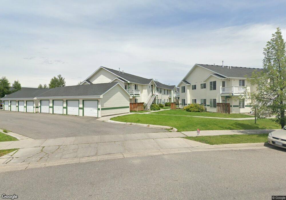
305 Michael Grove Ave Bozeman, MT 59718
Babcock NeighborhoodEstimated Value: $381,227 - $443,000
3
Beds
2
Baths
1,263
Sq Ft
$321/Sq Ft
Est. Value
About This Home
This home is located at 305 Michael Grove Ave, Bozeman, MT 59718 and is currently estimated at $405,307, approximately $320 per square foot. 305 Michael Grove Ave is a home located in Gallatin County with nearby schools including Lincoln Titus Elementary School, Emily Dickinson School, and William G. Houston Middle School.
Ownership History
Date
Name
Owned For
Owner Type
Purchase Details
Closed on
Dec 29, 2011
Sold by
Deutsche Bank National Trust Company
Bought by
Tomasetti Nicholas and Tomasetti Patricia
Current Estimated Value
Purchase Details
Closed on
Aug 26, 2011
Sold by
Denny Richar D
Bought by
Deutsche Bank National Trust Company
Purchase Details
Closed on
May 25, 2006
Sold by
Johnston Mark
Bought by
Denny Richard D
Home Financials for this Owner
Home Financials are based on the most recent Mortgage that was taken out on this home.
Original Mortgage
$32,600
Interest Rate
6.52%
Mortgage Type
Stand Alone Second
Create a Home Valuation Report for This Property
The Home Valuation Report is an in-depth analysis detailing your home's value as well as a comparison with similar homes in the area
Home Values in the Area
Average Home Value in this Area
Purchase History
| Date | Buyer | Sale Price | Title Company |
|---|---|---|---|
| Tomasetti Nicholas | -- | Rels Centralized Title | |
| Deutsche Bank National Trust Company | $91,868 | None Available | |
| Denny Richard D | -- | Montana Title & Escrow |
Source: Public Records
Mortgage History
| Date | Status | Borrower | Loan Amount |
|---|---|---|---|
| Previous Owner | Denny Richard D | $32,600 | |
| Previous Owner | Denny Richard D | $130,400 |
Source: Public Records
Tax History Compared to Growth
Tax History
| Year | Tax Paid | Tax Assessment Tax Assessment Total Assessment is a certain percentage of the fair market value that is determined by local assessors to be the total taxable value of land and additions on the property. | Land | Improvement |
|---|---|---|---|---|
| 2025 | $1,549 | $401,400 | $0 | $0 |
| 2024 | $2,607 | $391,700 | $0 | $0 |
| 2023 | $2,525 | $411,800 | $0 | $0 |
| 2022 | $1,841 | $240,100 | $0 | $0 |
| 2021 | $2,031 | $240,100 | $0 | $0 |
| 2020 | $1,709 | $199,600 | $0 | $0 |
| 2019 | $1,748 | $199,600 | $0 | $0 |
| 2018 | $1,428 | $151,000 | $0 | $0 |
| 2017 | $1,408 | $151,000 | $0 | $0 |
| 2016 | $1,211 | $127,800 | $0 | $0 |
| 2015 | $1,212 | $127,800 | $0 | $0 |
| 2014 | $1,393 | $86,602 | $0 | $0 |
Source: Public Records
Map
Nearby Homes
- 350 Meriwether Ave
- 440 Meriwether Ave
- 454 Meriwether Ave
- 470 Meriwether Ave
- 520 Valley Dr
- 3108 Oliver St
- 51 Michael Grove Ave
- 560 Christopher Way
- 508 Sweetgrass Ave
- 134 N 25th Ave
- 302 Swayback Ln
- 357 Swayback Ln
- 111 White Horse Loop
- 911 N Aster Ave
- 2400 Durston Rd Unit 15
- 3241 Annie St
- 3334 W Babcock St Unit D
- 2619 Annie St
- 745 Rogers Way
- 2366 W Beall St Unit 1
- 305 Michael Grove Ave
- 305 Michael Grove Ave
- 305 Michael Grove Ave
- 305 Michael Grove Ave
- 305 Michael Grove Ave
- 305 Michael Grove Ave
- 305 Michael Grove Ave
- 305 Michael Grove Ave Unit F
- 305 Michael Grove Ave Unit 2B
- 305 Michael Grove Ave Unit 2C
- 305 Michael Grove Ave Unit C
- 305 Michael Grove Ave Unit D
- 305 Michael Grove Ave Unit 2F
- 305 Michael Grove Ave Unit 2A
- 311 Michael Grove Ave
- 311 Michael Grove Ave
- 311 Michael Grove Ave
- 311 Michael Grove Ave
- 311 Michael Grove Ave
- 311 Michael Grove Ave