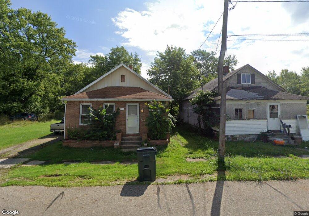
305 N Mahoning Ave Alliance, OH 44601
Estimated Value: $54,000 - $103,000
2
Beds
1
Bath
764
Sq Ft
$102/Sq Ft
Est. Value
About This Home
This home is located at 305 N Mahoning Ave, Alliance, OH 44601 and is currently estimated at $77,781, approximately $101 per square foot. 305 N Mahoning Ave is a home located in Mahoning County with nearby schools including Alliance Early Learning School, Alliance Intermediate School at Northside, and Alliance Middle School.
Ownership History
Date
Name
Owned For
Owner Type
Purchase Details
Closed on
Jun 28, 2023
Sold by
Martin Glenn
Bought by
Sloat Brendan
Current Estimated Value
Purchase Details
Closed on
Jul 11, 2001
Sold by
Rupp Stephanie and Rupp Eugene
Bought by
Martin Glenn and Martin Rachel
Purchase Details
Closed on
May 10, 2001
Sold by
Payton Sam and Lamarr Carol J
Bought by
Rupp Eugene and Rupp Stephanie
Purchase Details
Closed on
Oct 21, 1982
Bought by
Millner Charles and Millner Jean
Create a Home Valuation Report for This Property
The Home Valuation Report is an in-depth analysis detailing your home's value as well as a comparison with similar homes in the area
Purchase History
| Date | Buyer | Sale Price | Title Company |
|---|---|---|---|
| Sloat Brendan | $1,000 | None Listed On Document | |
| Sloat Brendan | $1,000 | None Listed On Document | |
| Martin Glenn | $2,000 | -- | |
| Rupp Eugene | $5,000 | -- | |
| Millner Charles | -- | -- |
Source: Public Records
Tax History
| Year | Tax Paid | Tax Assessment Tax Assessment Total Assessment is a certain percentage of the fair market value that is determined by local assessors to be the total taxable value of land and additions on the property. | Land | Improvement |
|---|---|---|---|---|
| 2025 | $6 | $140 | $140 | -- |
| 2024 | $6 | $140 | $140 | -- |
| 2023 | $75 | $1,680 | $710 | $970 |
| 2022 | $92 | $1,890 | $550 | $1,340 |
| 2021 | $88 | $1,890 | $550 | $1,340 |
| 2020 | $91 | $1,890 | $550 | $1,340 |
| 2019 | $86 | $1,680 | $550 | $1,130 |
| 2018 | $108 | $1,680 | $550 | $1,130 |
| 2017 | $91 | $1,680 | $550 | $1,130 |
| 2016 | $84 | $1,550 | $550 | $1,000 |
| 2015 | $87 | $1,550 | $550 | $1,000 |
| 2014 | $86 | $1,550 | $550 | $1,000 |
| 2013 | $85 | $1,550 | $550 | $1,000 |
Source: Public Records
Map
Nearby Homes
- 1226 Noble St
- 1025 Reed St
- 847 E Patterson St
- 16190 River St NE
- 000 Lexington Rd
- 442 S Liberty Ave
- 955 E Summit St
- V/L S Freedom Ave
- 361 E Main St
- 22862 Norman Ave
- 15832 Waverly St NE
- 710 N Freedom Ave
- 935 S Morgan Ave
- 452 E Summit St
- 62 E Market St
- 11344 Walnut Ave NE
- 505 N Union Ave
- 726 S Arch Ave
- 62 E High St
- 0 E Oxford St
- 317 N Mahoning Ave
- 303 N Mahoning Ave
- 263 N Mahoning Ave
- 1450 Noble St
- 239 N Mahoning Ave
- 1440 Noble St
- 13416 Stanley Ave
- 1430 Noble St
- 1481 Pike St
- 1420 Noble St
- 1463 Pike St
- 1443 Pike St
- 1413 Noble St
- 1410 Noble St
- 1421 Pike St
- 1404 Noble St
- 22850 Alliance Sebring Rd
- 22860 Alliance-Sebring Rd
- 1416 E Patterson St
- 1401 Pike St
Your Personal Tour Guide
Ask me questions while you tour the home.