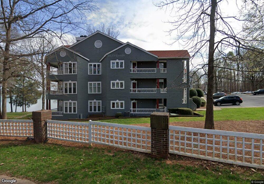
305 Northwest Dr Davidson, NC 28036
Estimated Value: $388,864 - $469,000
2
Beds
2
Baths
862
Sq Ft
$492/Sq Ft
Est. Value
About This Home
This home is located at 305 Northwest Dr, Davidson, NC 28036 and is currently estimated at $423,716, approximately $491 per square foot. 305 Northwest Dr is a home located in Mecklenburg County with nearby schools including Davidson Elementary School, William Amos Hough High School, and Davidson Day School.
Ownership History
Date
Name
Owned For
Owner Type
Purchase Details
Closed on
Oct 21, 2016
Sold by
William Wilson
Bought by
Biscoff Philipp
Current Estimated Value
Home Financials for this Owner
Home Financials are based on the most recent Mortgage that was taken out on this home.
Original Mortgage
$140,000
Outstanding Balance
$112,449
Interest Rate
3.52%
Estimated Equity
$311,267
Create a Home Valuation Report for This Property
The Home Valuation Report is an in-depth analysis detailing your home's value as well as a comparison with similar homes in the area
Home Values in the Area
Average Home Value in this Area
Purchase History
| Date | Buyer | Sale Price | Title Company |
|---|---|---|---|
| Biscoff Philipp | -- | -- |
Source: Public Records
Mortgage History
| Date | Status | Borrower | Loan Amount |
|---|---|---|---|
| Open | Biscoff Philipp | $140,000 | |
| Closed | Biscoff Philipp | -- |
Source: Public Records
Tax History
| Year | Tax Paid | Tax Assessment Tax Assessment Total Assessment is a certain percentage of the fair market value that is determined by local assessors to be the total taxable value of land and additions on the property. | Land | Improvement |
|---|---|---|---|---|
| 2025 | $2,731 | $357,934 | -- | $357,934 |
| 2024 | $2,731 | $357,934 | -- | $357,934 |
| 2023 | $2,690 | $357,934 | $0 | $357,934 |
| 2022 | $1,892 | $196,700 | $0 | $196,700 |
| 2021 | $1,883 | $196,700 | $0 | $196,700 |
| 2020 | $1,823 | $196,700 | $0 | $196,700 |
| 2019 | $1,877 | $196,700 | $0 | $196,700 |
| 2018 | $2,301 | $188,700 | $91,000 | $97,700 |
| 2017 | $2,284 | $188,700 | $91,000 | $97,700 |
| 2016 | $2,280 | $188,700 | $91,000 | $97,700 |
| 2015 | $2,277 | $188,700 | $91,000 | $97,700 |
| 2014 | $2,275 | $188,700 | $91,000 | $97,700 |
Source: Public Records
Map
Nearby Homes
- 306 Northwest Dr
- 345 Northwest Dr Unit 45
- 367 Northwest Dr Unit 67
- 633 Portside Dr
- 753 Southwest Dr Unit 4
- 754 Southwest Dr Unit 5
- 765 Southwest Dr Unit 15
- 854 Southwest Dr Unit 54
- 706 Northeast Dr
- 1018 Southwest Dr Unit 18
- 921 Northeast Dr Unit 38
- 1113 Torrence Cir Unit 61
- 714 Northeast Dr Unit 44
- 714 Northeast Dr Unit 53
- 1125 Torrence Cir Unit 67
- 930 Jetton St Unit 20
- 1331 Torrence Cir Unit 1331
- 245 Davidson Gateway Dr
- 229 Davidson Gateway Dr
- 233 Davidson Gateway Dr
- 305 Northwest Dr Unit 305
- 305 Northwest Dr Unit 225
- 308 Northwest Dr
- 304 Northwest Dr
- 309 Northwest Dr
- 307 Northwest Dr Unit 7
- 301 Northwest Dr Unit 1
- 301 Northwest Dr
- 311 Northwest Dr Unit 11
- 312 Northwest Dr
- 310 Northwest Dr Unit 10
- 313 Northwest Dr Unit 13
- 314 Northwest Dr
- 315 Northwest Dr
- 318 Northwest Dr Unit 18
- 317 Northwest Dr Unit 17
- 316 Northwest Dr
- 321 Northwest Dr Unit 21
- 320 Northwest Dr Unit 320
- 320 Northwest Dr
Your Personal Tour Guide
Ask me questions while you tour the home.