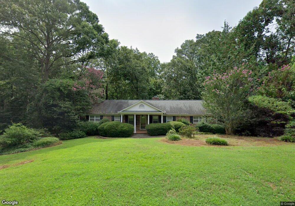
305 Woodland Cir Pendleton, SC 29670
Estimated Value: $260,000 - $337,000
3
Beds
2
Baths
2,204
Sq Ft
$136/Sq Ft
Est. Value
About This Home
This home is located at 305 Woodland Cir, Pendleton, SC 29670 and is currently estimated at $299,354, approximately $135 per square foot. 305 Woodland Cir is a home located in Anderson County with nearby schools including Pendleton High School, Holy Trinity Episcopal Day School, and Clemson Montessori School.
Ownership History
Date
Name
Owned For
Owner Type
Purchase Details
Closed on
Dec 30, 2025
Sold by
Green Fleming Orene and Fleming Snowden Susan Renee
Bought by
Taylor Henry William and Taylor Audrey Henry
Current Estimated Value
Home Financials for this Owner
Home Financials are based on the most recent Mortgage that was taken out on this home.
Original Mortgage
$192,000
Outstanding Balance
$191,817
Interest Rate
6.23%
Mortgage Type
New Conventional
Estimated Equity
$107,537
Purchase Details
Closed on
Oct 1, 2010
Sold by
Estate Of Horace W Fleming Jr and Snowden Susan Renee Fleming
Bought by
Snowden Susan Renee Fleming and Fleming Patrick Weldon
Create a Home Valuation Report for This Property
The Home Valuation Report is an in-depth analysis detailing your home's value as well as a comparison with similar homes in the area
Home Values in the Area
Average Home Value in this Area
Purchase History
| Date | Buyer | Sale Price | Title Company |
|---|---|---|---|
| Taylor Henry William | $240,000 | None Listed On Document | |
| Snowden Susan Renee Fleming | -- | -- |
Source: Public Records
Mortgage History
| Date | Status | Borrower | Loan Amount |
|---|---|---|---|
| Open | Taylor Henry William | $192,000 |
Source: Public Records
Tax History
| Year | Tax Paid | Tax Assessment Tax Assessment Total Assessment is a certain percentage of the fair market value that is determined by local assessors to be the total taxable value of land and additions on the property. | Land | Improvement |
|---|---|---|---|---|
| 2024 | $4,641 | $11,090 | $1,740 | $9,350 |
| 2023 | $4,630 | $11,090 | $1,740 | $9,350 |
| 2022 | $4,440 | $11,090 | $1,740 | $9,350 |
| 2021 | $3,976 | $8,770 | $690 | $8,080 |
| 2020 | $3,958 | $8,770 | $690 | $8,080 |
| 2019 | $3,958 | $8,770 | $690 | $8,080 |
| 2018 | $3,916 | $8,770 | $690 | $8,080 |
| 2017 | -- | $8,770 | $690 | $8,080 |
| 2016 | $3,673 | $8,180 | $480 | $7,700 |
| 2015 | $3,680 | $8,180 | $480 | $7,700 |
| 2014 | $3,682 | $8,180 | $480 | $7,700 |
Source: Public Records
Map
Nearby Homes
- 110 Maple St
- 125 Maple St Unit 101
- 125 Maple St Unit 101
- 103 Stephens Rd
- 00 Westminster Dr
- 00 Westminster Dr Unit Lot 35
- 501 Westminster Dr
- 125 Cambridge Ln
- 00 Spake Rd Unit Lot C
- 00 Spake Rd Unit Lot D
- Lot 3 Crenshaw St
- Lot 1 Crenshaw St
- 320 Thompson St
- 356 Thompson St
- 335 Winston St
- 216 N Mechanic St
- 727 Greenville St Unit 17
- 340 Allingham Rd
- 826 Greenville St
- 156 Grand Oak Cir
- 603 Woodland Cir Unit 603 Woodland Cr.
- 300 Woodland Cir
- 306 Woodland Cir
- 310 Woodland Cir
- 524 Woodland Cir
- 104 Poplar St
- 518 Woodland Cir
- 111 Poplar St
- 318 Woodland Cir
- 514 Woodland Cir
- 321 Woodland Cir
- 526 Woodland Cir
- 320 Woodland Cir
- 330 Woodland Cir
- 512 Woodland Cir
- 103 Poplar St
- 106 Maple St
- 106 Maple St
- 202 Woodland Cir
- 108 Maple St
Your Personal Tour Guide
Ask me questions while you tour the home.