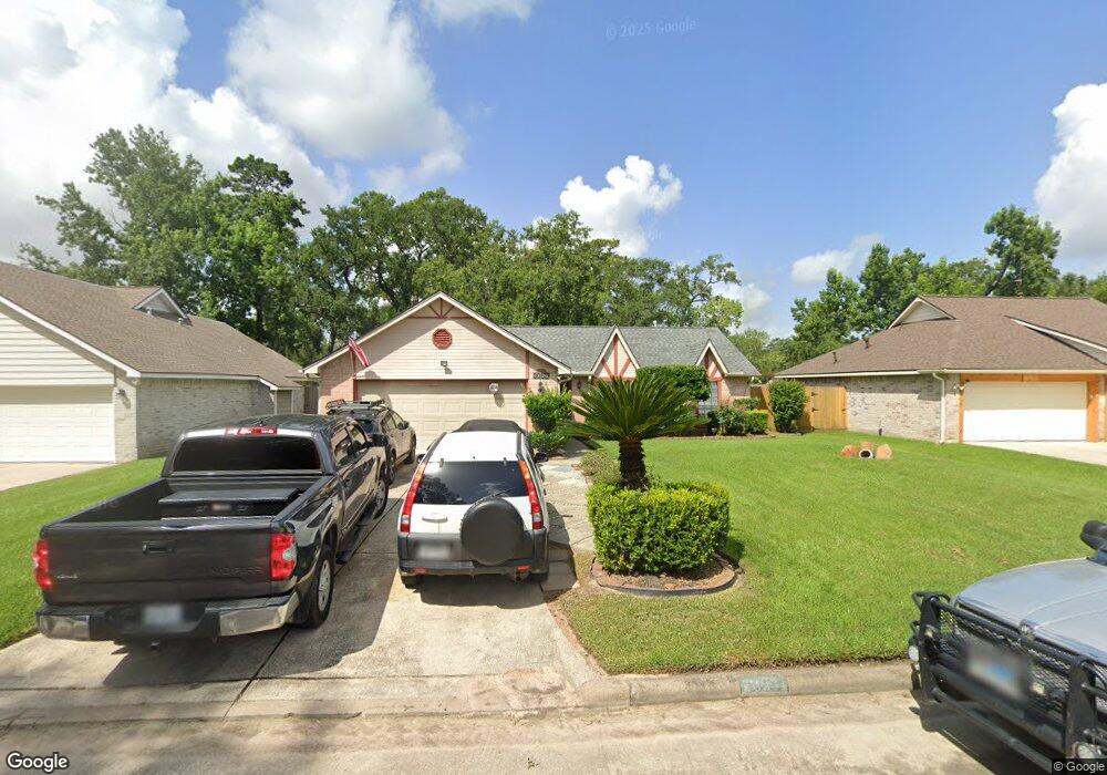
30511 Thorsby Dr Spring, TX 77386
Imperial Oaks NeighborhoodEstimated Value: $244,048 - $265,000
Studio
2
Baths
1,552
Sq Ft
$162/Sq Ft
Est. Value
About This Home
This home is located at 30511 Thorsby Dr, Spring, TX 77386 and is currently estimated at $250,762, approximately $161 per square foot. 30511 Thorsby Dr is a home located in Montgomery County with nearby schools including Kaufman Elementary School, Vogel Intermediate School, and Irons J High School.
Ownership History
Date
Name
Owned For
Owner Type
Purchase Details
Closed on
Dec 9, 2025
Sold by
Munoz Ben and Munoz Bertha
Bought by
Ben And Bertha Munoz Family Trust
Current Estimated Value
Purchase Details
Closed on
Sep 11, 2003
Sold by
Hud
Bought by
Munoz Ben and Munoz Bertha I
Home Financials for this Owner
Home Financials are based on the most recent Mortgage that was taken out on this home.
Original Mortgage
$80,750
Interest Rate
9.3%
Mortgage Type
Purchase Money Mortgage
Purchase Details
Closed on
Jan 7, 2003
Sold by
Hall Carol
Bought by
First Nationwide Mortgage Corp
Purchase Details
Closed on
Jun 25, 1998
Sold by
Dominy Marvin L and Dominy Kathy
Bought by
Hall Carol
Home Financials for this Owner
Home Financials are based on the most recent Mortgage that was taken out on this home.
Original Mortgage
$85,950
Interest Rate
7.13%
Mortgage Type
FHA
Create a Home Valuation Report for This Property
The Home Valuation Report is an in-depth analysis detailing your home's value as well as a comparison with similar homes in the area
Home Values in the Area
Average Home Value in this Area
Purchase History
| Date | Buyer | Sale Price | Title Company |
|---|---|---|---|
| Ben And Bertha Munoz Family Trust | -- | None Listed On Document | |
| Munoz Ben | -- | First American Title | |
| First Nationwide Mortgage Corp | $88,652 | -- | |
| Hud | -- | -- | |
| Hall Carol | -- | Old Republic Title |
Source: Public Records
Mortgage History
| Date | Status | Borrower | Loan Amount |
|---|---|---|---|
| Previous Owner | Munoz Ben | $80,750 | |
| Previous Owner | Hall Carol | $85,950 |
Source: Public Records
Tax History
| Year | Tax Paid | Tax Assessment Tax Assessment Total Assessment is a certain percentage of the fair market value that is determined by local assessors to be the total taxable value of land and additions on the property. | Land | Improvement |
|---|---|---|---|---|
| 2025 | $1,612 | $226,681 | -- | -- |
| 2024 | $1,493 | $206,074 | -- | -- |
| 2023 | $1,493 | $187,340 | $58,000 | $181,060 |
| 2022 | $3,928 | $170,310 | $9,920 | $190,080 |
| 2021 | $3,844 | $154,830 | $9,920 | $144,910 |
| 2020 | $3,852 | $149,050 | $9,920 | $139,130 |
| 2019 | $3,891 | $154,150 | $9,920 | $144,230 |
| 2018 | $2,610 | $149,210 | $9,920 | $139,290 |
| 2017 | $4,046 | $149,210 | $9,920 | $139,290 |
| 2016 | $3,934 | $145,090 | $9,920 | $135,170 |
| 2015 | $3,684 | $138,270 | $9,920 | $128,350 |
| 2014 | $3,684 | $131,350 | $9,920 | $121,430 |
Source: Public Records
Map
Nearby Homes
- 2110 Creston Dr
- 2007 Havenhouse Dr
- 1915 W Welsford Dr
- 1719 Eastvale Dr
- 30427 W Legends Trail Dr
- 1711 Woodhue Dr
- 30206 Glenboro Dr
- 1702 Bembridge Dr
- 1927 Enchanted Park Dr
- 1711 Telkwa Dr
- 1619 Sungail Dr
- 30719 Aldine Westfield Rd
- 30715 Eastridge Dr
- 2130 Medway Dr
- 30026 Nanton Dr
- 30122 Falher Dr
- 1618 Mercoal Dr
- 1614 Mercoal Dr
- 1723 Forestburg Dr
- 30615 Winlock Trails Dr
- 30515 Thorsby Dr
- 30503 Thorsby Dr
- 2039 Woodhue Dr
- 30519 Thorsby Dr
- 30419 Thorsby Dr
- 2034 Woodhue Dr
- 30510 Thorsby Dr
- 2035 Woodhue Dr
- 30514 Thorsby Dr
- 30506 Thorsby Dr
- 2038 Invermere Dr
- 30518 Thorsby Dr
- 30415 Thorsby Dr
- 30502 Thorsby Dr
- 30522 Thorsby Dr
- 2031 Woodhue Dr
- 2034 Invermere Dr
- 30418 Thorsby Dr
- 2119 Creston Dr
- 2030 Woodhue Dr
Your Personal Tour Guide
Ask me questions while you tour the home.