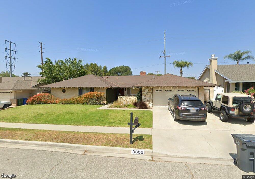
3053 Peoria Ave Simi Valley, CA 93063
Central Simi Valley NeighborhoodEstimated Value: $960,000 - $1,029,546
6
Beds
4
Baths
2,494
Sq Ft
$405/Sq Ft
Est. Value
About This Home
This home is located at 3053 Peoria Ave, Simi Valley, CA 93063 and is currently estimated at $1,008,887, approximately $404 per square foot. 3053 Peoria Ave is a home located in Ventura County with nearby schools including Township Elementary School, Valley View Middle School, and Simi Valley High School.
Ownership History
Date
Name
Owned For
Owner Type
Purchase Details
Closed on
Aug 11, 2000
Sold by
Kent Turner S
Bought by
Reed Michael and Vico Reed Jalyn N
Current Estimated Value
Home Financials for this Owner
Home Financials are based on the most recent Mortgage that was taken out on this home.
Original Mortgage
$243,000
Interest Rate
7.98%
Create a Home Valuation Report for This Property
The Home Valuation Report is an in-depth analysis detailing your home's value as well as a comparison with similar homes in the area
Home Values in the Area
Average Home Value in this Area
Purchase History
| Date | Buyer | Sale Price | Title Company |
|---|---|---|---|
| Reed Michael | $312,000 | First American Title Ins Co |
Source: Public Records
Mortgage History
| Date | Status | Borrower | Loan Amount |
|---|---|---|---|
| Previous Owner | Reed Michael | $243,000 |
Source: Public Records
Tax History
| Year | Tax Paid | Tax Assessment Tax Assessment Total Assessment is a certain percentage of the fair market value that is determined by local assessors to be the total taxable value of land and additions on the property. | Land | Improvement |
|---|---|---|---|---|
| 2025 | $5,864 | $470,107 | $188,042 | $282,065 |
| 2024 | $5,864 | $460,890 | $184,355 | $276,535 |
| 2023 | $5,515 | $451,853 | $180,740 | $271,113 |
| 2022 | $5,491 | $442,994 | $177,196 | $265,798 |
| 2021 | $5,450 | $434,308 | $173,721 | $260,587 |
| 2020 | $5,336 | $429,857 | $171,941 | $257,916 |
| 2019 | $5,095 | $421,429 | $168,570 | $252,859 |
| 2018 | $5,051 | $413,166 | $165,265 | $247,901 |
| 2017 | $8,670 | $405,066 | $162,025 | $243,041 |
| 2016 | $8,458 | $397,125 | $158,849 | $238,276 |
| 2015 | $4,619 | $391,162 | $156,464 | $234,698 |
| 2014 | $4,554 | $383,501 | $153,400 | $230,101 |
Source: Public Records
Map
Nearby Homes
- 2916 Esperanza Way Unit F
- 4168 Felipe Ln Unit A
- 3096 Anchorage Ave
- 2696 Santa Ynez Ave
- 4514 Lubbock Dr Unit C
- 3055 Amarillo Ave
- 3562 Quincy Ave
- 4391 Adam Rd
- 3259 Valarie Ave
- 4448 Lubbock Dr Unit C
- 3598 Scofield Ave
- 3042 Austin Ave
- 4545 Alamo St Unit G
- 3477 Vicki Ct
- 4321 Apricot Rd
- 3239 Hamlin Ave
- 3918 Cochran St Unit 19
- 3648 Woodhaven St
- 3474 Highwood Ct Unit 80
- 3279 Avenida Simi
- 3047 Peoria Ave
- 3069 Peoria Ave
- 3025 Peoria Ave
- 3087 Peoria Ave
- 3054 Peoria Ave
- 3046 Peoria Ave
- 3068 Peoria Ave
- 3990 Russ Ct
- 3043 Tapo Canyon Rd
- 3022 Peoria Ave
- 3011 Peoria Ave
- 3091 Peoria Ave
- 3086 Peoria Ave
- 3025 Tapo Canyon Rd
- 3057 Waukegan Ave
- 3045 Waukegan Ave
- 3010 Peoria Ave
- 3071 Waukegan Ave
- 3976 Russ Ct
- 3991 Avenida Simi
Your Personal Tour Guide
Ask me questions while you tour the home.