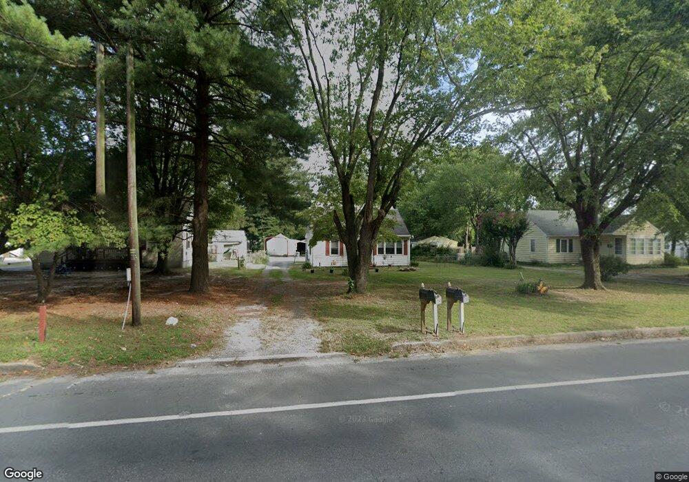
30570 Zion Rd Salisbury, MD 21804
North Salisbury NeighborhoodEstimated Value: $119,000 - $176,000
--
Bed
1
Bath
1,020
Sq Ft
$144/Sq Ft
Est. Value
About This Home
This home is located at 30570 Zion Rd, Salisbury, MD 21804 and is currently estimated at $146,672, approximately $143 per square foot. 30570 Zion Rd is a home located in Wicomico County with nearby schools including West Salisbury Elementary School, North Salisbury Elementary School, and Wicomico Middle School.
Ownership History
Date
Name
Owned For
Owner Type
Purchase Details
Closed on
Jul 30, 2020
Sold by
Duvall Richard M and The Donald Laurence Mooney Tru
Bought by
Adkins Brian and Adkins Kimberly
Current Estimated Value
Home Financials for this Owner
Home Financials are based on the most recent Mortgage that was taken out on this home.
Original Mortgage
$60,000
Outstanding Balance
$53,224
Interest Rate
3%
Mortgage Type
Future Advance Clause Open End Mortgage
Estimated Equity
$93,448
Purchase Details
Closed on
Dec 31, 2007
Sold by
Mooney Donald L
Bought by
Duvall Richard M and Trustee
Purchase Details
Closed on
Jun 1, 2004
Sold by
Mooney Donald L
Bought by
Mooney Donald L
Purchase Details
Closed on
May 2, 2001
Sold by
Mooney Donald L and Mooney Ruby L
Bought by
Mooney Donald L and Mooney Shawn E
Create a Home Valuation Report for This Property
The Home Valuation Report is an in-depth analysis detailing your home's value as well as a comparison with similar homes in the area
Home Values in the Area
Average Home Value in this Area
Purchase History
| Date | Buyer | Sale Price | Title Company |
|---|---|---|---|
| Adkins Brian | $60,000 | Mid Atlantic T&E Co Inc | |
| Duvall Richard M | -- | -- | |
| Duvall Richard M | -- | -- | |
| Mooney Donald L | -- | -- | |
| Mooney Donald L | -- | -- |
Source: Public Records
Mortgage History
| Date | Status | Borrower | Loan Amount |
|---|---|---|---|
| Open | Adkins Brian | $60,000 |
Source: Public Records
Tax History Compared to Growth
Tax History
| Year | Tax Paid | Tax Assessment Tax Assessment Total Assessment is a certain percentage of the fair market value that is determined by local assessors to be the total taxable value of land and additions on the property. | Land | Improvement |
|---|---|---|---|---|
| 2025 | $917 | $93,600 | $28,600 | $65,000 |
| 2024 | $917 | $89,433 | $0 | $0 |
| 2023 | $903 | $85,267 | $0 | $0 |
| 2022 | $886 | $81,100 | $28,600 | $52,500 |
| 2021 | $870 | $79,267 | $0 | $0 |
| 2020 | $859 | $77,433 | $0 | $0 |
| 2019 | $791 | $75,600 | $28,600 | $47,000 |
| 2018 | $845 | $75,133 | $0 | $0 |
| 2017 | $849 | $74,667 | $0 | $0 |
| 2016 | -- | $74,200 | $0 | $0 |
| 2015 | $796 | $74,200 | $0 | $0 |
| 2014 | $796 | $74,200 | $0 | $0 |
Source: Public Records
Map
Nearby Homes
- 30575 Zion Rd
- 30536 Bennett Rd
- 30483 Bennett Rd
- 30446 Zion Rd
- 517 Holly Ridge Ct
- 413 Lindenhurst Ct
- 707 W Morris Leonard Rd
- 1002 Sherwood Cir
- 803 Lyndhurst Ln
- 529 Birchwood Dr
- 504 Parker Rd Unit 1
- 6957 Amber Fields Ct
- 2519 N Salisbury Blvd
- 421 Stream Valley Ct
- 506 Barnsdale Dr
- 0 N U S 13 Unit 1004257479
- 2302 Allen Dr
- 213 Clement Loop
- 223 Clement Loop
- 215 Clement Loop
- 30566 Zion Rd
- 30580 Zion Rd
- 30560 Zion Rd
- 30586 Zion Rd
- 30556 Zion Rd
- 30592 Zion Rd
- 7458 Forest Plains Ln
- 30553 Zion Rd
- 30553 Zion Rd
- 30550 Zion Rd
- 30565 Bennett Rd
- 30555 Bennett Rd
- 30571 Bennett Rd
- 7444 Forest Plains Ln
- 7444 Forest Plains Ln
- 30551 Bennett Rd
- 30542 Zion Rd
- 30579 Bennett Rd
- 30547 Zion Rd
- 30587 Bennett Rd