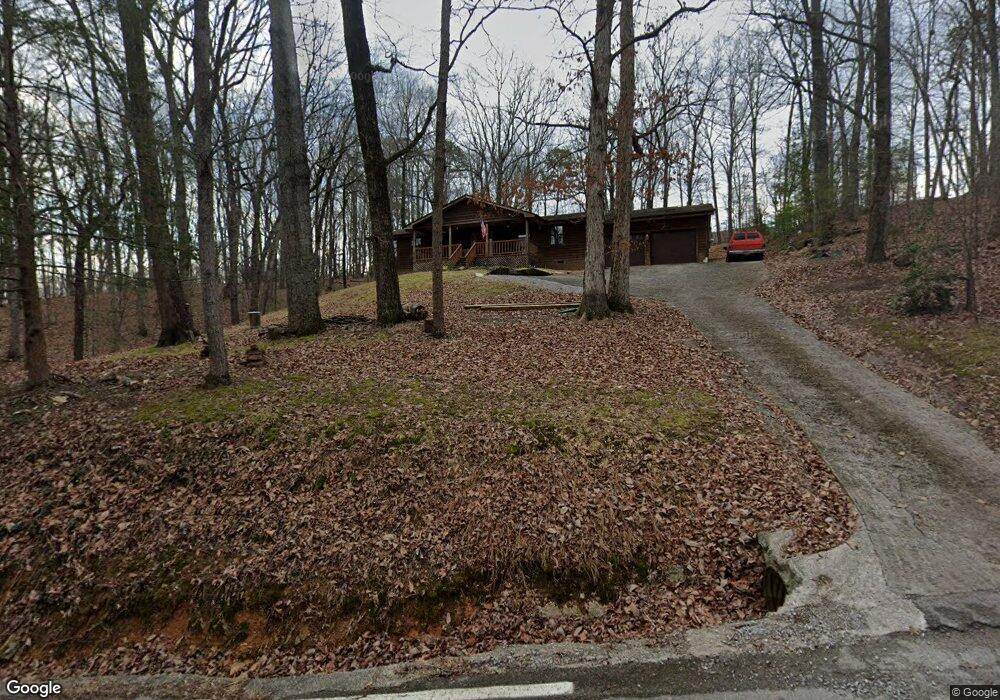
3064 Gold Point Cir S Unit S Hixson, TN 37343
Estimated Value: $301,807 - $368,000
--
Bed
2
Baths
1,568
Sq Ft
$223/Sq Ft
Est. Value
About This Home
This home is located at 3064 Gold Point Cir S Unit S, Hixson, TN 37343 and is currently estimated at $348,952, approximately $222 per square foot. 3064 Gold Point Cir S Unit S is a home located in Hamilton County with nearby schools including McConnell Elementary School, Loftis Middle School, and Hixson High School.
Ownership History
Date
Name
Owned For
Owner Type
Purchase Details
Closed on
Oct 10, 2018
Sold by
Underwood Sam N and Underwood Martha D
Bought by
Edens Thomas Phillip
Current Estimated Value
Home Financials for this Owner
Home Financials are based on the most recent Mortgage that was taken out on this home.
Original Mortgage
$180,775
Outstanding Balance
$157,647
Interest Rate
4.5%
Mortgage Type
VA
Estimated Equity
$191,305
Purchase Details
Closed on
Dec 28, 2006
Sold by
Rock Billy R and Rock Brenda L
Bought by
Underwood Sam N and Underwood Martha D
Home Financials for this Owner
Home Financials are based on the most recent Mortgage that was taken out on this home.
Original Mortgage
$95,000
Interest Rate
6.19%
Mortgage Type
Seller Take Back
Create a Home Valuation Report for This Property
The Home Valuation Report is an in-depth analysis detailing your home's value as well as a comparison with similar homes in the area
Home Values in the Area
Average Home Value in this Area
Purchase History
| Date | Buyer | Sale Price | Title Company |
|---|---|---|---|
| Edens Thomas Phillip | $175,000 | Northgate Title Ins Agency I | |
| Underwood Sam N | $107,000 | Northgate Title Escrow Inc |
Source: Public Records
Mortgage History
| Date | Status | Borrower | Loan Amount |
|---|---|---|---|
| Open | Edens Thomas Phillip | $180,775 | |
| Previous Owner | Underwood Sam N | $95,000 |
Source: Public Records
Tax History Compared to Growth
Tax History
| Year | Tax Paid | Tax Assessment Tax Assessment Total Assessment is a certain percentage of the fair market value that is determined by local assessors to be the total taxable value of land and additions on the property. | Land | Improvement |
|---|---|---|---|---|
| 2024 | $1,032 | $46,125 | $0 | $0 |
| 2023 | $1,041 | $46,125 | $0 | $0 |
| 2022 | $1,041 | $46,125 | $0 | $0 |
| 2021 | $1,041 | $46,125 | $0 | $0 |
| 2020 | $1,051 | $37,700 | $0 | $0 |
| 2019 | $1,051 | $37,700 | $0 | $0 |
| 2018 | $1,051 | $37,700 | $0 | $0 |
| 2017 | $1,051 | $37,700 | $0 | $0 |
| 2016 | $1,032 | $0 | $0 | $0 |
| 2015 | $1,032 | $37,000 | $0 | $0 |
| 2014 | $1,032 | $0 | $0 | $0 |
Source: Public Records
Map
Nearby Homes
- 7622 Cove Ridge Dr
- 7604 Cove Ridge Dr
- 7900 Cove Ridge Dr
- 7825 Cove Ridge Dr
- 7551 Foster Hixson Cemetery Rd
- 7716 Ridge Bay Dr
- 3513 Gold Point Cir S
- 3418 Gold Point Cir S
- 2002 Gold Point Cir N
- 1983 Thrasher Pike
- 7498 Bendire Loop
- 7492 Bendire Loop
- 7468 Bendire Loop
- 7474 Bendire Loop
- 7450 Bendire Loop
- 1963 Thrasher Pike
- 7420 Bendire Loop
- Freeport Plan at The Cove at Thrasher Landing
- Hayden Plan at The Cove at Thrasher Landing
- Cali Plan at The Cove at Thrasher Landing
- 3064 Gold Point Cir S
- 3052 Gold Point Cir S
- 7614 Hunter Rd
- 7618 Hunter Rd
- 7610 Hunter Rd
- 7622 Hunter Rd
- 3003 Tandy Ln
- 7604 Hunter Rd
- 7604 Hunter Rd
- 3108 Gold Point Cir S
- 7617 Hunter Rd
- 7613 Hunter Rd
- 3111 Gold Point Cir S
- 3019 Tandy Ln
- 3114 Gold Point Cir S
- 7609 Hunter Rd
- 7623 Hunter Rd
- 3109 Gold Point Cir S
- 7605 Hunter Rd
- 3035 Tandy Ln