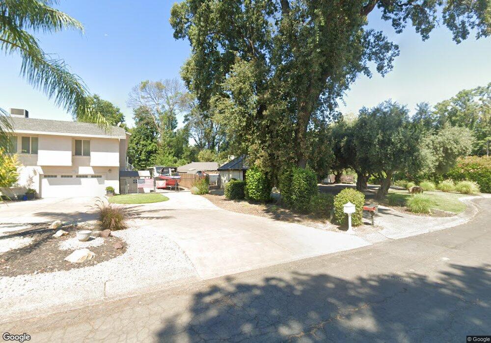
3066 Brent Rd Redding, CA 96002
Bechelli NeighborhoodEstimated Value: $428,000 - $579,499
3
Beds
3
Baths
2,883
Sq Ft
$179/Sq Ft
Est. Value
About This Home
This home is located at 3066 Brent Rd, Redding, CA 96002 and is currently estimated at $515,375, approximately $178 per square foot. 3066 Brent Rd is a home located in Shasta County with nearby schools including Rother Elementary School, Parsons Junior High School, and Enterprise High School.
Ownership History
Date
Name
Owned For
Owner Type
Purchase Details
Closed on
Dec 28, 2021
Sold by
Brian White Mark
Bought by
Mark And Cheryl White Living Trust
Current Estimated Value
Purchase Details
Closed on
Dec 1, 2011
Sold by
White Steven H
Bought by
The White Family Trust and White Joseph Wayne
Purchase Details
Closed on
Jul 1, 2004
Sold by
The White Family Trust and White Wayne
Bought by
White Steven H
Purchase Details
Closed on
Jun 26, 1998
Sold by
White Steven H and White Millie L
Bought by
White J Wayne and White Jane K
Home Financials for this Owner
Home Financials are based on the most recent Mortgage that was taken out on this home.
Original Mortgage
$90,500
Interest Rate
7%
Create a Home Valuation Report for This Property
The Home Valuation Report is an in-depth analysis detailing your home's value as well as a comparison with similar homes in the area
Home Values in the Area
Average Home Value in this Area
Purchase History
| Date | Buyer | Sale Price | Title Company |
|---|---|---|---|
| Mark And Cheryl White Living Trust | -- | King Law Offices | |
| The White Family Trust | -- | None Available | |
| White Steven H | -- | -- | |
| White J Wayne | -- | Fidelity National Title |
Source: Public Records
Mortgage History
| Date | Status | Borrower | Loan Amount |
|---|---|---|---|
| Previous Owner | White J Wayne | $90,500 |
Source: Public Records
Tax History
| Year | Tax Paid | Tax Assessment Tax Assessment Total Assessment is a certain percentage of the fair market value that is determined by local assessors to be the total taxable value of land and additions on the property. | Land | Improvement |
|---|---|---|---|---|
| 2025 | $2,746 | $252,178 | $38,368 | $213,810 |
| 2024 | $2,708 | $247,234 | $37,616 | $209,618 |
| 2023 | $2,708 | $242,387 | $36,879 | $205,508 |
| 2022 | $2,631 | $237,635 | $36,156 | $201,479 |
| 2021 | $2,542 | $232,977 | $35,448 | $197,529 |
| 2020 | $2,531 | $230,589 | $35,085 | $195,504 |
| 2019 | $2,511 | $226,069 | $34,398 | $191,671 |
| 2018 | $2,482 | $221,637 | $33,724 | $187,913 |
| 2017 | $2,526 | $217,292 | $33,063 | $184,229 |
| 2016 | $2,363 | $213,032 | $32,415 | $180,617 |
| 2015 | $2,343 | $209,833 | $31,929 | $177,904 |
| 2014 | $2,327 | $482,179 | $200,908 | $281,271 |
Source: Public Records
Map
Nearby Homes
- 3425 Riverview Dr
- 2590 Henderson Rd
- 351 Weldon St
- 2630 Wyndham Ln
- 3829 Thea Dr
- 3817 Thea Dr
- 0000 Wyndham Pointe Subdivision
- 3660-3671 Technology Way
- 550 Parsons Dr
- 864 Kite Ln
- 745 Parkview Ave
- 1108 4th St
- 3244 Veda St
- 1106 2nd St
- 0 Lot4 Unit 2 Ph 2 Stillwater Unit 25-4962
- 0 Lot3 Unit 2 Ph 2 Stillwater Unit 25-4961
- 0 Lot6 Unit 2 Ph 2 Stillwater Unit 25-4964
- 0 Lot5 Unit 2 Ph 2 Stillwater Unit 25-4963
- 0 Lot16 Unit 2 Ph 2 Stillwater Unit 25-4958
- 0 Lot9 Unit 2 Ph 2 Stillwater Unit 25-4967
Your Personal Tour Guide
Ask me questions while you tour the home.