Estimated Value: $553,519 - $625,000
3
Beds
3
Baths
1,531
Sq Ft
$383/Sq Ft
Est. Value
About This Home
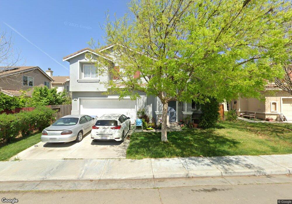
This home is located at 3067 Nelson Ln, Tracy, CA 95377 and is currently estimated at $587,130, approximately $383 per square foot. 3067 Nelson Ln is a home located in San Joaquin County with nearby schools including Melville S. Jacobson Elementary School, Monte Vista Middle School, and Merrill F. West High School.
Ownership History
Date
Name
Owned For
Owner Type
Purchase Details
Closed on
Oct 15, 2015
Sold by
Kitt Jeanette Ann
Bought by
The Kitt Family Trust and Kitt Jeannette A
Current Estimated Value
Purchase Details
Closed on
Mar 30, 2000
Sold by
First American Title Ins Co Co
Bought by
Kitt Jeanette Ann
Purchase Details
Closed on
Mar 28, 2000
Sold by
Kitt Byron
Bought by
Kitt Jeanette Ann
Create a Home Valuation Report for This Property
The Home Valuation Report is an in-depth analysis detailing your home's value as well as a comparison with similar homes in the area
Home Values in the Area
Average Home Value in this Area
Purchase History
| Date | Buyer | Sale Price | Title Company |
|---|---|---|---|
| The Kitt Family Trust | -- | None Available | |
| Kitt Jeanette Ann | $202,000 | First American Title Co | |
| Kitt Jeanette Ann | -- | First American Title Co |
Source: Public Records
Tax History
| Year | Tax Paid | Tax Assessment Tax Assessment Total Assessment is a certain percentage of the fair market value that is determined by local assessors to be the total taxable value of land and additions on the property. | Land | Improvement |
|---|---|---|---|---|
| 2025 | $3,898 | $310,375 | $122,950 | $187,425 |
| 2024 | $3,612 | $304,290 | $120,540 | $183,750 |
| 2023 | $3,487 | $298,325 | $118,177 | $180,148 |
| 2022 | $4,139 | $292,476 | $115,860 | $176,616 |
| 2021 | $4,213 | $286,742 | $113,589 | $173,153 |
| 2020 | $4,188 | $283,803 | $112,425 | $171,378 |
| 2019 | $4,051 | $278,239 | $110,221 | $168,018 |
| 2018 | $3,988 | $272,784 | $108,060 | $164,724 |
| 2017 | $3,836 | $267,437 | $105,942 | $161,495 |
| 2016 | $3,865 | $262,194 | $103,865 | $158,329 |
| 2015 | $3,824 | $258,256 | $102,305 | $155,951 |
| 2014 | $3,651 | $253,197 | $100,301 | $152,896 |
Source: Public Records
Map
Nearby Homes
- 1294 Dover Ln
- 1214 Dover Ln
- 2902 Campbell Ln
- 3030 W Byron Rd
- 2685 Remy Javier St
- 921 Kennedy Place
- 2488 Gaines Ln
- 2689 Jackson Ave
- 2431 Ogden Sannazor Ct
- 2921 Compton Place
- 2306 Sabrina Way
- 2431 Garrett Ct
- 1233 Plaza Ct
- 840 Saffron Dr
- 2260 Redington Dr
- 2219 Yellowstone Ave
- 2065 Seville Dr
- 1890 Spring Valley Way
- 1420 Teakwood Way
- 8300 W 11th St
- 3057 Nelson Ln
- 1326 Gentry Ln
- 1336 Gentry Ln
- 1345 Lankershire Dr
- 1345 Lakeshire Dr
- 1335 Lankershire Dr
- 1346 Gentry Ln
- 3047 Nelson Ln
- 1285 Dover Ln
- 1296 Gentry Ct
- 1355 Lankershire Dr
- 1325 Lankershire Dr
- 1356 Gentry Ln
- 1275 Dover Ln
- 1284 Dover Ln
- 1286 Gentry Ct
- 1327 Gentry Ln
- 1365 Lankershire Dr
- 1317 Gentry Ln
- 1337 Gentry Ln
Your Personal Tour Guide
Ask me questions while you tour the home.