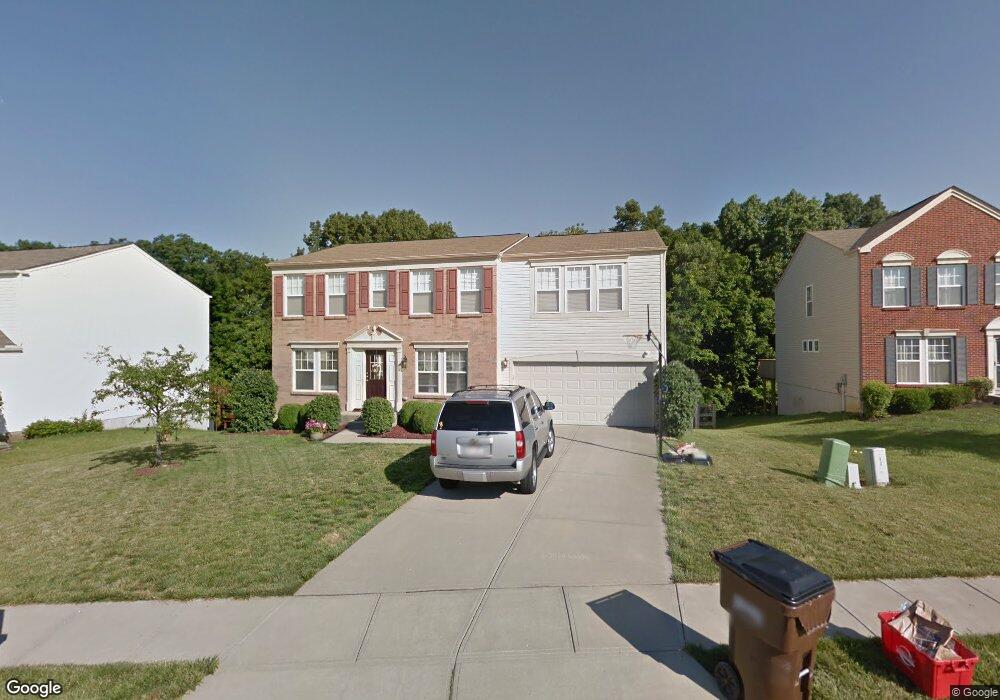
3068 Bruces Trail Independence, KY 41051
Estimated Value: $359,000 - $412,000
4
Beds
3
Baths
3,000
Sq Ft
$129/Sq Ft
Est. Value
About This Home
This home is located at 3068 Bruces Trail, Independence, KY 41051 and is currently estimated at $387,193, approximately $129 per square foot. 3068 Bruces Trail is a home located in Kenton County with nearby schools including Taylor Mill Elementary School, Woodland Middle School, and Scott High School.
Ownership History
Date
Name
Owned For
Owner Type
Purchase Details
Closed on
Oct 24, 2006
Sold by
Maple Street Homes Llc
Bought by
Overman John Charles and Overman Billie Jae
Current Estimated Value
Home Financials for this Owner
Home Financials are based on the most recent Mortgage that was taken out on this home.
Original Mortgage
$209,587
Outstanding Balance
$129,621
Interest Rate
6.31%
Mortgage Type
Purchase Money Mortgage
Estimated Equity
$257,572
Purchase Details
Closed on
Apr 12, 2006
Sold by
Shadybrook Llc
Bought by
Maple Street Homes Llc
Create a Home Valuation Report for This Property
The Home Valuation Report is an in-depth analysis detailing your home's value as well as a comparison with similar homes in the area
Home Values in the Area
Average Home Value in this Area
Purchase History
| Date | Buyer | Sale Price | Title Company |
|---|---|---|---|
| Overman John Charles | $209,587 | Homestead Title Agency Ltd | |
| Maple Street Homes Llc | $38,000 | None Available |
Source: Public Records
Mortgage History
| Date | Status | Borrower | Loan Amount |
|---|---|---|---|
| Open | Overman John Charles | $209,587 |
Source: Public Records
Tax History Compared to Growth
Tax History
| Year | Tax Paid | Tax Assessment Tax Assessment Total Assessment is a certain percentage of the fair market value that is determined by local assessors to be the total taxable value of land and additions on the property. | Land | Improvement |
|---|---|---|---|---|
| 2024 | $3,015 | $246,100 | $42,000 | $204,100 |
| 2023 | $3,106 | $246,100 | $42,000 | $204,100 |
| 2022 | $3,162 | $246,100 | $42,000 | $204,100 |
| 2021 | $3,209 | $246,100 | $42,000 | $204,100 |
| 2020 | $2,801 | $209,500 | $42,000 | $167,500 |
| 2019 | $2,808 | $209,500 | $42,000 | $167,500 |
| 2018 | $2,823 | $209,500 | $42,000 | $167,500 |
| 2017 | $2,746 | $209,500 | $42,000 | $167,500 |
| 2015 | $2,669 | $209,500 | $38,000 | $171,500 |
| 2014 | $2,631 | $209,500 | $38,000 | $171,500 |
Source: Public Records
Map
Nearby Homes
- 3068 Saddlebred Ct
- 3088 Summitrun Dr
- 3146 Meadoway Ct
- 3140 Summitrun Dr
- 3327 Summitrun Dr
- 6256 Woodsgrove Ct
- 6269 Streamside Dr
- 907 Stablewatch Dr
- 951 Stablewatch Dr
- 6212 Streamside Dr
- 6339 Arabian Dr
- 6388 Alexandra Ct
- 1477 Hands Pike
- 143 Tando Way
- 964 Stablewatch Dr
- 6416 Arabian Dr
- Somerset Plan at Hickory Valley
- Avalon Plan at Hickory Valley
- Rockford Plan at Hickory Valley
- Miramar Plan at Hickory Valley
- 3068 Bruces Trail Unit 219
- 3064 Bruces Trail
- 3064 Bruces Trail Unit 218
- 3072 Bruces Trail
- 3060 Bruces Trail
- 3060 Bruces Trail Unit 217
- 3076 Bruces Trail
- 3056 Bruces Trail
- 3056 Bruces Trail Unit 216
- 3080 Bruces Trail
- 3061 Bruces Trail
- 3061 Bruces Trail Unit 246
- 3071 Bruces Trail
- 3052 Bruces Trail
- 3084 Bruces Trail
- 2895 Faubush Ct
- 2895 Faubush Ct Unit 245
- 3051 Bruces Trail
- 3075 Bruces Trail
- 3088 Bruces Trail