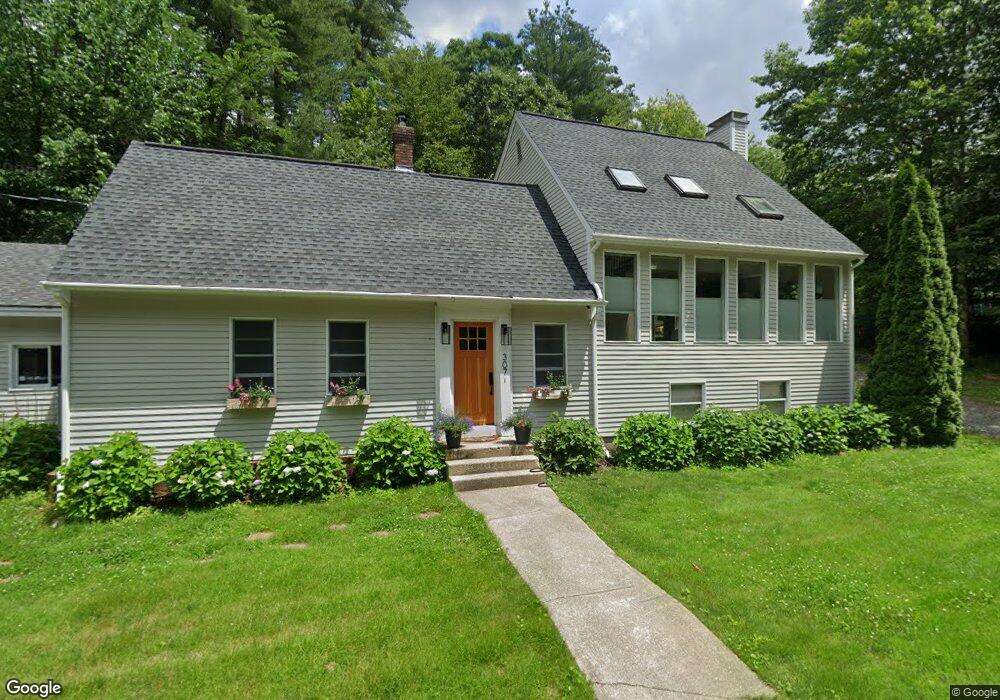
307 Addison Rd Goffstown, NH 03045
Estimated Value: $639,532 - $758,000
3
Beds
3
Baths
1,776
Sq Ft
$385/Sq Ft
Est. Value
About This Home
This home is located at 307 Addison Rd, Goffstown, NH 03045 and is currently estimated at $683,133, approximately $384 per square foot. 307 Addison Rd is a home located in Hillsborough County with nearby schools including Mountain View Middle School, Goffstown High School, and Polaris Charter School.
Ownership History
Date
Name
Owned For
Owner Type
Purchase Details
Closed on
Jun 29, 2010
Sold by
Jordan Richard D
Bought by
Lynch Sean P and Sell Megan E
Current Estimated Value
Home Financials for this Owner
Home Financials are based on the most recent Mortgage that was taken out on this home.
Original Mortgage
$235,481
Interest Rate
4.98%
Mortgage Type
Purchase Money Mortgage
Create a Home Valuation Report for This Property
The Home Valuation Report is an in-depth analysis detailing your home's value as well as a comparison with similar homes in the area
Home Values in the Area
Average Home Value in this Area
Purchase History
| Date | Buyer | Sale Price | Title Company |
|---|---|---|---|
| Lynch Sean P | $244,800 | -- |
Source: Public Records
Mortgage History
| Date | Status | Borrower | Loan Amount |
|---|---|---|---|
| Open | Lynch Sean P | $230,341 | |
| Closed | Lynch Sean P | $235,481 | |
| Previous Owner | Lynch Sean P | $75,000 |
Source: Public Records
Tax History Compared to Growth
Tax History
| Year | Tax Paid | Tax Assessment Tax Assessment Total Assessment is a certain percentage of the fair market value that is determined by local assessors to be the total taxable value of land and additions on the property. | Land | Improvement |
|---|---|---|---|---|
| 2024 | $10,709 | $523,900 | $194,400 | $329,500 |
| 2023 | $9,881 | $523,900 | $194,400 | $329,500 |
| 2022 | $7,877 | $299,400 | $127,900 | $171,500 |
| 2021 | $6,868 | $276,700 | $127,900 | $148,800 |
| 2020 | $6,868 | $276,700 | $127,900 | $148,800 |
| 2019 | $6,801 | $276,700 | $127,900 | $148,800 |
| 2018 | $5,147 | $276,700 | $127,900 | $148,800 |
| 2017 | $6,444 | $235,000 | $106,100 | $128,900 |
| 2016 | $4,850 | $233,200 | $106,100 | $127,100 |
| 2015 | $6,254 | $222,100 | $99,600 | $122,500 |
| 2014 | $5,997 | $222,100 | $99,600 | $122,500 |
Source: Public Records
Map
Nearby Homes
- 14 Angel Point Cir Unit B
- 1 Oakwood Ln Unit 2
- 175 Saint Anselm Dr
- 35 Foch St
- 28 Joffre St
- 11 Timberwood Dr Unit 206
- 16 Larch St
- 24 Whippoorwill Ln
- 46 Moose Club Park Rd
- 2A Dearborn Cir
- 3B Dearborn Cir
- 3A Dearborn Cir
- 3D Dearborn Cir
- 115 Moose Club Park Rd
- 4 Chip St
- 4 Arabian Ct Unit B
- 5 Mustang Ct
- 2 Shore Dr
- 40 Tirrell Hill Rd
- 3 Tanager Rd
- 303 Addison Rd
- 298 Addison Rd
- 3 Winding Brook Rd Unit A
- 505 Shirley Hill Rd Unit A
- 505 Shirley Hill Rd
- 11 Winding Brook Rd
- 510 Shirley Hill Rd
- 20 Angel Point Cir
- 16 Angel Point Cir Unit 18B
- 16A Angel Point Cir Unit 18A
- 14B Angel Point Cir Unit 19B
- 14 Angel Point Cir Unit 19A
- 20 Angel Point Cir Unit 17B
- 20 Angel Point Cir Unit 17A
- 22 Angel Point Cir Unit 16B
- 22 Angel Point Cir Unit 16A
- 286 Addison Rd
- 12 Winding Brook Rd
- 00 Cote Ave
- 502 Shirley Hill Rd