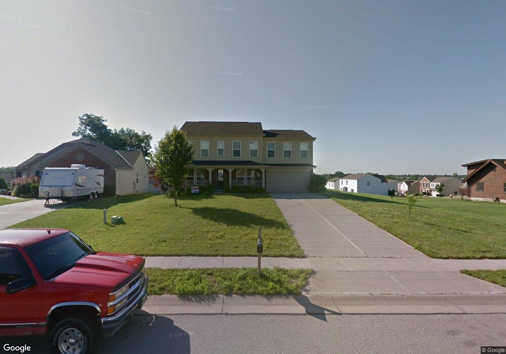
3071 Bruces Trail Independence, KY 41051
Estimated Value: $368,000 - $407,000
4
Beds
3
Baths
2,980
Sq Ft
$129/Sq Ft
Est. Value
About This Home
This home is located at 3071 Bruces Trail, Independence, KY 41051 and is currently estimated at $383,501, approximately $128 per square foot. 3071 Bruces Trail is a home located in Kenton County with nearby schools including Taylor Mill Elementary School, Woodland Middle School, and Scott High School.
Ownership History
Date
Name
Owned For
Owner Type
Purchase Details
Closed on
Jul 8, 2015
Sold by
Fannie Mae
Bought by
Eclipse Properties Llc
Current Estimated Value
Purchase Details
Closed on
Mar 16, 2015
Sold by
Norman Dale L and Norman Terry L
Bought by
Federal National Mortgage Association
Purchase Details
Closed on
Nov 13, 2006
Sold by
Fischer Single Family Homes Ii Llc
Bought by
Norman Dale L and Norman Terry L
Home Financials for this Owner
Home Financials are based on the most recent Mortgage that was taken out on this home.
Original Mortgage
$234,876
Interest Rate
6.33%
Mortgage Type
Purchase Money Mortgage
Purchase Details
Closed on
Aug 25, 2006
Sold by
Grand Communities Ltd
Bought by
Fischer Single Family Homes Ii Llc
Create a Home Valuation Report for This Property
The Home Valuation Report is an in-depth analysis detailing your home's value as well as a comparison with similar homes in the area
Home Values in the Area
Average Home Value in this Area
Purchase History
| Date | Buyer | Sale Price | Title Company |
|---|---|---|---|
| Eclipse Properties Llc | $179,900 | Attorney | |
| Federal National Mortgage Association | $180,000 | None Available | |
| Norman Dale L | $234,876 | Homestead Title Agency Ltd | |
| Fischer Single Family Homes Ii Llc | $35,240 | None Available |
Source: Public Records
Mortgage History
| Date | Status | Borrower | Loan Amount |
|---|---|---|---|
| Previous Owner | Norman Dale L | $234,876 |
Source: Public Records
Tax History Compared to Growth
Tax History
| Year | Tax Paid | Tax Assessment Tax Assessment Total Assessment is a certain percentage of the fair market value that is determined by local assessors to be the total taxable value of land and additions on the property. | Land | Improvement |
|---|---|---|---|---|
| 2024 | $2,604 | $212,600 | $35,000 | $177,600 |
| 2023 | $2,683 | $212,600 | $35,000 | $177,600 |
| 2022 | $2,742 | $212,600 | $35,000 | $177,600 |
| 2021 | $2,782 | $212,600 | $35,000 | $177,600 |
| 2020 | $2,416 | $179,900 | $30,000 | $149,900 |
| 2019 | $2,422 | $179,900 | $30,000 | $149,900 |
| 2018 | $2,435 | $179,900 | $30,000 | $149,900 |
| 2017 | $2,368 | $179,900 | $30,000 | $149,900 |
| 2015 | $2,984 | $234,800 | $35,200 | $199,600 |
| 2014 | $2,942 | $234,800 | $35,200 | $199,600 |
Source: Public Records
Map
Nearby Homes
- 3068 Saddlebred Ct
- 3088 Summitrun Dr
- 3146 Meadoway Ct
- 3140 Summitrun Dr
- 3327 Summitrun Dr
- 6256 Woodsgrove Ct
- 907 Stablewatch Dr
- 6269 Streamside Dr
- 951 Stablewatch Dr
- 6339 Arabian Dr
- 6212 Streamside Dr
- 1477 Hands Pike
- 6388 Alexandra Ct
- 964 Stablewatch Dr
- 143 Tando Way
- 6416 Arabian Dr
- 690 Rusconi Dr
- Somerset Plan at Hickory Valley
- Avalon Plan at Hickory Valley
- Rockford Plan at Hickory Valley
- 3075 Bruces Trail
- 3079 Bruces Trail
- 3080 Bruces Trail
- 2898 Faubush Ct
- 3083 Bruces Trail
- 3084 Bruces Trail
- 3076 Bruces Trail
- 3055 Saddlebred Ct
- 3051 Saddlebred Ct
- 3072 Bruces Trail
- 3059 Saddlebred Ct
- 3047 Saddlebred Ct
- 3068 Bruces Trail
- 3068 Bruces Trail Unit 219
- 3063 Saddlebred Ct
- 3043 Saddlebred Ct
- 3043 Saddlebred Ct Unit 67
- 3088 Bruces Trail
- 2902 Faubush Ct
- 2902 Faubush Ct Unit 224