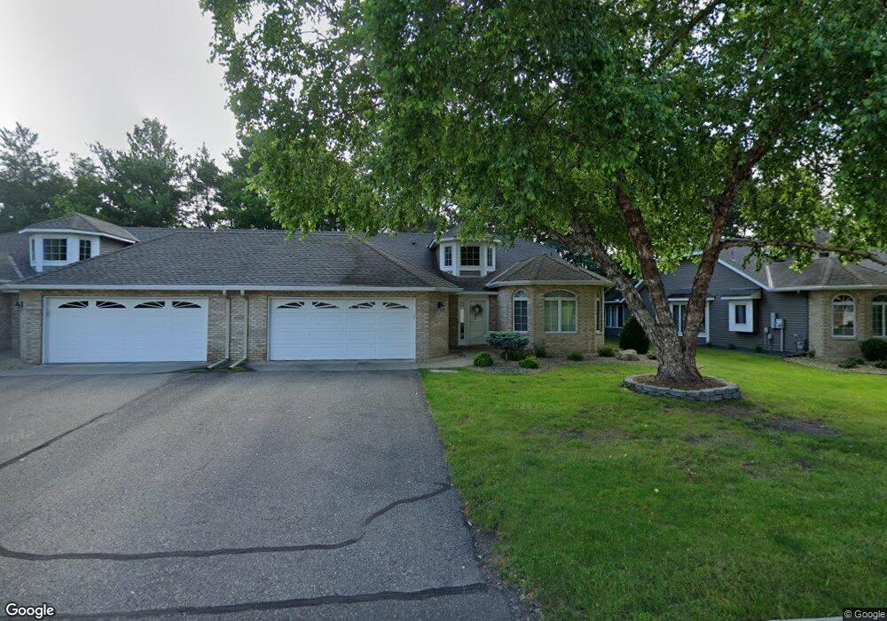
3075 Highpointe Curve Saint Paul, MN 55113
South Owasso NeighborhoodEstimated Value: $447,000 - $478,000
2
Beds
2
Baths
1,736
Sq Ft
$266/Sq Ft
Est. Value
About This Home
This home is located at 3075 Highpointe Curve, Saint Paul, MN 55113 and is currently estimated at $462,407, approximately $266 per square foot. 3075 Highpointe Curve is a home located in Ramsey County with nearby schools including Central Park Elementary School, Roseville Area Middle School, and Roseville Area Senior High School.
Ownership History
Date
Name
Owned For
Owner Type
Purchase Details
Closed on
Aug 21, 2020
Sold by
Lentsch Mary Therese
Bought by
Arola Michael C and Arola Kay K
Current Estimated Value
Home Financials for this Owner
Home Financials are based on the most recent Mortgage that was taken out on this home.
Original Mortgage
$264,500
Interest Rate
2.9%
Mortgage Type
New Conventional
Purchase Details
Closed on
Oct 30, 2015
Sold by
Nelson Lois L and Hankey Denise
Bought by
Lentsch Mary Therese
Home Financials for this Owner
Home Financials are based on the most recent Mortgage that was taken out on this home.
Original Mortgage
$244,000
Interest Rate
3.78%
Purchase Details
Closed on
Nov 29, 2004
Sold by
Carson Melvin L and Carson Judith M
Bought by
Nelson Lois L and Nelson Roger L
Purchase Details
Closed on
Mar 5, 1996
Sold by
In Harstad Hills
Bought by
Harstad Homes Inc
Create a Home Valuation Report for This Property
The Home Valuation Report is an in-depth analysis detailing your home's value as well as a comparison with similar homes in the area
Home Values in the Area
Average Home Value in this Area
Purchase History
| Date | Buyer | Sale Price | Title Company |
|---|---|---|---|
| Arola Michael C | $364,500 | Burnet Title | |
| Lentsch Mary Therese | $305,000 | Realstar Title | |
| Nelson Lois L | $300,000 | -- | |
| Harstad Homes Inc | $57,900 | -- | |
| Larson Melvin L | $187,680 | -- |
Source: Public Records
Mortgage History
| Date | Status | Borrower | Loan Amount |
|---|---|---|---|
| Previous Owner | Arola Michael C | $264,500 | |
| Previous Owner | Lentsch Mary Therese | $244,000 |
Source: Public Records
Tax History Compared to Growth
Tax History
| Year | Tax Paid | Tax Assessment Tax Assessment Total Assessment is a certain percentage of the fair market value that is determined by local assessors to be the total taxable value of land and additions on the property. | Land | Improvement |
|---|---|---|---|---|
| 2025 | $5,392 | $427,500 | $100,000 | $327,500 |
| 2024 | $5,392 | $422,200 | $100,000 | $322,200 |
| 2023 | $5,392 | $409,000 | $100,000 | $309,000 |
| 2022 | $4,800 | $386,800 | $100,000 | $286,800 |
| 2021 | $5,126 | $349,200 | $100,000 | $249,200 |
| 2020 | $4,944 | $365,100 | $100,000 | $265,100 |
| 2019 | $4,902 | $332,600 | $56,000 | $276,600 |
| 2018 | $4,318 | $321,500 | $56,000 | $265,500 |
| 2017 | $3,692 | $279,600 | $56,000 | $223,600 |
| 2016 | $3,790 | $0 | $0 | $0 |
| 2015 | $3,782 | $259,100 | $56,000 | $203,100 |
| 2014 | $3,522 | $0 | $0 | $0 |
Source: Public Records
Map
Nearby Homes
- 2970 Western Ave N
- 2841 Galtier St
- 405 Judith Ave
- 2821 Galtier St
- 2814 Matilda St
- 387 Iona Ln
- 2802 Marion St
- 417 W Horseshoe Dr
- 2720 MacKubin St
- 2687 Galtier St
- 540 Woodhill Dr Unit 71
- 2730 Dale St N Unit D101
- 2720 Dale St N Unit C208
- 2710 Dale St N Unit B212
- 556 County Road C W
- 2939 W Owasso Blvd
- 3318 W Owasso Blvd
- 667 County Road C W
- 3399 Kent St Unit 211
- 111 Yorkton Ridge
- 3073 Highpointe Curve
- 3081 Highpointe Curve
- 3083 Highpointe Curve
- 3069 Highpointe Curve
- 3005 W Owasso Blvd
- 3067 Highpointe Curve
- 3005 S Owasso Blvd W
- 3074 Highpointe Curve
- 3015 S Owasso Blvd W
- 3076 Highpointe Curve
- 3028 Highpointe Curve
- 3061 Highpointe Curve
- 2990 Western Ave N
- 0 Unassigned
- 3026 Highpointe Curve
- 0 Unassigned
- 3000 Western Ave N
- 3022 Highpointe Curve
- 2980 Western Ave N
- 3020 Highpointe Curve