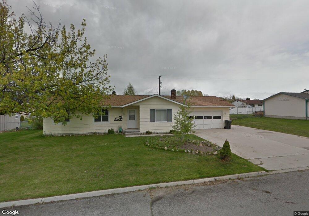
308 7th St Stevensville, MT 59870
Stevensville NeighborhoodEstimated Value: $401,000 - $439,000
3
Beds
1
Bath
1,160
Sq Ft
$362/Sq Ft
Est. Value
About This Home
This home is located at 308 7th St, Stevensville, MT 59870 and is currently estimated at $419,421, approximately $361 per square foot. 308 7th St is a home located in Ravalli County with nearby schools including Stevensville Elementary School, Stevensville Junior High School, and Stevensville High School.
Ownership History
Date
Name
Owned For
Owner Type
Purchase Details
Closed on
Oct 8, 2021
Sold by
Dix Nicole M
Bought by
Kowalski Michael and Kowalski Patricia
Current Estimated Value
Home Financials for this Owner
Home Financials are based on the most recent Mortgage that was taken out on this home.
Original Mortgage
$380,000
Outstanding Balance
$292,008
Interest Rate
2.1%
Mortgage Type
New Conventional
Estimated Equity
$127,413
Purchase Details
Closed on
Aug 29, 2019
Sold by
Vicki Wilkins
Bought by
Dix Nicole M
Home Financials for this Owner
Home Financials are based on the most recent Mortgage that was taken out on this home.
Original Mortgage
$237,813
Interest Rate
3.8%
Mortgage Type
New Conventional
Purchase Details
Closed on
May 26, 2005
Bought by
Wilkins Vicki and Greenup Shaun
Create a Home Valuation Report for This Property
The Home Valuation Report is an in-depth analysis detailing your home's value as well as a comparison with similar homes in the area
Home Values in the Area
Average Home Value in this Area
Purchase History
| Date | Buyer | Sale Price | Title Company |
|---|---|---|---|
| Kowalski Michael | $505,400 | New Title Company Name | |
| Dix Nicole M | $297,266 | First American Title | |
| Wilkins Vicki | -- | -- |
Source: Public Records
Mortgage History
| Date | Status | Borrower | Loan Amount |
|---|---|---|---|
| Open | Kowalski Michael | $380,000 | |
| Previous Owner | Dix Nicole M | $237,813 |
Source: Public Records
Tax History
| Year | Tax Paid | Tax Assessment Tax Assessment Total Assessment is a certain percentage of the fair market value that is determined by local assessors to be the total taxable value of land and additions on the property. | Land | Improvement |
|---|---|---|---|---|
| 2025 | $1,558 | $434,300 | $0 | $0 |
| 2024 | $2,196 | $360,900 | $0 | $0 |
| 2023 | $2,291 | $360,900 | $0 | $0 |
| 2022 | $1,719 | $223,800 | $0 | $0 |
| 2021 | $1,722 | $206,400 | $0 | $0 |
| 2020 | $1,639 | $183,000 | $0 | $0 |
| 2019 | $1,545 | $180,900 | $0 | $0 |
| 2018 | $1,248 | $150,500 | $0 | $0 |
| 2017 | $1,239 | $150,500 | $0 | $0 |
| 2016 | $1,203 | $138,500 | $0 | $0 |
| 2015 | $1,203 | $138,500 | $0 | $0 |
| 2014 | $1,266 | $86,072 | $0 | $0 |
Source: Public Records
Map
Nearby Homes
- Lot 5 Bessie Ln
- 615 Park Ave
- 623 Park St Unit 3
- 103 Peterson Place
- 516 Buck St
- 411 Church St
- 404 Pine St
- NHN Mystic River Rd
- 194 Kadex Place
- 515 Mission St
- 302 Turner St
- 325 Valley View St
- 211 Buck St
- 214 Mission St
- 101 Binks Way Unit 6
- 2663 Eastside Hwy
- 3572 Cimarron Ln
- 3585 Sourdough Ln
- 1417 Creekside Dr
- 3523 Hitching Post Ln
Your Personal Tour Guide
Ask me questions while you tour the home.