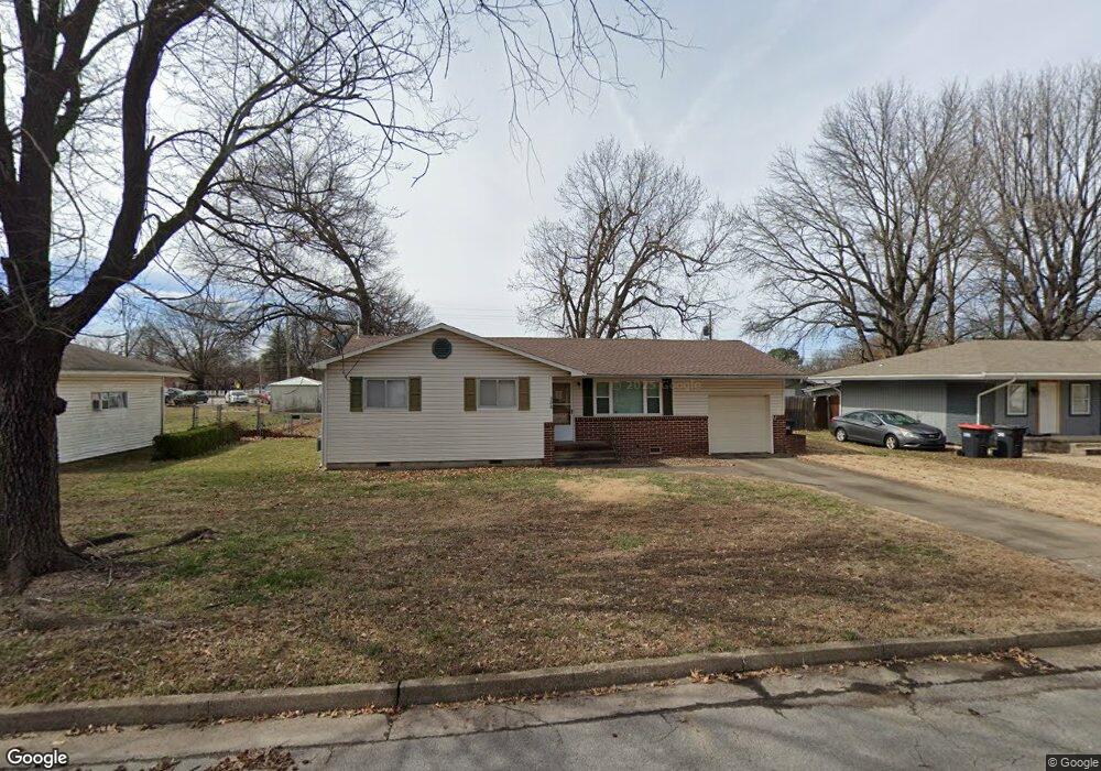
308 Harve St Springdale, AR 72762
Estimated Value: $233,000 - $243,000
--
Bed
1
Bath
1,259
Sq Ft
$189/Sq Ft
Est. Value
About This Home
This home is located at 308 Harve St, Springdale, AR 72762 and is currently estimated at $237,522, approximately $188 per square foot. 308 Harve St is a home located in Washington County with nearby schools including Westwood Elementary School, Southwest Junior High School, and Helen Tyson Middle School.
Ownership History
Date
Name
Owned For
Owner Type
Purchase Details
Closed on
Aug 25, 2006
Sold by
Ames Stuart Anna M and Stuart James Ronald
Bought by
Martin Aaron Todd
Current Estimated Value
Home Financials for this Owner
Home Financials are based on the most recent Mortgage that was taken out on this home.
Original Mortgage
$115,000
Outstanding Balance
$69,157
Interest Rate
6.79%
Mortgage Type
Purchase Money Mortgage
Estimated Equity
$168,365
Purchase Details
Closed on
Nov 25, 1994
Bought by
Williams James Conley and Williams Linda K
Purchase Details
Closed on
Oct 20, 1989
Bought by
Capps James A and Capps Judy A
Purchase Details
Closed on
Sep 16, 1987
Bought by
Costner Robert Earl and Costner Teresa E
Purchase Details
Closed on
Oct 16, 1984
Bought by
Ditta Robert J and Ditta Tami L
Create a Home Valuation Report for This Property
The Home Valuation Report is an in-depth analysis detailing your home's value as well as a comparison with similar homes in the area
Home Values in the Area
Average Home Value in this Area
Purchase History
| Date | Buyer | Sale Price | Title Company |
|---|---|---|---|
| Martin Aaron Todd | $115,000 | Elite Title Company Inc | |
| Williams James Conley | $46,000 | -- | |
| Capps James A | $52,000 | -- | |
| Costner Robert Earl | $48,000 | -- | |
| Ditta Robert J | $42,000 | -- |
Source: Public Records
Mortgage History
| Date | Status | Borrower | Loan Amount |
|---|---|---|---|
| Open | Martin Aaron Todd | $115,000 |
Source: Public Records
Tax History Compared to Growth
Tax History
| Year | Tax Paid | Tax Assessment Tax Assessment Total Assessment is a certain percentage of the fair market value that is determined by local assessors to be the total taxable value of land and additions on the property. | Land | Improvement |
|---|---|---|---|---|
| 2025 | $1,477 | $40,140 | $14,000 | $26,140 |
| 2024 | $1,364 | $40,140 | $14,000 | $26,140 |
| 2023 | $1,274 | $40,140 | $14,000 | $26,140 |
| 2022 | $1,159 | $25,820 | $6,000 | $19,820 |
| 2021 | $1,069 | $25,820 | $6,000 | $19,820 |
| 2020 | $980 | $25,820 | $6,000 | $19,820 |
| 2019 | $891 | $16,910 | $5,000 | $11,910 |
| 2018 | $891 | $16,910 | $5,000 | $11,910 |
| 2017 | $88 | $16,910 | $5,000 | $11,910 |
| 2016 | $883 | $16,910 | $5,000 | $11,910 |
| 2015 | $883 | $16,910 | $5,000 | $11,910 |
| 2014 | $952 | $18,230 | $6,000 | $12,230 |
Source: Public Records
Map
Nearby Homes
- 1325 Rogers Ave
- 126 Rogers Circle Dr
- 504 Zachary St
- 508 Geneva St
- 506 Dyer St
- 614 Zachary St
- 1807 Westwood Ave
- 404 Henryetta St
- 301 Michael St
- 702 S West End St
- 1611 Theodore Dr
- 510 Maria St
- 2009 Emily Circle Dr Unit A
- 1708 Theodore Dr
- 604 Maria St
- 406 Michael St
- 713 Carlton St
- 2003 Dee Ave
- 712 Carlton St
- 1511 W Huntsville Ave