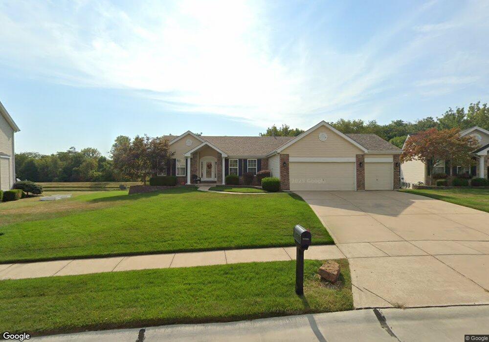
308 William Clark Dr O Fallon, MO 63368
Estimated Value: $406,118 - $537,000
3
Beds
2
Baths
1,760
Sq Ft
$259/Sq Ft
Est. Value
About This Home
This home is located at 308 William Clark Dr, O Fallon, MO 63368 and is currently estimated at $455,280, approximately $258 per square foot. 308 William Clark Dr is a home located in St. Charles County with nearby schools including Ostmann Elementary School, Fort Zumwalt West Middle School, and Fort Zumwalt West High School.
Ownership History
Date
Name
Owned For
Owner Type
Purchase Details
Closed on
Apr 21, 2011
Sold by
Harris Robert C and Harris Tammy S
Bought by
Edmondson Steven A and Edmondson Claudia J
Current Estimated Value
Home Financials for this Owner
Home Financials are based on the most recent Mortgage that was taken out on this home.
Original Mortgage
$110,000
Interest Rate
4.91%
Mortgage Type
New Conventional
Purchase Details
Closed on
Jan 26, 2004
Sold by
The Jones Co Homes Llc
Bought by
Harris Robert C and Harris Tammy S
Home Financials for this Owner
Home Financials are based on the most recent Mortgage that was taken out on this home.
Original Mortgage
$105,000
Interest Rate
5.79%
Mortgage Type
Purchase Money Mortgage
Create a Home Valuation Report for This Property
The Home Valuation Report is an in-depth analysis detailing your home's value as well as a comparison with similar homes in the area
Home Values in the Area
Average Home Value in this Area
Purchase History
| Date | Buyer | Sale Price | Title Company |
|---|---|---|---|
| Edmondson Steven A | $220,000 | Multiple | |
| Harris Robert C | -- | Ust |
Source: Public Records
Mortgage History
| Date | Status | Borrower | Loan Amount |
|---|---|---|---|
| Closed | Edmondson Steven A | $110,000 | |
| Previous Owner | Harris Robert C | $105,000 | |
| Closed | Harris Robert C | $12,000 |
Source: Public Records
Tax History
| Year | Tax Paid | Tax Assessment Tax Assessment Total Assessment is a certain percentage of the fair market value that is determined by local assessors to be the total taxable value of land and additions on the property. | Land | Improvement |
|---|---|---|---|---|
| 2025 | $4,212 | $72,182 | -- | -- |
| 2024 | $4,212 | $67,603 | -- | -- |
| 2023 | $4,210 | $67,603 | -- | -- |
| 2022 | $3,509 | $52,361 | $0 | $0 |
| 2021 | $3,507 | $52,361 | $0 | $0 |
| 2020 | $3,437 | $49,588 | $0 | $0 |
| 2019 | $3,425 | $49,588 | $0 | $0 |
| 2018 | $3,252 | $45,024 | $0 | $0 |
| 2017 | $3,235 | $45,024 | $0 | $0 |
| 2016 | $2,830 | $39,236 | $0 | $0 |
| 2015 | $2,599 | $39,236 | $0 | $0 |
| 2014 | $2,858 | $42,101 | $0 | $0 |
Source: Public Records
Map
Nearby Homes
- 19 Lautrec Ct
- 604 Sunward Dr
- 798 Wilbie Ct
- 1723 Monet Dr
- 516 Sunward Dr
- 7132 Oak Stream Dr
- 262 Royallsprings Pkwy
- 2 the Durango at the Grove
- 2026 Avalon Mist Cir
- 14 Rock Church Dr
- 109 Sterling Crossing Dr
- 2325 Sundance Dr
- 2132 Bates Rd
- 2058 Avalon Mist Cir
- 76 Brook Hollow Ct
- 3 Royallbend Ct
- 189 Sanctuary Dr
- 7101 Curtis Dr Unit 795B
- 2359 Cheneaux Ln Unit 57F
- 7409 Heathermoor Ln
- 310 William Clark Dr
- 304 William Clark Dr
- 305 William Clark Dr
- 311 William Clark Dr
- 312 William Clark Dr
- 302 William Clark Dr
- 314 William Clark Dr
- 141 Snake River Dr
- 315 William Clark Dr
- 143 Snake River Dr
- 224 Meriwether Lewis Dr
- 300 William Clark Dr
- 226 Meriwether Lewis Dr
- 139 Snake River Dr
- 316 William Clark Dr
- 317 William Clark Dr
- 228 Meriwether Lewis Dr
- 137 Snake River Dr
- 147 Snake River Dr
Your Personal Tour Guide
Ask me questions while you tour the home.