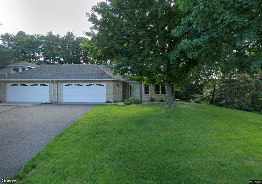
3083 Highpointe Curve Saint Paul, MN 55113
South Owasso NeighborhoodEstimated Value: $443,000 - $506,000
1
Bed
2
Baths
1,729
Sq Ft
$268/Sq Ft
Est. Value
About This Home
This home is located at 3083 Highpointe Curve, Saint Paul, MN 55113 and is currently estimated at $463,569, approximately $268 per square foot. 3083 Highpointe Curve is a home located in Ramsey County with nearby schools including Central Park Elementary School, Roseville Area Middle School, and Roseville Area Senior High School.
Ownership History
Date
Name
Owned For
Owner Type
Purchase Details
Closed on
May 17, 2024
Sold by
Bentley Judith A
Bought by
Judith A Bentley Trust and Bentley
Current Estimated Value
Purchase Details
Closed on
Dec 30, 2009
Sold by
Melbye Carolyn M
Bought by
Bentley Judith A
Purchase Details
Closed on
Dec 1, 1995
Sold by
Harstad Homes In
Bought by
Melbye Robert C and Melbye Carolyn M
Create a Home Valuation Report for This Property
The Home Valuation Report is an in-depth analysis detailing your home's value as well as a comparison with similar homes in the area
Home Values in the Area
Average Home Value in this Area
Purchase History
| Date | Buyer | Sale Price | Title Company |
|---|---|---|---|
| Judith A Bentley Trust | $500 | None Listed On Document | |
| Bentley Judith A | $250,000 | -- | |
| Melbye Robert C | $185,630 | -- | |
| Harstad Homes Inc | $53,900 | -- |
Source: Public Records
Tax History Compared to Growth
Tax History
| Year | Tax Paid | Tax Assessment Tax Assessment Total Assessment is a certain percentage of the fair market value that is determined by local assessors to be the total taxable value of land and additions on the property. | Land | Improvement |
|---|---|---|---|---|
| 2025 | $5,984 | $441,400 | $100,000 | $341,400 |
| 2023 | $5,984 | $422,900 | $100,000 | $322,900 |
| 2022 | $5,216 | $398,500 | $100,000 | $298,500 |
| 2021 | $5,256 | $349,200 | $100,000 | $249,200 |
| 2020 | $5,026 | $373,600 | $100,000 | $273,600 |
| 2019 | $4,902 | $337,600 | $56,000 | $281,600 |
| 2018 | $4,318 | $321,500 | $56,000 | $265,500 |
| 2017 | $3,692 | $279,600 | $56,000 | $223,600 |
| 2016 | $3,944 | $0 | $0 | $0 |
| 2015 | $3,944 | $268,500 | $56,000 | $212,500 |
| 2014 | $3,710 | $0 | $0 | $0 |
Source: Public Records
Map
Nearby Homes
- 2970 Western Ave N
- 2841 Galtier St
- 405 Judith Ave
- 2821 Galtier St
- 2814 Matilda St
- 387 Iona Ln
- 2802 Marion St
- 417 W Horseshoe Dr
- 2720 MacKubin St
- 2687 Galtier St
- 540 Woodhill Dr Unit 71
- 2730 Dale St N Unit D101
- 2720 Dale St N Unit C208
- 2710 Dale St N Unit B212
- 556 County Road C W
- 2939 W Owasso Blvd
- 3318 W Owasso Blvd
- 667 County Road C W
- 3399 Kent St Unit 211
- 111 Yorkton Ridge
- 3081 Highpointe Curve
- 3075 Highpointe Curve
- 3005 W Owasso Blvd
- 3073 Highpointe Curve
- 3005 S Owasso Blvd W
- 2990 Western Ave N
- 3076 Highpointe Curve
- 3074 Highpointe Curve
- 2980 Western Ave N
- 3000 Western Ave N
- 3069 Highpointe Curve
- 3015 S Owasso Blvd W
- 0 Unassigned
- 3067 Highpointe Curve
- 2982 Highcourte
- 340 S Owasso Blvd W
- 2984 Highcourte
- 351 Stanbridge Cir
- 0 Unassigned
- 361 Stanbridge Cir